Line 396:
Line 396: |-
|-
| [[Nottinghamshire]]
| [[Nottinghamshire]]
| [[Silverhill]]
| Newtonwood Lane, near [[Huthwaite ]]
| 671
| 671
| 205
| 205
| {{getmapecho|SK4561760649}}
| {{getmapecho|SK45626065 }}
|-
|-
| [[Orkney]]
| [[Orkney]]
Revision as of 12:38, 7 November 2011
A County top is the highest point of a county. A county top need not be in the heart of a county; many indeed are at the edges, where the county boundary runs over a ridge or watershed. A few are on the border of the county and may be the top of two counties.
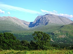
The highest of them all is the magnificent Ben Nevis, the highest ground in the British Isles and consequently the county top of Inverness-shire , and the lowest the modestly named Boring Field in Huntingdonshire , a county not known for hills.
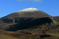
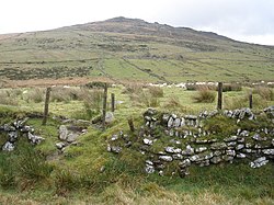
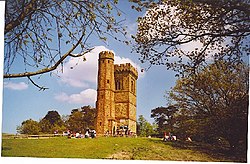
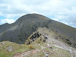
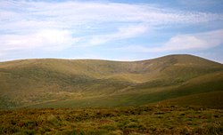
County tops of the United Kingdom Ben Nevis, Inverness-shire, highest point in the United Kingdom Slieve Donard, Downshire, highest mountain in Northern Ireland Brown Willy, Cornwall Leith Hill, Surrey A top which is the highest point in two different counties has an asterisk; *
County
Hill
Height (ft)
Height (m)
Grid reference
Aberdeenshire
Ben Macdhui *
4,295
1,309
NN988989
Anglesey
Holyhead Mountain
722
220
SH2185882948
Angus
Glas Maol
3,504
1,068
NO166765
Antrim
Trostan
1,808
551
D17952360
Argyllshire
Bidean nam Bian
3,773
1,150
NN143542
Armagh
Slieve Gullion
1,880
573
J024201
Ayrshire
Kirriereoch Hill shoulder
2,565
782
NX421870
Banffshire
Ben Macdhui *
4,295
1,309
NN988989
Bedfordshire
Dunstable Downs
797
243
TL0088119424
Berkshire
Walbury Hill
974
297
SU3734861631
Berwickshire
Meikle Says Law shoulder
1,746
532
NT581616
Brecknockshire
Pen y Fan
2,906
886
SO0121221588
Buckinghamshire
Haddington Hill
875
267
SP8907209088
Buteshire
Goatfell , Arran
2,867
874
NR991415
Caernarfonshire
Snowdon
3,560
1,085
SH6098954379
Caithness
Morven
2,316
706
ND004285
Cambridgeshire
deserted village nearCastle Camps
420
128
TL632418
Cardiganshire
Pen Pumlumon Fawr
2,467
752
SN7897186945
Carmarthenshire
Fan Foel
2,562
781
SN8214022338
Cheshire
Black Hill
1,909
582
SE0781604687
Clackmannanshire
Ben Cleuch
2,365
721
NN902006
Cornwall
Brown Willy
1,378
420
SX1587280004
Cromartyshire
Sgùrr Mòr
3,642
1,110
NH203718
Cumberland
Scafell Pike
3,209
978
NY2154207217
Denbighshire
Cadair Berwyn south summit
2,726
830
SJ0716532355
Derbyshire
Kinder Scout
2,087
636
SK0851887520
Devon
High Willhays
2,037
621
SX5802389203
Dorset
Lewesdon Hill
915
279
ST4377801172
Down
Slieve Donard
2,789
850
J357276
Dumfriesshire
White Coomb
2,694
821
NT163151
Dunbartonshire
Ben Vorlich
3,094
943
NN295124
Durham
Burnhope Seat
2,447
746
NY7879037536
East Lothian
Meikle Says Law
1,755
535
NT581617
Essex
High Wood, Chrishall Common
482
147
TL4430136202
Fermanagh
Cuilcagh *
2,182
665
H123280
Fife
West Lomond
1,713
522
NO197066
Flintshire
Moel Famau
1,817
555
SJ1610962667
Glamorgan
Craig y Llyn
1,969
600
SN9068903156
Gloucestershire
Cleeve Hill
1,082
330
SO9969624599
Hampshire
Pilot Hill
938
286
SU3987560111
Herefordshire
Black Mountains ridge
2,306
703
SO2558835051
Hertfordshire
Pavis Wood
800
244
SP9142009190
Huntingdonshire
Boring Field
263
80
TL0472071050
Inverness-shire
Ben Nevis
4,409
1,344
NN166712
Kent
Betsom's Hill
823
251
TQ4355556332
Kincardineshire
Mount Battock
2,552
778
NO549844
Kinross-shire
Innerdouny Hill
1,631
497
NO032073
Kirkcudbrightshire
Merrick
2,766
843
NX427855
Lanarkshire
Culter Fell
2,454
748
NT052290
Lancashire
Coniston Old Man [1] 2,634
803
SD2723797827
Leicestershire
Bardon Hill
912
278
SK4599213199
Lincolnshire
Normanby Top , The Wolds
551
168
TF1211096470
Londonderry
Sawel Mountain *
2,224
678
H618973
Merionethshire
Aran Fawddwy
2,969
905
SH8627222386
Middlesex
Bushey Heath
509
155
TQ1523593970
Midlothian
Blackhope Scar
2,136
651
NT315483
Monmouthshire
Chwarel y Fan
2,228
680
SO2581929416
Montgomeryshire
Moel Sych
2,726
827
SJ0663231863
Morayshire
Carn a' Ghille Chearr
2,329
710
NJ139298
Nairnshire
Carn Glas-choire
2,162
659
NH891291
Norfolk
Beacon Hill
343
105
TG1835941425
Northamptonshire
Arbury Hill
738
225
SP5401558770
Northumberland
The Cheviot
2,674
815
NT9090420522
Nottinghamshire
Newtonwood Lane, near Huthwaite
671
205
SK45626065
Orkney
Ward Hill, Hoy
1,578
481
HY228022
Oxfordshire
Bald Hill
843
257
SU7288595775 ?
Peeblesshire
Broad Law *
2,756
840
NT146235
Pembrokeshire
Foel Cwmcerwyn
1,760
536
SN0940931161
Perthshire
Ben Lawers
3,983
1,214
NN635414
Radnorshire
Great Rhos
2,166
660
SO1821963902
Renfrewshire
Hill of Stake
1,713
522
NS273630
Ross-shire
Carn Eige
3,881
1,183
NH123261
Roxburghshire
Auchope Cairn
2,438
743
NT895193
Rutland
Cold Overton Park
646
197
SK8270808533
Shetland
Ronas Hill
1,476
450
HU305834
Selkirkshire
Broad Law [2] 2,756
840
NT146235
Shropshire
Brown Clee Hill
1,772
540
SO5936686556
Somerset
Dunkery Beacon
1,702
519
SS8914341587
Staffordshire
Cheeks Hill
1,705
520
SK0260969904
Stirlingshire
Ben Lomond
3,196
974
NN367028
Suffolk
Great Wood, Rede
420
128
TL7869055863
Surrey
Leith Hill
965
294
TQ1394943162
Sussex
Black Down
918
280
SU9193529613
Sutherland
Ben More Assynt
3,274
998
NC318201
Tyrone
Sawel Mountain *
2,224
678
H618973
Warwickshire
The Downs, Ilmington
794
242
SP199425
West Lothian
Cairnpapple Hill (South Top)[3] 1,024
312
NS987711
Westmorland
Helvellyn
3,117
950
NY3426015090
Wigtownshire
Craigairie Fell
1,056
322
NX236736
Wiltshire
Milk Hill
967
295
SU1041564341
Worcestershire
Worcestershire Beacon
1,394
425
SO7688445223
Yorkshire , East Riding
Bishop Wilton Wold
807
246
SE8218257026
Yorkshire , North Riding
Mickle Fell
2,585
788
NY8058224534
Yorkshire , West Riding
Whernside
2,415
736
SD7385081415
County tops of the Republic of Ireland In the Irish Republic , nine Counties share a highest point with another county, whether a British or Irish county, and these are marked with an asterisk; *
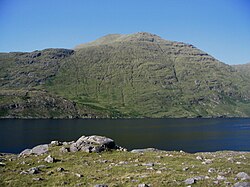
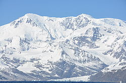
Carrauntoohil, County Kerry; the highest mountain in Munster and all Ireland Lugnaquilla, County Wicklow. The highest mountain in Leinster Mweelrea, County Mayo . The highest mountain in Connaught Territory tops Mount Paget, South Georgia The following lists the highest point in each of the British overseas territories and Crown dependencies .
Territory
Hill (& island)
Height (ft)
Location
Akrotiri and Dhekelia
unnamed
x
34°42′20″N 32°50′18″E(best estimate)
Anguilla
Crocus Hill
213
18°12′43″N 63°04′14″W
Bermuda
Town Hill
249
32°19′N 64°44′W
British Antarctic Territory
Mount Jackson (Antarctic peninsula)
10,446
71°23′S 63°22′W
British Indian Ocean Territory
(unnamed)Diego Garcia
49
7°18′S 72°24′E
British Virgin Islands
Mount Sage Tortola
1,709
18°24′0″N 64°39′0″W
Cayman Islands
The Bluff, limestone outcropCayman Brac
141
19°44′07″N 79°44′09″W
Falkland Islands
Mount Usborne East Falkland
2,313
51°41′50″S 58°50′04″W
Gibraltar
O'Hara's Battery
1,398
36°07'42"N 5°20'39"
Guernsey, Bailiwick of
Le Moulin Sark
375
49°26′09″N 2°21′39″W
Isle of Man
Snaefell
2,034
SC397881
Jersey, Bailiwick of
Les PlatonsJersey
469
49°14′52″N 2°06′18″W
Montserrat
Chances Peak
3.002
16°42′40″N 62°10′38″W
Pitcairn Islands
Pawala Valley RidgePitcairn
1,138
25°4′0″S 130°7′0″W
South Georgia and
Mount Paget South Georgia
9,629
54°26′S 36°33′W
St Helena, Ascension and
Queen Mary's Peak Tristan da Cunha
6,765
37°05′30″S 12°17′00″W
Turks and Caicos Islands
?[4]
x
x
Outside links Footnotes and references
↑ Lancashire 's county top is believed to be the Old Man of Coniston but a claim is also made for nearby Swirl How , which is a few feet lower or higher, depending on exact measurement and perhaps on whether the cairn at the summit of the Old Man is included.↑ Selkirkshire: possibly Ettrick Pen at 2,269 feet
↑ West Lothian: possibly The Knock at 1,023 feet
↑ Turks and Caicos Islands: disputed between Flamingo Hill on East Caicos and the Blue Hills on Provdenciales, both around 160 feet
