County top: Difference between revisions
No edit summary |
|||
| (One intermediate revision by the same user not shown) | |||
| Line 40: | Line 40: | ||
| align="right"| 1,808 | | align="right"| 1,808 | ||
| align="right"| 551 | | align="right"| 551 | ||
| {{ | | {{map|D17952360}} | ||
|- | |- | ||
| [[Argyllshire]] | | [[Argyllshire]] | ||
| Line 52: | Line 52: | ||
| align="right"| 1,880 | | align="right"| 1,880 | ||
| align="right"| 573 | | align="right"| 573 | ||
| {{ | | {{map|J024201}} | ||
|- | |- | ||
| [[Ayrshire]] | | [[Ayrshire]] | ||
| Line 190: | Line 190: | ||
| align="right"| 2,789 | | align="right"| 2,789 | ||
| align="right"| 850 | | align="right"| 850 | ||
| {{ | | {{map|J357276}} | ||
|- | |- | ||
| [[Dumfriesshire]] | | [[Dumfriesshire]] | ||
| Line 226: | Line 226: | ||
| align="right"| 2,182 | | align="right"| 2,182 | ||
| align="right"| 665 | | align="right"| 665 | ||
| {{ | | {{map|H123280}} | ||
|- | |- | ||
| [[Fife]] | | [[Fife]] | ||
| Line 334: | Line 334: | ||
| align="right"| 2,224 | | align="right"| 2,224 | ||
| align="right"| 678 | | align="right"| 678 | ||
| {{ | | {{map|H618973}} | ||
|- | |- | ||
| [[Merionethshire]] | | [[Merionethshire]] | ||
| Line 461: | Line 461: | ||
| align="right"| 197 | | align="right"| 197 | ||
| {{map|SK8270808533}} | | {{map|SK8270808533}} | ||
|- | |||
| [[Selkirkshire]] | |||
| [[Dun Rig]] | |||
| align="right"| 2,441 | |||
| align="right"| 840 | |||
| {{map|NT254315}} | |||
|- | |- | ||
| [[Shetland]] | | [[Shetland]] | ||
| Line 467: | Line 473: | ||
| align="right"| 450 | | align="right"| 450 | ||
| {{map|HU305834}} | | {{map|HU305834}} | ||
|- | |- | ||
| [[Shropshire]] | | [[Shropshire]] | ||
| Line 526: | Line 526: | ||
| align="right"| 2,224 | | align="right"| 2,224 | ||
| align="right"| 678 | | align="right"| 678 | ||
| {{ | | {{map|H618973}} | ||
|- | |- | ||
| [[Warwickshire]] | | [[Warwickshire]] | ||
| Line 619: | Line 619: | ||
| align="right"| 2,612 | | align="right"| 2,612 | ||
| align="right"| 796 | | align="right"| 796 | ||
| {{ | | {{map|S844528}} | ||
|- | |- | ||
| [[County Cavan|Cavan]] | | [[County Cavan|Cavan]] | ||
| Line 625: | Line 625: | ||
| align="right"| 2,182 | | align="right"| 2,182 | ||
| align="right"| 665 | | align="right"| 665 | ||
| {{ | | {{map|H123280}} | ||
|- | |- | ||
| [[County Clare|Clare]] | | [[County Clare|Clare]] | ||
| Line 631: | Line 631: | ||
| align="right"| 1,745 | | align="right"| 1,745 | ||
| align="right"| 532 | | align="right"| 532 | ||
| {{ | | {{map|R64837593}} | ||
|- | |- | ||
| [[County Cork|Cork]] | | [[County Cork|Cork]] | ||
| Line 637: | Line 637: | ||
| align="right"| 2,316 | | align="right"| 2,316 | ||
| align="right"| 706 | | align="right"| 706 | ||
| {{ | | {{map|W00486206}} | ||
|- | |- | ||
| [[County Donegal|Donegal]] | | [[County Donegal|Donegal]] | ||
| Line 643: | Line 643: | ||
| align="right"| 2,464 | | align="right"| 2,464 | ||
| align="right"| 751 | | align="right"| 751 | ||
| {{ | | {{map|B92832078}} | ||
|- | |- | ||
| [[County Dublin|Dublin]] | | [[County Dublin|Dublin]] | ||
| Line 649: | Line 649: | ||
| align="right"| 2,484 | | align="right"| 2,484 | ||
| align="right"| 757 | | align="right"| 757 | ||
| {{ | | {{map|O11581546}} | ||
|- | |- | ||
| [[County Galway|Galway]] | | [[County Galway|Galway]] | ||
| Line 655: | Line 655: | ||
| align="right"| 2,392 | | align="right"| 2,392 | ||
| align="right"| 729 | | align="right"| 729 | ||
| {{ | | {{map|L78565390}} | ||
|- | |- | ||
| [[County Kerry|Kerry]] | | [[County Kerry|Kerry]] | ||
| Line 661: | Line 661: | ||
| align="right"| 3,406 | | align="right"| 3,406 | ||
| align="right"| 1,038 | | align="right"| 1,038 | ||
| {{ | | {{map|V80368442}} | ||
|- | |- | ||
| [[County Kildare|Kildare]] | | [[County Kildare|Kildare]] | ||
| Line 667: | Line 667: | ||
| align="right"| 1,243 | | align="right"| 1,243 | ||
| align="right"| 379 | | align="right"| 379 | ||
| {{ | | {{map|O00572060}} | ||
|- | |- | ||
| [[County Kilkenny|Kilkenny]] | | [[County Kilkenny|Kilkenny]] | ||
| Line 673: | Line 673: | ||
| align="right"| 1,690 | | align="right"| 1,690 | ||
| align="right"| 515 | | align="right"| 515 | ||
| {{ | | {{map|Q460116}} | ||
|- | |- | ||
| [[County Laois|Laois]] | | [[County Laois|Laois]] | ||
| Line 679: | Line 679: | ||
| align="right"| 1,729 | | align="right"| 1,729 | ||
| align="right"| 527 | | align="right"| 527 | ||
| {{ | | {{map|S23259890}} | ||
|- | |- | ||
| [[County Leitrim|Leitrim]] | | [[County Leitrim|Leitrim]] | ||
| Line 685: | Line 685: | ||
| align="right"| 2,070 | | align="right"| 2,070 | ||
| align="right"| 631 | | align="right"| 631 | ||
| {{ | | {{map|G759473}} | ||
|- | |- | ||
| [[County Limerick|Limerick]] | | [[County Limerick|Limerick]] | ||
| Line 691: | Line 691: | ||
| align="right"| 3,015 | | align="right"| 3,015 | ||
| align="right"| 919 | | align="right"| 919 | ||
| {{ | | {{map|R87852379}} | ||
|- | |- | ||
| [[County Longford|Longford]] | | [[County Longford|Longford]] | ||
| Line 697: | Line 697: | ||
| align="right"| 912 | | align="right"| 912 | ||
| align="right"| 278 | | align="right"| 278 | ||
| {{ | | {{map|N187841}} | ||
|- | |- | ||
| [[County Louth|Louth]] | | [[County Louth|Louth]] | ||
| Line 703: | Line 703: | ||
| align="right"| 1,932 | | align="right"| 1,932 | ||
| align="right"| 589 | | align="right"| 589 | ||
| {{ | | {{map|J16901193}} | ||
|- | |- | ||
| [[County Mayo|Mayo]] | | [[County Mayo|Mayo]] | ||
| Line 709: | Line 709: | ||
| align="right"| 2,671 | | align="right"| 2,671 | ||
| align="right"| 814 | | align="right"| 814 | ||
| {{ | | {{map|L789668}} | ||
|- | |- | ||
| [[Meath]] | | [[Meath]] | ||
| Line 715: | Line 715: | ||
| align="right"| 915 | | align="right"| 915 | ||
| align="right"| 279 | | align="right"| 279 | ||
| {{ | | {{map|N585775}} | ||
|- | |- | ||
| [[County Monaghan|Monaghan]] | | [[County Monaghan|Monaghan]] | ||
| Line 721: | Line 721: | ||
| align="right"| 1,224 | | align="right"| 1,224 | ||
| align="right"| 373 | | align="right"| 373 | ||
| {{ | | {{map|H532435}} | ||
|- | |- | ||
| [[County Offaly|Offaly]] | | [[County Offaly|Offaly]] | ||
| Line 727: | Line 727: | ||
| align="right"| 1,729 | | align="right"| 1,729 | ||
| align="right"| 527 | | align="right"| 527 | ||
| {{ | | {{map|S23259890}} | ||
|- | |- | ||
| [[County Roscommon|Roscommon]] | | [[County Roscommon|Roscommon]] | ||
| Line 733: | Line 733: | ||
| align="right"| 1,385 | | align="right"| 1,385 | ||
| align="right"| 422 | | align="right"| 422 | ||
| {{ | | {{map|G901202}} | ||
|- | |- | ||
| [[County Sligo|Sligo]] | | [[County Sligo|Sligo]] | ||
| Line 739: | Line 739: | ||
| align="right"| 2,123 | | align="right"| 2,123 | ||
| align="right"| 647 | | align="right"| 647 | ||
| {{ | | {{map|G759473}} | ||
|- | |- | ||
| [[County Tipperary|Tipperary]] | | [[County Tipperary|Tipperary]] | ||
| Line 745: | Line 745: | ||
| align="right"| 3,015 | | align="right"| 3,015 | ||
| align="right"| 919 | | align="right"| 919 | ||
| {{ | | {{map|R87852379}} | ||
|- | |- | ||
| [[County Waterford|Waterford]] | | [[County Waterford|Waterford]] | ||
| Line 751: | Line 751: | ||
| align="right"| 2,605 | | align="right"| 2,605 | ||
| align="right"| 794 | | align="right"| 794 | ||
| {{ | | {{map|S058084}} | ||
|- | |- | ||
| [[Westmeath]] | | [[Westmeath]] | ||
| Line 757: | Line 757: | ||
| align="right"| 856 | | align="right"| 856 | ||
| align="right"| 261 | | align="right"| 261 | ||
| {{ | | {{map|N469793}} | ||
|- | |- | ||
| [[County Wexford|Wexford]] | | [[County Wexford|Wexford]] | ||
| Line 763: | Line 763: | ||
| align="right"| 2,612 | | align="right"| 2,612 | ||
| align="right"| 796 | | align="right"| 796 | ||
| {{ | | {{map|S844528}} | ||
|- | |- | ||
| [[County Wicklow|Wicklow]] | | [[County Wicklow|Wicklow]] | ||
| Line 769: | Line 769: | ||
| align="right"| 3,035 | | align="right"| 3,035 | ||
| align="right"| 925 | | align="right"| 925 | ||
| {{ | | {{map|T032917}} | ||
|- | |- | ||
|} | |} | ||
Latest revision as of 15:25, 22 August 2021
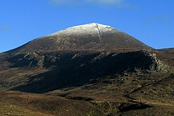
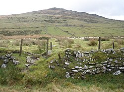
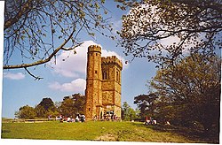
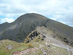
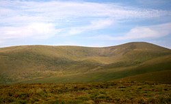
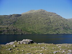
A County top is the highest point of a county. A county top need not be in the heart of a county; many indeed are at the edges, where the county boundary runs over a ridge or watershed. A few are on the border of the county and may be the top of two counties.
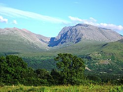
The highest of them all is the magnificent Ben Nevis, the highest ground in the British Isles and consequently the county top of Inverness-shire, and the lowest Bush Ground in Huntingdonshire, a county not known for hills.
County tops of the United Kingdom
A top which is the highest point in two different counties has an asterisk; *
Yorkshire Riding Tops
| Riding | Hill | Height (ft) | Height (m) | Grid reference |
|---|---|---|---|---|
| East Riding | Bishop Wilton Wold | 807 | 246 | SE8218257026 |
| North Riding | Mickle Fell | 2,585 | 788 | NY8058224534 |
| West Riding | Whernside | 2,415 | 736 | SD7385081415 |
County tops of the Republic of Ireland
In the Irish Republic, nine Counties share a highest point with another county, whether a British or Irish county, and these are marked with an asterisk; *
Territory tops
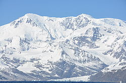
The following lists the highest point in each of the British overseas territories and Crown dependencies.
Outside links
- Map of the County Tops on WildþingUK
- County Descriptions - The Historic Counties Trust
- Hill Bagging - Historic County Tops
- Hill Bagging – English Counties; The Mountains of England and Wales, Simon Edwardes
Footnotes and references
- ↑ Lancashire's county top is believed to be the Old Man of Coniston but a claim is also made for nearby Swirl How, which is a few feet lower or higher, depending on exact measurement and perhaps on whether the cairn at the summit of the Old Man is included.
- ↑ The very top of Ebrington Hill is in Gloucestershire; Warwickshire's highest point is at the county border some yards to the SE
- ↑ West Lothian: possibly The Knock at 1,023 feet
- ↑ B Naqqi Manco: The Hills Are Alive - The Times of the Islands, Winter 2011/2012