County top: Difference between revisions
Jump to navigation
Jump to search
→County tops of the United Kingdom: Corrections & clarifications |
|||
| Line 96: | Line 96: | ||
|- | |- | ||
| [[Buteshire]] | | [[Buteshire]] | ||
| [[Goatfell]] | | [[Goatfell]], Arran | ||
| 2,867 | | 2,867 | ||
| 874 | | 874 | ||
| Line 114: | Line 114: | ||
|- | |- | ||
| [[Cambridgeshire]] | | [[Cambridgeshire]] | ||
| [[ | | deserted village near<br>[[Castle Camps]] | ||
| | | 420 | ||
| | | 128 | ||
| {{getmapecho| | | {{getmapecho|TL632418}} | ||
|- | |- | ||
| [[Cardiganshire]] | | [[Cardiganshire]] | ||
| Line 162: | Line 162: | ||
|- | |- | ||
| [[Denbighshire]] | | [[Denbighshire]] | ||
| [[Cadair Berwyn]] | | [[Cadair Berwyn]] south summit | ||
| 2,726 | | 2,726 | ||
| 830 | | 830 | ||
| Line 216: | Line 216: | ||
|- | |- | ||
| [[Essex]] | | [[Essex]] | ||
| [[Chrishall Common]] | | High Wood, [[Chrishall Common]] | ||
| 482 | | 482 | ||
| 147 | | 147 | ||
| Line 258: | Line 258: | ||
|- | |- | ||
| [[Herefordshire]] | | [[Herefordshire]] | ||
| [[Black | | [[Black Mountains]] ridge | ||
| 2, | | 2,306 | ||
| | | 703 | ||
| {{getmapecho|SO2558835051}} | | {{getmapecho|SO2558835051}} | ||
|- | |- | ||
| Line 396: | Line 396: | ||
|- | |- | ||
| [[Nottinghamshire]] | | [[Nottinghamshire]] | ||
| [[ | | [[Silverhill]] | ||
| | | 671 | ||
| | | 205 | ||
| {{getmapecho|SK4561760649}} | | {{getmapecho|SK4561760649}} | ||
|- | |- | ||
| [[Orkney]] | | [[Orkney]] | ||
| [[Ward Hill, Hoy | | [[Ward Hill, Hoy]] | ||
| 1,578 | | 1,578 | ||
| 481 | | 481 | ||
| Line 412: | Line 412: | ||
| 257 | | 257 | ||
| {{getmapecho|SU7288595775}}? | | {{getmapecho|SU7288595775}}? | ||
|- | |||
| [[Peeblesshire]] | |||
| [[Broad Law]]* | |||
| 2,756 | |||
| 840 | |||
| {{getmapecho|NT146235}} | |||
|- | |- | ||
| [[Pembrokeshire]] | | [[Pembrokeshire]] | ||
| Line 418: | Line 424: | ||
| 536 | | 536 | ||
| {{getmapecho|SN0940931161}} | | {{getmapecho|SN0940931161}} | ||
|- | |- | ||
| [[Perthshire]] | | [[Perthshire]] | ||
| Line 450: | Line 450: | ||
|- | |- | ||
| [[Roxburghshire]] | | [[Roxburghshire]] | ||
| [[ | | [[Auchop Cairn]] | ||
| 2, | | 2,422 | ||
| | | 738 | ||
| {{getmapecho|NT456006}} | | {{getmapecho|NT456006}} | ||
|- | |- | ||
| Line 468: | Line 468: | ||
|- | |- | ||
| [[Selkirkshire]] | | [[Selkirkshire]] | ||
| [[Broad Law]] | | [[Broad Law]]<ref>Selkirkshire: possibly [[Ettrick Pen]] at 2,269 feet</ref> | ||
| 2,756 | | 2,756 | ||
| 840 | | 840 | ||
| Line 498: | Line 498: | ||
|- | |- | ||
| [[Suffolk]] | | [[Suffolk]] | ||
| [[ | | Great Wood, [[Rede]] | ||
| 420 | | 420 | ||
| 128 | | 128 | ||
| Line 510: | Line 510: | ||
|- | |- | ||
| [[Sussex]] | | [[Sussex]] | ||
| [[ | | [[Black Down, Sussex|Black Down]] | ||
| 918 | | 918 | ||
| 280 | | 280 | ||
| Line 528: | Line 528: | ||
|- | |- | ||
| [[Warwickshire]] | | [[Warwickshire]] | ||
| [[ | | [[The Downs, Ilmington]] | ||
| | | 794 | ||
| | | 242 | ||
| {{getmapecho| | | {{getmapecho|SP199425}} | ||
|- | |- | ||
| [[West Lothian]] | | [[West Lothian]] | ||
| [[Cairnpapple Hill]] (South Top) | | [[Cairnpapple Hill]] (South Top)<ref>West Lothian: possibly [[The Knock]] at 1,023 feet</ref> | ||
| 1,024 | | 1,024 | ||
| 312 | | 312 | ||
Revision as of 12:44, 20 September 2011
A County top is the highest point of a county. A county top need not be in the heart of a county; many indeed are at the edges, where the county boundary runs over a ridge or watershed. A few are on the border of the county and may be the top of two counties.
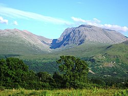
The highest of them all is the magnificent Ben Nevis, the highest ground in the British Isles and consequently the county top of Inverness-shire, and the lowest the modestly named Boring Field in Huntingdonshire, a county not known for hills.
County tops of the United Kingdom
A top which is the highest point in two different counties has an asterisk; *
County tops of the Republic of Ireland
In the Irish Republic, nine Counties share a highest point with another county, whether a British or Irish county, and these are marked with an asterisk; *
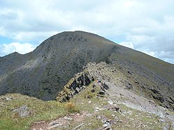
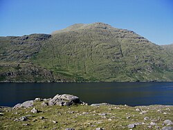
| County | Hill | Height (m) | Grid reference |
|---|---|---|---|
| Carlow | Mount Leinster* | 796 | |
| Cavan | Cuilcagh* | 665 | |
| Cork | Knockboy | 706 | |
| Donegal | Mount Errigal | 751 | |
| Dublin | Kippure | 757 | |
| Galway | Benbaun | 729 | |
| Leitrim | Truskmore Cairn | 631 | |
| Louth | Slieve Foy | 589 | |
| Clare | Moylussa | 532 | |
| Kerry | Carrauntoohil | 1038 | |
| Kildare | Cupidstown Hill | 379 | |
| Kilkenny | Brandon Hill | 515 | |
| Laois | Arderin* | 527 | |
| Limerick | Galtymore* | 919 | |
| Longford | Carn Clonhugh | 278 | |
| Mayo | Mweelrea | 814 | |
| Meath | Slieve na Calliagh | 276 | |
| Monaghan | Slieve Beagh | 373 | |
| Offaly | Arderin* | 527 | |
| Roscommon | Seltannasaggart | 422 | |
| Sligo | Truskmore | 647 | |
| Tipperary | Galtymore* | 919 | |
| Waterford | Knockmealdown | 794 | |
| Westmeath | Mullaghmeen | 261 | |
| Wexford | Mount Leinster* | 796 | |
| Wicklow | Lugnaquilla | 925 |
Outside links
- Hill Bagging - Historic County Tops
- Hill Bagging – English Counties; The Mountains of England and Wales, Simon Edwardes
References
- ↑ Lancashire's county top is believed to be the Old Man of Coniston but a claim is also made for nearby Swirl How, which is a few feet lower or higher, depending on exact measurement and perhaps on whether the cairn at the summit of the Old Man is included.
- ↑ Selkirkshire: possibly Ettrick Pen at 2,269 feet
- ↑ West Lothian: possibly The Knock at 1,023 feet