Aberdeenshire: Difference between revisions
| Line 185: | Line 185: | ||
{{div col|3}} | {{div col|3}} | ||
*Aden Country Park | *Aden Country Park | ||
*[[Balmoral Castle]] | *{{i-Castle}} [[Balmoral Castle]] | ||
*[[Bullers of Buchan]] | *[[Bullers of Buchan]] | ||
*[[Cairness House]] | *{{i-House}} [[Cairness House]] | ||
*Deer Abbey, Old Deer | *{{i-Abbey}}{{i-HS}} [[Deer Abbey]], Old Deer | ||
*[[Fyvie Castle]] | *{{i-Castle}}{{i-NTS}} [[Fyvie Castle]] | ||
*[[Haddo House]] | *{{i-House}}{{i-NTS}} [[Haddo House]] | ||
*[[Huntly Castle]] | *{{i-Castle}} [[Huntly Castle]] | ||
*[[ | *{{i-Museum}} [[Kinnaird Head Lighthouse#Museum of Scottish Lighthouses|Museum of Scottish Lighthouses]] | ||
{{div col end}} | {{div col end}} | ||
Latest revision as of 12:51, 20 September 2024
| Aberdeenshire United Kingdom | |
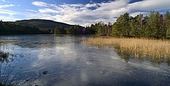
 The Queen's Loch | |
|---|---|

| |
| Flag | |

| |
| [Interactive map] | |
| Area: | 1,950 square miles |
| Population: | 380,495 |
| County town: | Aberdeen |
| County flower: | Bearberry [1] |
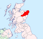
The County of Aberdeen is a shire in the Highlands of Scotland. It borders Kincardineshire, Angus and Perthshire to the south, Inverness-shire and Banffshire to the west, and the North Sea to the north and east. It has a coast-line of 65 miles. Aberdeenshire has a detached part locally situate in Banffshire south of Banff: Forming the northern part of the Banffshire parish of Alvah, it also forms a detached part of Aberdeenshire's ancient parish of King Edward.
Geography
Popular geography divides the traditional shire into five districts:
- Mar, mostly between the Dee and Don, which nearly covers the southern half of the county and contains the city of Aberdeen. It is mountainous, especially Braemar, which contains the greatest mass of elevated land in the British Isles. The Dee valley has sandy soil, the Don valley loamy.
- Formartine, between the lower Don and Ythan, has a sandy coast, which is succeeded inland by a clayey, fertile, tilled tract, and then by low hills, moors, mosses and tilled land.
- Buchan lies north of the Ythan, and comprising the north-east of the county, is next in size to Mar, parts of the coast being bold and rocky, the interior bare, low, flat, undulating and in places peaty. On the coast, six miles south of Peterhead, are the Bullers of Buchan – a basin in which the sea, entering by a natural arch, boils up violently in stormy weather. Buchan Ness is the most easterly point of Scotland.
- Garioch, in the centre of the shire, comprises a beautiful, undulating, loamy, fertile valley, formerly called the granary of Aberdeen.
- Strathbogie, occupying a considerable area south of the Deveron, mostly consists of hills, moors and mosses.
The mountains provide the most striking of the physical features of the county.
- Ben Macdhui, 4,296 feet, a magnificent mass, the county top and the second-highest mountain in the United Kingdom,
- Braeriach 4,248 feet
- Cairn Toul, 4,241 feet
- Beinn a' Bhùird, 3,924 feet
- Ben Avon, 3,843 feet
- "Dark" Lochnagar, 3,786 feet, the subject of a well-known song by Lord Byron,
- Cairn Eas, 3,556 feet, a subsidiary Munro top of Ben Avon
- Sgarsoch, 3,402 feet
- Culardoch, 2,953 feet
are the principal heights in the division of Mar
Farther north rise the Buck of Cabrach, 2,368 feet on the Banffshire border, Tap o' Noth, 1,830 feet, Bennachie, 1,698 feet, a beautiful peak which from its central position is a landmark visible from many different parts of the county, and which is celebrated in John Imlah's song, O gin I war faur the Gadie rins, and Foudland, 1,529 feet.

The chief rivers are the Dee, 90 miles long; the Don, 82 miles; the Ythan, 37 miles, with mussel-beds at its mouth; the Ugie, 20 miles, and the Deveron, 62 miles, partly on the boundary of Banffshire.
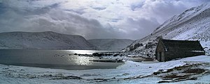
The rivers abound with salmon and trout, and the pearl mussel occurs in the Ythan and Don. A valuable pearl in the Scottish crown is said to be from the Ythan. Loch Muick, the largest of the few lakes in the county, 1,310 ft above the sea, 2½ miles long and ⅓ to ½ miles broad, lies some 8½ miles south-west of Ballater, and has Altnagiuthasach, a royal shooting-box, near its south-western end. Loch Strathbeg, 6 miles south-east of Fraserburgh, is only separated from the sea by a narrow strip of land. There are noted chalybeate springs at Peterhead, Fraserburgh, and Pannanich near Ballater.
Cities
- Aberdeen (county town, partly in Kincardineshire)
Towns and villages
Parishes
- Aberdeen*†
- Aberdour
- Aboyne and Glen Tanar
- Alford
- Auchindoir and Kearn
- Auchterless
- Belhelvie
- Birse
- Bourtie
- Cabrach‡
- Cairnie
- Chapel of Garioch
- Clatt
- Cluny
- Coull
- Crathie and Braemar
- Crimond
- Cruden
- Culsalmond
- Daviot
- Drumblade
- Drumoak†
- Dyce
- Echt
- Ellon
- Fintray
- Forgue
- Foveran
- Fraserburgh
- Fyvie
- Gartly
- Glass‡
- Glenbuchat
- Glenmuick, Tullich and Glengairn
- Huntly
- Insch
- Inverurie
- Keig
- Keithhall and Kinkell
- Kemnay
- Kennethmont
- Kildrummy
- Kincardine O'Neil
- Kinellar
- King Edward
- Kintore
- Leochel-Cushnie
- Leslie
- Logie Buchan
- Logie-Coldstone
- Longside
- Lonmay
- Lumphanan
- Meldrum
- Methlick
- Midmar
- Monquhitter
- Monymusk
- New Deer
- Newhills
- New Machar
- Old Deer
- Old Machar
- Oyne
- Peterculter
- Peterhead
- Pitsligo
- Premnay
- Rathen
- Rayne
- Rhynie
- Skene
- Slains
- St Fergus
- Strathdon
- Strichen
- Tarland
- Tarves
- Tough
- Towie
- Tullynessle and Forbes
- Turriff
- Tyrie
- Udny
*: The City Parish of Aberdeen comprises the ancient parishes of Greyfriars, St Clements, East, West, North & South, and parts of Banchory-Devenick, Newhills, Nigg, Old Machar and Peterculter.
†: Extends into Kincardineshire.
‡: Shared with Banffshire.
Additionally small parts of the parishes of Banchory-Ternan and Maryculter, otherwise in Kincardineshire, extend into Aberdeenshire.
Transport

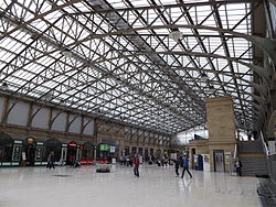
In the south of the county, Aberdeen has rail links with Stonehaven, Montrose and Dundee, and to the north-west a line runs to Inverness via Huntly, Keith and Elgin.
Branch lines from various points used to run to several smaller towns, e.g. from Aberdeen to Ballater by Deeside, from Aberdeen to Fraserburgh (with a branch at Maud for Peterhead and at Ellon for Cruden Bay and Boddam), from Kintore to Alford, and from Inverurie to Old Meldrum and also to Macduff.[1] These lines all closed, largely as a result of the Beeching Axe in the 1960s, they now serve as local pathways or bicycle tracks.
By sea Aberdeenshire has regular communication with the Orkney and the Shetland Islands.[1]
The highest of the macadamized roads crossing the eastern Grampians rises to a point 2,200 feet above sea-level.[1]
Over the 20th century road and air communications were much improved. Aberdeen Airport is an international airport, located at Dyce, a suburb of Aberdeen, approximately five nautical miles north-west of Aberdeen city centre.[2] A total of nearly 3½ million passengers used the airport in 2015, a fall of 6.8% compared with 2014.[3]
History
The country later forming the shires of Aberdeen and Banff once served as home to the northern Picts, whom Ptolemy called Taixall, dubbing the territory Taixalon. Their town of Devana, once supposed to be the modern Aberdeen, has been identified by John Stuart with a site in the parish of Peterculter, where there are remains of an ancient camp at Normandykes, and by William Forbes Skene with a station on Loch Davan, west of Aboyne. Roman Camps have also been discovered on the upper Ythan and Deveron, but evidence of effective Roman occupation is still to seek. Traces of the native inhabitants, however, occur much more frequently. Weems or earth-houses occur fairly commonly in the west. Relics of crannogs or lake-dwellings exist at Loch Kinord, five miles north-east of Ballater, at Loch Goul in the parish of New Machar and elsewhere. Duns or forts occur on hills at Dunecht, where the dun encloses an area of two acres, Barra near Old Meldrum, Tap o' Noth, Dunnideer near Insch and other places. Monoliths, standing stones and "druidical" circles of the pagan period abound, as do many examples of the sculptured stones of the early Christian epoch.[1]
Efforts to convert the Picts started with Teman in the 5th century, and continued with Columba (who founded a monastery at Old Deer), Drostan, Maluog, and Machar, lasting results emerged only slowly. Indeed, dissensions within the Columban church and the expulsion of the clergy from Pictland by the Pictish king Nectan in the 8th century undid most of the progress that missionaries had made. The Vikings and Danes periodically raided the coast, but after Macbeth ascended the throne of Scotland in 1040, the Orkney men, under the guidance of Thorfinn Sigurdsson, refrained from further trouble in the north-east. Macbeth was afterwards slain at Lumphanan (1057), a cairn on Perkhill marking the spot.[1]
The influence of the Norman conquest made itself felt even in Aberdeenshire. Along with numerous Anglo-Saxon exiles, there also settled Flemings who introduced various industries, Saxons who brought farming, and Scandinavians who taught nautical skill. The Celts revolted more than once, but Malcolm Canmore and his successors crushed them and confiscated their lands. In the reign of Alexander I (ruled 1107–1124) mention first appears of Aberdeen (originally called Abordo] and, in the Norse sagas, Apardion), which received its charter from William the Lion in 1179, by which date its burgesses had already combined with those of Banff, Elgin, Inverness and other trans-Grampian communities to form a free Hanse, under which they enjoyed exceptional trading privileges. By this time, too, the Church had extended its organisation, establishing the bishopric of Aberdeen in 1150.[1]
In the 12th and 13th centuries some of the great Aberdeenshire families arose, including the earl of Mar (c. 1122), the Leslies, Freskins (ancestors of the dukes of Sutherland), Durwards, Bysets, Comyns and Cheynes; significantly, in most cases their founders had immigrated to the district.[1]
The Celtic thanes and their retainers slowly fused with the settlers. They declined to take advantage of the disturbed condition of the country during the wars of the Scots independence, and made common cause with the bulk of the nation.[1]
Though John Comyn (d. 1300?), one of the competitors for the throne, had considerable interests in the shire, his claim received locally little support. In 1296 Edward I made a triumphal march to the north to terrorise the more turbulent nobles. Next year William Wallace surprised the English garrison in Aberdeen, but failed to capture the castle. In 1303 Edward again visited the county, halting at the Castle of Kildrummy, then in the possession of Robert Bruce, who shortly afterwards became the acknowledged leader of the Scots and made Aberdeen his headquarters for several months. Despite the seizure of Kildrummy Castle by the English in 1306, Bruce's prospects brightened from 1308, when he defeated John Comyn, earl of Buchan (died 1313?), at Inverurie.[4]
For a hundred years after Robert Bruce's death (1329) intermittent anarchy occurred in the shire. The English burned Aberdeen itself in 1336, and the re-settlement of the districts of Buchan and Strathbogie occasioned constant quarrels on the part of the dispossessed. Moreover, the crown had embroiled itself with some of the Highland chieftains, whose independence it sought to abolish. This policy culminated in the invasion of Aberdeenshire by Donald, Lord of the Isles, who, however, suffered defeat at Harlaw, near Inverurie, at the hands of the Earl of Mar in 1411.[5]
In the 15th century two further leading county families emerged: Sir Alexander Forbes becoming Lord Forbes about 1442, and Sir Alexander Seton, Lord Gordon in 1437 and Earl of Huntly in 1445. Bitter feuds raged between these families for a long period, but the Gordons reached the height of their power in the first half of the 16th century, when their domains, already vast, were enhanced by the acquisition, through marriage, of the Earldom of Sutherland (1514).[5]
Meanwhile, commerce with the Low Countries, Poland and the Baltic had grown apace, Campvere (Veere in Dutch), near Flushing (Vlissingen) in the Netherlands, becoming the emporium of the Scottish traders, while education was fostered by the foundation of King's College, Aberdeen in 1497 (Marischal College followed a century later). At the Reformation so little intuition had the clergy of the drift of opinion that at the very time that religious structures were being despoiled in the south, the building and decoration of churches went on in the shire. Protestantism came in without much tumult, though rioting took place in Aberdeen and St Machar's Cathedral in the city suffered damage. The Earl of Huntly offered some resistance, on behalf of the Catholics, to the influence of James Stewart, 1st Earl of Moray, who was regent during the reign of James VI, but was defeated and killed at Corrichie on the Hill of Fare in 1562.[5]
As years passed it became apparent that Presbyterianism gained less generally support than Episcopacy, of which system Aberdeenshire remained for generations the stronghold in Scotland.[5]
Another crisis in ecclesiastical affairs arose in 1638, when the authorities ordered subscription to the National Covenant. Aberdeenshire responded so grudgingly to this demand that James Graham, 1st Marquess of Montrose visited the shire in the following year to enforce acceptance. The Cavaliers, not being disposed to yield, dispersed an armed gathering of Covenanters in the affair called the Trot of Turriff (1639), shedding the first blood of the civil war. The Covenanters obtained the upper hand in a few weeks, when Montrose appeared at the Bridge of Dee and compelled the surrender of Aberdeen, which had no choice but to cast in its lot with the victors.[5]
Montrose, however, soon changed sides, and after defeating the Covenanters under Lord Balfour of Burleigh (1644), delivered the city to rapine. He worsted the Covenanters again after a stiff fight on 2 July 1645, at Alford, a village in the beautiful Howe of Alford. Peace was temporarily restored on the "engagement" of the Scots commissioners to assist Charles I.[5]
Aberdeen welcomed Charles II on his return from the Netherlands in 1650, but in little more than a year General George Monck entered the city at the head of the Cromwellian regiments. The English garrison remained till 1659, but the following year Aberdeenshire effusively hailed the Restoration, and prelacy once more went into the ascendant. Most of the Presbyterians conformed, but the Quakers, more numerous in the county and the adjoining Kincardineshire than anywhere else in Scotland, suffered systematic persecution.[5]
After the Glorious Revolution (1688) episcopacy passed under a cloud, but the clergy, yielding to force majeure, gradually accepted the inevitable, hoping, as long as Queen Anne lived, that prelacy might yet become the national form of Church government. Her death dissipated these dreams, and as George I, her successor, was antipathetic to the clergy, it happened that Jacobitism and episcopalianism came to be regarded in the shire as identical, though the non-jurors as a body never countenanced rebellion.[5]
On 6 September 1715 the Earl of Mar raised the standard of revolt in Braemar; a fortnight later James Francis Edward Stuart was proclaimed at Aberdeen cross; the Pretender landed at Peterhead on 22 December, and in February 1716 he was back again in France. The collapse of the first rising ruined many of the lairds, and when the second rebellion occurred thirty years afterwards the county in the main remained apathetic, though the insurgents held Aberdeen for five months, and Lord Lewis Gordon won a trifling victory for Prince Charles Edward Stuart at Inverurie (23 December 1745). The Duke of Cumberland relieved Aberdeen at the end of February 1746, and by April the Young Pretender had become a fugitive.[5]
Thereafter the people devoted themselves to agriculture, industry and commerce, which developed by leaps and bounds, and, along with equally remarkable progress in education, transformed the aspect of the shire and made the community as a whole one of the most prosperous in Scotland.[5]
Places of interest
- Aden Country Park
 Balmoral Castle
- Bullers of Buchan
 Cairness House
 Deer Abbey, Old Deer
 Fyvie Castle
 Haddo House
 Huntly Castle
 Museum of Scottish Lighthouses
References
| Counties of the United Kingdom |
|---|
|
Aberdeen • Anglesey • Angus • Antrim • Argyll • Armagh • Ayr • Banff • Bedford • Berks • Berwick • Brecknock • Buckingham • Bute • Caernarfon • Caithness • Cambridge • Cardigan • Carmarthen • Chester • Clackmannan • Cornwall • Cromarty • Cumberland • Denbigh • Derby • Devon • Dorset • Down • Dumfries • Dunbarton • Durham • East Lothian • Essex • Fermanagh • Fife • Flint • Glamorgan • Gloucester • Hants • Hereford • Hertford • Huntingdon • Inverness • Kent • Kincardine • Kinross • Kirkcudbright • Lanark • Lancaster • Leicester • Lincoln • Londonderry • Merioneth • Middlesex • Midlothian • Monmouth • Montgomery • Moray • Nairn • Norfolk • Northampton • Northumberland • Nottingham • Orkney • Oxford • Peebles • Pembroke • Perth • Radnor • Renfrew • Ross • Roxburgh • Rutland • Selkirk • Shetland • Salop • Somerset • Stafford • Stirling • Suffolk • Surrey • Sussex • Sutherland • Tyrone • Warwick • West Lothian • Westmorland • Wigtown • Wilts • Worcester • York |