Norfolk: Difference between revisions
Created page with '{{Infobox county |name=Norfolk |map image=NorfolkBrit5.PNG |picture=Norfolk broads.jpg |picture caption= |area=2,044 square miles |county town=Norwich }} '''Norfolk''' is a …' |
|||
| (12 intermediate revisions by 2 users not shown) | |||
| Line 1: | Line 1: | ||
{{Infobox county | {{Infobox county | ||
|name=Norfolk | |name=Norfolk | ||
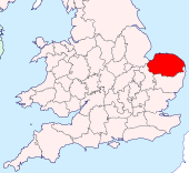
|map image= | |map image=Norfolk Brit Isles Sect 5.svg | ||
|picture=Norfolk broads.jpg | |picture=Norfolk broads.jpg | ||
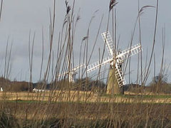
|picture caption= | |picture caption=The Norfolk Broads | ||
|flag={{database|Norfolk|flag}} | |||
|area=2,044 square miles | |area=2,044 square miles | ||
|county town=[[Norwich]] | |county town=[[Norwich]] | ||
}} | }} | ||
The '''County of Norfolk''' is a [[Counties of the United Kingdom|shire]] of [[East Anglia]], which along with [[Suffolk]], is one of only two counties entirely east of the [[Prime Meridian]]. | |||
Norfolk's long border with its southern neighbour Suffolk is marked by the River [[Little Ouse]] from its source to the [[Cambridgeshire]] border to the west; and by the [[River Waveney]] from its source to the sea, the two rivers rising within yards of each other in Little Fen and flowing in opposite directions. To the west lie Cambridgeshire and [[Lincolnshire]], the latter border running across the drained [[Terrington Marsh]] to [[the Wash]]. The [[North Sea]] washes Norfolk to the east and to the north, a long, flat coast. | |||
{{ | The [[county town]] is the cathedral city of [[Norwich]]. | ||
Norfolk is a large and largely rural with a low population density, of some 400 people a square mile. The main population is centred on the county town, [[Norwich]]. It is a county of farms and charms, many visitors brought by the calm or by sights and experiences such as historic Norwich and the Norfolk Broads. | |||
==The Norfolk Broads== | |||
[[The Broads|The Norfolk Broads]] spread out across the east of the county, a network of rivers and lakes in flat countryside and spreading into neighbouring [[Suffolk]]. This land is at sea level and here the rivers are embanked, with countless straight, narrow “dikes” (ditches) draining into them across the fields. | |||
The broads themselves are the broad, flat lakes which punctuate the landscape as rivers spread out into reed-filled meres. The broads are popular for sailing and leisure cruising. | |||
The Norfolk and Suffolk Broads Authority is a statutory body similar to those governing the National Parks.<ref>http://www.broads-authority.gov.uk/index.html</ref> | |||
==History== | |||
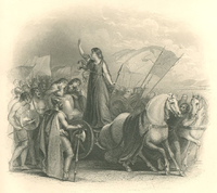
[[File:Boadicea haranguing2.png|right|thumb|200px|Queen Boadicea]] | |||
Flint has been quarried and mined in Norfolk since the Stone Age; Grimes Graves are prehistoric flint mines. By the Roman period the Iceni tribe lived in this land. The Iceni resisted the Roman invasion of Britain in AD 47, and revolted in AD 60 led by their famous Queen Boadicea. The rebellion was brutally crushed and the county was opened to the Romans. During this time Roman roads were driven across the land, the routes of some of which are still in use. Norfolk roads and ports were constructed throughout the county and farming improved. Norfolk looks east at the sea, and from here came seaborne raiders from late Roman times. The Romans built forts to defend against them, such as those whose remains are found at [[Caister-on-Sea]] and [[Burgh Castle]]. | |||
By the 5th century the Angles, after whom East Anglia and England itself are named, had established control of the region, the people divided into the "north folk" and the "south folk"; "Norfolk" and "Suffolk". This period gave the county some of the distinctive place-names it bears, some of the earlier English place-names. The Northfolk became part of the Kingdom of the East Angles (East Anglia). After some years of brilliance, the kingdom fell under the influence of neighbouring kingdoms until in the 9th century the Danes descended upon it and East Anglia became a Danish-English kingdom; Guthrum, whom Alfred defeated, became Christian, took the baptismal name Athelstan and came to Norfolk to rule as King of the East Angles. | |||
In the centuries before the Norman Conquest the wetlands of the east of the county began to be converted to farmland, and settlements grew in these areas, so that by the time of the Conquest and [[Domesday Book]] survey of 1086, Norfolk was one of the most densely populated parts of the British Isles. | |||
During the high and late Middle Ages the county developed arable agriculture and woollen industries. The economy was in decline by the time of the Black Death, which dramatically reduced the population in 1349, so that even today the population outside Norwich is small. | |||
Over one-third of the population of Norwich died during a plague epidemic in 1579.<ref>{http://www.bbc.co.uk/radio4/history/voices/voices_salisbury.shtml BBC Radio 4 ''Voices of the Powerless''] - 29 August 2002, Plague in Tudor and Stuart Britain</ref> By the 16th century Norwich had grown to become the second largest city in England, but in 1665 the Great Plague again killed around one third of the population.<ref>Anon, 2002. [http://www.about-norfolk.com/about/county/norfolk%20history.htm Norfolk History].</ref> During the English Civil War Norfolk was largely Parliamentarian. The economy and agriculture of the region declined somewhat, and during the industrial revolution Norfolk developed little industry except in Norwich and was a late addition to the railway network. | |||
In the 20th century the county developed a role in aviation. The first development in airfields came with the First World War; there was then a massive expansion during the Second World War with the growth of the Royal Air Force and the influx of the American USAAF 8th Air Force which operated from many Norfolk Airfields. During the Second World War agriculture rapidly intensified, and has remained very intensive since with the establishment of large fields for cereal and oil seed rape growing. Norfolk's low-lying land and easily eroded cliffs, many of which are chalk and clay, make it vulnerable to the sea, the most recent major event being the North Sea flood of 1953. | |||
The low-lying section of coast between [[Kelling]] and [[Lowestoft]] Ness in [[Suffolk]] is currently managed by the Environment Agency to protect the Broads from sea flooding. Management policy for the North Norfolk coastline is described in the North Norfolk Shoreline Management Plan which was published in 2006 but has yet to be accepted by the local authorities. The Shoreline Management Plan states that the stretch of coast will be protected for at least another 50 years, but that in the face of sea level rise and post-glacial lowering of land levels in the South East, there is an urgent need for further research to inform future management decisions, including the possibility that the sea defences may have to be realigned to a more sustainable position. Natural England have contributed some research into the impacts on the environment of various realignment options. The draft report of their research was leaked to the press, who created great anxiety by reporting that Natural England plan to abandon a large section of the Norfolk Broads, villages and farmland face to the sea to save the rest of the Norfolk coastline from the impact of climate change.<ref>{{Cite news|url=http://www.timesonline.co.uk/tol/news/environment/article3642929.ece|publisher=''The Times''|title=Climate change: surrender a slab of Norfolk, say conservationists|first=Valerie|last=Elliott|date=2008-03-29|accessdate=2008-05-14 | location=London}}</ref> | |||
==Towns and villages== | |||
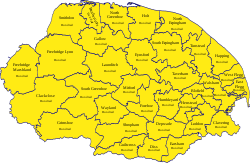
[[File:Norfolk Hundreds.svg|thumb|250px|The hundreds of Norfolk]] | |||
Norfolk's county town and only city is [[Norwich]]. Norwich was one of the largest towns in England during the Middle Ages and though now surpassed elsewhere it remains the largest town in East Anglia and the county's main business and culture centre. | |||
===City=== | |||
*[[Norwich]] ''([[county town]])'' | |||
===Other towns=== | |||
*[[King's Lynn]], a port town on [[the Wash]] | |||
*[[Great Yarmouth]], a seaside resort and gateway to the Broads ''(partly in [[Suffolk]])'' | |||
*[[Aylsham]] | |||
*[[Dereham]] | |||
*[[Diss]] | |||
*[[Downham Market]] | |||
*[[Fakenham]] | |||
*[[Holt, Norfolk|Holt]] | |||
*[[North Walsham]] | |||
*[[Swaffham]] | |||
*[[Thetford, Norfolk|Thetford]] ''(partly in [[Suffolk]])'' | |||
*[[Wymondham]] | |||
Additionally, the town of [[Wisbech]], otherwise in [[Cambridgeshire]] extends into Norfolk. | |||
==Dialect, accent and nickname== | |||
The Norfolk dialect, also known as "Broad Norfolk", is the accent or dialect of people living in Norfolk, although over the modern age much of the vocabulary and many of the phrases have died out through contact with mass media and incomers to the county. | |||
Norfolk has not just one accent but a multiple of subtly distinctive regional dialects which can vary noticeably even across the one county. | |||
More cutting, perhaps, was the pejorative medical slang term "Normal for Norfolk", alluding to the county's perceived status as an illiterate incestuous backwater. Use of term has ever been unofficial, and is now discredited, its use discouraged by the profession. | |||
==Tourism== | |||
Norfolk is a popular tourist destination and has several major examples of holiday attractions. There are many seaside resorts, including some of the finest British beaches, such as those at Great Yarmouth, [[Waxham]], [[Cromer]] and [[Holkham]] Bay. Norfolk is probably best known for [[the Broads]] and other areas of outstanding natural beauty and many areas of the coast are wild bird sanctuaries and reserves with some areas given conservation designations, such as the 'Norfolk Coast Area of Outstanding Natural Beauty'. Tourists and locals enjoy the wide variety of monuments and historical buildings in both Norfolk and the city of [[Norwich]]. | |||
<gallery widths="160px" heights="145px" perrow="6"> | |||
File:ElmHill.jpg|The historic city of Norwich | |||
File:Mundesleybeachnorth.jpg|The Norfolk Coast at Cromer | |||
File:WroxhamBridge.jpg|The [[Norfolk Broads]] | |||
File:Peddars_Way_-_Holkham_Bay.jpg|The beach at Holkham Bay | |||
</gallery> | |||
The Queen's residence at Sandringham House in [[Sandringham]] provides an all-year-round tourist attraction whilst the coast and some rural areas are popular locations for holidays and holiday homes. | |||
{{UKPlacesKey|E}} | |||
==Places of interest== | |||
===Gardens=== | |||
*Fairhaven Woodland and Water Garden | |||
*Gooderstone Water Gardens | |||
*Priory Maze | |||
===Areas of Interest=== | |||
*The [[Norfolk Broads]] | |||
*North Norfolk Heritage Coast | |||
*{{i-NTE}} [[Sheringham Park]] | |||
===Nature Reserves=== | |||
*Norfolk Wildlife Trust | |||
*National Nature Reserves in Norfolk | |||
*RSPB nature reserves: | |||
**Berney Marshes | |||
**[[Breydon Water]] | |||
**Halvergate Marshes | |||
**[[Snettisham]] | |||
**Strumpshaw Fen | |||
**Titchwell Marsh | |||
===Houses, Castles and Churches=== | |||
{{i-House}} | |||
*{{i-NTE}} [[Blickling Hall]] | |||
*[[Felbrigg Hall]] | |||
*{{i-NTE}} [[Oxburgh Hall]] | |||
*Walsingham Abbey | |||
*[[Wymondham Abbey]] | |||
*[[Castle Acre Priory]] | |||
*[[Holkham Hall]] | |||
===Footpaths=== | |||
Long distance footpaths: | |||
*[[Angles Way]] | |||
*[[Fen Rivers Way]] | |||
*[[Nar Valley Way]] | |||
*[[North Norfolk Coastal Path]] | |||
*[[Peddars Way]] | |||
*[[Weavers Way]] | |||
===Heritage Sites=== | |||
*{{i-HR}} Heritage railways: | |||
**[[Bressingham Steam Museum]] | |||
**[[Bure Valley Railway]] | |||
**[[Mid-Norfolk Railway]] | |||
**East Anglian Railway Museum | |||
**[[North Norfolk Railway]] | |||
*{{i-Museum}} [[Norwich Castle]] Museum | |||
*Norfolk Windmills Trust | |||
*{{i-Museum}} City of Norwich Aviation Museum | |||
===Amusement parks and zoos=== | |||
Norfolk has several amusement parks and zoos, several in [[Great Yarmouth]]: | |||
*{{i-Zoo}} Amazona Zoo, Cromer | |||
*{{i-Zoo}} Amazonia tropical jungle zoo, Great Yarmouth seafront | |||
*{{i-Zoo}} Banham Zoo, Banham | |||
*{{i-Themepark}} BeWILDerwood, within the Norfolk Broads at Hoveton near Wroxham | |||
*Britannia Pier, Great Yarmouth | |||
*Extreeme Adventure, Weasenham Woods (a high ropes course) | |||
*{{i-Zoo}} Pettitts Animal Adventure Park, Reedham | |||
*The Pleasure Beach, Great Yarmouth | |||
*The Sea Life Centre, [[Great Yarmouth]] | |||
*{{i-House}} {{i-Zoo}} Thrigby Hall, Great Yarmouth; its zoo has a large tiger enclosure, primate enclosures and the swamp house with crocodiles and alligators. | |||
==Outside links== | |||
*[http://www.visiteastofengland.com Official Visitor site for the East of England] | |||
*[http://www.visitnorfolk.co.uk Norfolk tourism (official site)] | |||
*[http://www.norfolktouristinformation.com Norfolk Tourist Information] | |||
*[http://video.google.co.uk/videoplay?docid=1561406051370981651 "60 Years of Change". A digital story, telling of the changes in a village school in rural Norfok] | |||
*[http://www.scenicnorfolk.co.uk Photos of Norfolk] | |||
*[http://www.norwich.anglican.org/church Churches in Norfolk] | |||
*[http://www.norfolkchurches.co.uk/mainpage.htm Norfolk Churches] website by Simon Knott | |||
*[http://www.historic-maps.norfolk.gov.uk Norfolk E-Map Explorer - historical maps and aerial photographs of Norfolk] | |||
*[http://www.escapeandexplore.co.uk/galleries/norfolk.htm?view=link Gallery of Norfolk] - Photographs of Norfolk | |||
*[http://www.archivefilmshop.co.uk/shop/product.php?pid=55 Video clip of 'Norfolk Past: The County our Parents Knew'] - original archive film from Norfolk | |||
*[http://www.grahammelbournephotography.co.uk Photographs of Norfolk and surrounding areas] | |||
==References== | |||
{{Reflist|2}} | |||
{{British county}} | {{British county}} | ||
Latest revision as of 18:28, 10 June 2019
| Norfolk United Kingdom | |
 The Norfolk Broads | |
|---|---|

| |
| Flag | |
| |
| [Interactive map] | |
| Area: | 2,044 square miles |
| Population: | 807,721 |
| County town: | Norwich |
| County flower: | Common poppy [1] |
The County of Norfolk is a shire of East Anglia, which along with Suffolk, is one of only two counties entirely east of the Prime Meridian.
Norfolk's long border with its southern neighbour Suffolk is marked by the River Little Ouse from its source to the Cambridgeshire border to the west; and by the River Waveney from its source to the sea, the two rivers rising within yards of each other in Little Fen and flowing in opposite directions. To the west lie Cambridgeshire and Lincolnshire, the latter border running across the drained Terrington Marsh to the Wash. The North Sea washes Norfolk to the east and to the north, a long, flat coast.
The county town is the cathedral city of Norwich.
Norfolk is a large and largely rural with a low population density, of some 400 people a square mile. The main population is centred on the county town, Norwich. It is a county of farms and charms, many visitors brought by the calm or by sights and experiences such as historic Norwich and the Norfolk Broads.
The Norfolk Broads
The Norfolk Broads spread out across the east of the county, a network of rivers and lakes in flat countryside and spreading into neighbouring Suffolk. This land is at sea level and here the rivers are embanked, with countless straight, narrow “dikes” (ditches) draining into them across the fields.
The broads themselves are the broad, flat lakes which punctuate the landscape as rivers spread out into reed-filled meres. The broads are popular for sailing and leisure cruising.
The Norfolk and Suffolk Broads Authority is a statutory body similar to those governing the National Parks.[1]
History
Flint has been quarried and mined in Norfolk since the Stone Age; Grimes Graves are prehistoric flint mines. By the Roman period the Iceni tribe lived in this land. The Iceni resisted the Roman invasion of Britain in AD 47, and revolted in AD 60 led by their famous Queen Boadicea. The rebellion was brutally crushed and the county was opened to the Romans. During this time Roman roads were driven across the land, the routes of some of which are still in use. Norfolk roads and ports were constructed throughout the county and farming improved. Norfolk looks east at the sea, and from here came seaborne raiders from late Roman times. The Romans built forts to defend against them, such as those whose remains are found at Caister-on-Sea and Burgh Castle.
By the 5th century the Angles, after whom East Anglia and England itself are named, had established control of the region, the people divided into the "north folk" and the "south folk"; "Norfolk" and "Suffolk". This period gave the county some of the distinctive place-names it bears, some of the earlier English place-names. The Northfolk became part of the Kingdom of the East Angles (East Anglia). After some years of brilliance, the kingdom fell under the influence of neighbouring kingdoms until in the 9th century the Danes descended upon it and East Anglia became a Danish-English kingdom; Guthrum, whom Alfred defeated, became Christian, took the baptismal name Athelstan and came to Norfolk to rule as King of the East Angles.
In the centuries before the Norman Conquest the wetlands of the east of the county began to be converted to farmland, and settlements grew in these areas, so that by the time of the Conquest and Domesday Book survey of 1086, Norfolk was one of the most densely populated parts of the British Isles.
During the high and late Middle Ages the county developed arable agriculture and woollen industries. The economy was in decline by the time of the Black Death, which dramatically reduced the population in 1349, so that even today the population outside Norwich is small.
Over one-third of the population of Norwich died during a plague epidemic in 1579.[2] By the 16th century Norwich had grown to become the second largest city in England, but in 1665 the Great Plague again killed around one third of the population.[3] During the English Civil War Norfolk was largely Parliamentarian. The economy and agriculture of the region declined somewhat, and during the industrial revolution Norfolk developed little industry except in Norwich and was a late addition to the railway network.
In the 20th century the county developed a role in aviation. The first development in airfields came with the First World War; there was then a massive expansion during the Second World War with the growth of the Royal Air Force and the influx of the American USAAF 8th Air Force which operated from many Norfolk Airfields. During the Second World War agriculture rapidly intensified, and has remained very intensive since with the establishment of large fields for cereal and oil seed rape growing. Norfolk's low-lying land and easily eroded cliffs, many of which are chalk and clay, make it vulnerable to the sea, the most recent major event being the North Sea flood of 1953.
The low-lying section of coast between Kelling and Lowestoft Ness in Suffolk is currently managed by the Environment Agency to protect the Broads from sea flooding. Management policy for the North Norfolk coastline is described in the North Norfolk Shoreline Management Plan which was published in 2006 but has yet to be accepted by the local authorities. The Shoreline Management Plan states that the stretch of coast will be protected for at least another 50 years, but that in the face of sea level rise and post-glacial lowering of land levels in the South East, there is an urgent need for further research to inform future management decisions, including the possibility that the sea defences may have to be realigned to a more sustainable position. Natural England have contributed some research into the impacts on the environment of various realignment options. The draft report of their research was leaked to the press, who created great anxiety by reporting that Natural England plan to abandon a large section of the Norfolk Broads, villages and farmland face to the sea to save the rest of the Norfolk coastline from the impact of climate change.[4]
Towns and villages
Norfolk's county town and only city is Norwich. Norwich was one of the largest towns in England during the Middle Ages and though now surpassed elsewhere it remains the largest town in East Anglia and the county's main business and culture centre.
City
Other towns
- King's Lynn, a port town on the Wash
- Great Yarmouth, a seaside resort and gateway to the Broads (partly in Suffolk)
- Aylsham
- Dereham
- Diss
- Downham Market
- Fakenham
- Holt
- North Walsham
- Swaffham
- Thetford (partly in Suffolk)
- Wymondham
Additionally, the town of Wisbech, otherwise in Cambridgeshire extends into Norfolk.
Dialect, accent and nickname
The Norfolk dialect, also known as "Broad Norfolk", is the accent or dialect of people living in Norfolk, although over the modern age much of the vocabulary and many of the phrases have died out through contact with mass media and incomers to the county.
Norfolk has not just one accent but a multiple of subtly distinctive regional dialects which can vary noticeably even across the one county.
More cutting, perhaps, was the pejorative medical slang term "Normal for Norfolk", alluding to the county's perceived status as an illiterate incestuous backwater. Use of term has ever been unofficial, and is now discredited, its use discouraged by the profession.
Tourism
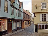
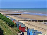
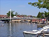
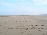
Norfolk is a popular tourist destination and has several major examples of holiday attractions. There are many seaside resorts, including some of the finest British beaches, such as those at Great Yarmouth, Waxham, Cromer and Holkham Bay. Norfolk is probably best known for the Broads and other areas of outstanding natural beauty and many areas of the coast are wild bird sanctuaries and reserves with some areas given conservation designations, such as the 'Norfolk Coast Area of Outstanding Natural Beauty'. Tourists and locals enjoy the wide variety of monuments and historical buildings in both Norfolk and the city of Norwich.
-
The historic city of Norwich
-
The Norfolk Coast at Cromer
-
The Norfolk Broads
-
The beach at Holkham Bay
The Queen's residence at Sandringham House in Sandringham provides an all-year-round tourist attraction whilst the coast and some rural areas are popular locations for holidays and holiday homes.
| Key | |
| Cathedral/Abbey/Priory | |
| Accessible open space | |
| Amusement/Theme Park | |
| Castle | |
| Country Park | |
| English Heritage | |
| Forestry Commission | |
| Heritage railway | |
| Historic House | |
| Museum (free/not free) | |
| National Trust | |
| Zoo | |
Places of interest
Gardens
- Fairhaven Woodland and Water Garden
- Gooderstone Water Gardens
- Priory Maze
Areas of Interest
- The Norfolk Broads
- North Norfolk Heritage Coast
 Sheringham Park
Nature Reserves
- Norfolk Wildlife Trust
- National Nature Reserves in Norfolk
- RSPB nature reserves:
- Berney Marshes
- Breydon Water
- Halvergate Marshes
- Snettisham
- Strumpshaw Fen
- Titchwell Marsh
Houses, Castles and Churches
 Blickling Hall
- Felbrigg Hall
 Oxburgh Hall
- Walsingham Abbey
- Wymondham Abbey
- Castle Acre Priory
- Holkham Hall
Footpaths
Long distance footpaths:
Heritage Sites
 Heritage railways:
- Bressingham Steam Museum
- Bure Valley Railway
- Mid-Norfolk Railway
- East Anglian Railway Museum
- North Norfolk Railway
 Norwich Castle Museum
- Norfolk Windmills Trust
 City of Norwich Aviation Museum
Amusement parks and zoos
Norfolk has several amusement parks and zoos, several in Great Yarmouth:
 Amazona Zoo, Cromer
 Amazonia tropical jungle zoo, Great Yarmouth seafront
 Banham Zoo, Banham
 BeWILDerwood, within the Norfolk Broads at Hoveton near Wroxham
- Britannia Pier, Great Yarmouth
- Extreeme Adventure, Weasenham Woods (a high ropes course)
 Pettitts Animal Adventure Park, Reedham
- The Pleasure Beach, Great Yarmouth
- The Sea Life Centre, Great Yarmouth

 Thrigby Hall, Great Yarmouth; its zoo has a large tiger enclosure, primate enclosures and the swamp house with crocodiles and alligators.
Outside links
- Official Visitor site for the East of England
- Norfolk tourism (official site)
- Norfolk Tourist Information
- "60 Years of Change". A digital story, telling of the changes in a village school in rural Norfok
- Photos of Norfolk
- Churches in Norfolk
- Norfolk Churches website by Simon Knott
- Norfolk E-Map Explorer - historical maps and aerial photographs of Norfolk
- Gallery of Norfolk - Photographs of Norfolk
- Video clip of 'Norfolk Past: The County our Parents Knew' - original archive film from Norfolk
- Photographs of Norfolk and surrounding areas
References
- ↑ http://www.broads-authority.gov.uk/index.html
- ↑ {http://www.bbc.co.uk/radio4/history/voices/voices_salisbury.shtml BBC Radio 4 Voices of the Powerless] - 29 August 2002, Plague in Tudor and Stuart Britain
- ↑ Anon, 2002. Norfolk History.
- ↑ Elliott, Valerie (2008-03-29). "Climate change: surrender a slab of Norfolk, say conservationists". London: The Times. http://www.timesonline.co.uk/tol/news/environment/article3642929.ece. Retrieved 2008-05-14.
| Counties of the United Kingdom |
|---|
|
Aberdeen • Anglesey • Angus • Antrim • Argyll • Armagh • Ayr • Banff • Bedford • Berks • Berwick • Brecknock • Buckingham • Bute • Caernarfon • Caithness • Cambridge • Cardigan • Carmarthen • Chester • Clackmannan • Cornwall • Cromarty • Cumberland • Denbigh • Derby • Devon • Dorset • Down • Dumfries • Dunbarton • Durham • East Lothian • Essex • Fermanagh • Fife • Flint • Glamorgan • Gloucester • Hants • Hereford • Hertford • Huntingdon • Inverness • Kent • Kincardine • Kinross • Kirkcudbright • Lanark • Lancaster • Leicester • Lincoln • Londonderry • Merioneth • Middlesex • Midlothian • Monmouth • Montgomery • Moray • Nairn • Norfolk • Northampton • Northumberland • Nottingham • Orkney • Oxford • Peebles • Pembroke • Perth • Radnor • Renfrew • Ross • Roxburgh • Rutland • Selkirk • Shetland • Salop • Somerset • Stafford • Stirling • Suffolk • Surrey • Sussex • Sutherland • Tyrone • Warwick • West Lothian • Westmorland • Wigtown • Wilts • Worcester • York |
