County Durham: Difference between revisions
No edit summary |
m Edit to page County Durham |
||
| (11 intermediate revisions by 5 users not shown) | |||
| Line 1: | Line 1: | ||
{{Infobox county | {{Infobox county | ||
|name=County Durham | |name=County Durham | ||
|map image= | |map image=Durham Brit Isles Sect 3.svg | ||
|picture= Durham Cathedral 2.jpg | |picture= Durham Cathedral 2.jpg | ||
|picture caption= Durham Cathedral | |picture caption= Durham Cathedral | ||
|flag=County Durham Flag.svg | |||
|area=1,015 square miles | |area=1,015 square miles | ||
|county town=[[Durham]] | |county town=[[Durham]] | ||
|biggest town=[[Sunderland]] | |biggest town=[[Sunderland]] | ||
}} | }} | ||
The '''County Palatine of Durham''' is a [[Counties of the United Kingdom|shire]] | The '''County Palatine of Durham''' is a [[Counties of the United Kingdom|shire]] in the north of England. It is the only English county whose common name is prefixed with "County", as is more familiar in [[Ireland]], rather than being suffixed with "shire". | ||
The county is named after its [[county town]], the City of [[Durham]], which lies in the middle of the county. County Durham reaches from the [[North Sea]] coast up into the [[Pennines]], separated from [[Northumberland]] to the north by the River Tyne and the Derwent and from the [[North Riding of Yorkshire]] by the River Tees from its source to its mouth. | The county is named after its [[county town]], the City of [[Durham]], which lies in the middle of the county. County Durham reaches from the [[North Sea]] coast up into the [[Pennines]], separated from [[Northumberland]] to the north by the River Tyne and the Derwent and from the [[North Riding of Yorkshire]] by the River Tees from its source to its mouth. | ||
| Line 16: | Line 17: | ||
The county is heavily urbanised on the coast, in particular around the mouths of the Rivers [[River Tyne|Tyne]], [[River Wear|Wear]] and [[River Tees|Tees]]. The biggest towns are the City of [[Sunderland]] at the mouth of the Wear, [[Gateshead]] and [[South Shields]] on the Tyne and [[Stockton-on-Tees]] and [[Darlington]] on the Tees. | The county is heavily urbanised on the coast, in particular around the mouths of the Rivers [[River Tyne|Tyne]], [[River Wear|Wear]] and [[River Tees|Tees]]. The biggest towns are the City of [[Sunderland]] at the mouth of the Wear, [[Gateshead]] and [[South Shields]] on the Tyne and [[Stockton-on-Tees]] and [[Darlington]] on the Tees. | ||
Durham's growth was driven by coal mining, iron mining and the industry they brought. From ancient days, "sea coal" has been collected where it is washed up on the sea coast<ref>[http://www.englandsnortheast.co.uk/NewcastleCoal.html ''England’s Northeast''] Mediaeval Coal and Industry: Newcastle and the North East 1100AD - 1500AD</ref> | Durham's growth was driven by coal mining, iron mining and the industry they brought. From ancient days, "sea coal" has been collected where it is washed up on the sea coast,<ref>[http://www.englandsnortheast.co.uk/NewcastleCoal.html ''England’s Northeast''] Mediaeval Coal and Industry: Newcastle and the North East 1100AD - 1500AD</ref> but more importantly in modern times have been the coal mines dug through the rich seams beneath the county. Since mining declined in the 1980s, County Durham has been promoted more as a tourist destination.<ref name=durham_heritage>Durham County Council - [http://www.durham.gov.uk/durhamcc/usp.nsf/pws/History+and+heritage+-+History+and+heritage+of+county+durham History and Heritage of County Durham]. Retrieved 30 November 2007.</ref> | ||
[[File:The village of Rookhope - geograph.org.uk - 255498.jpg|right|thumb|200px|Rookhope]] | [[File:The village of Rookhope - geograph.org.uk - 255498.jpg|right|thumb|200px|Rookhope]] | ||
| Line 22: | Line 23: | ||
===Early mediæval period=== | ===Early mediæval period=== | ||
[[File:Escombe Church.jpg|right|thumb|200px|Escomb's 7th century church]] | [[File:Escombe Church.jpg|right|thumb|200px|Escomb's 7th century church]] | ||
The lands of County Durham were part of the Kingdom of Northumbria from its foundation until the | The lands of County Durham were part of the Kingdom of Northumbria from its foundation until the Viking incursions. At the height of Northumbrian power it becaome a centre of learning and ecclesiastical development, in particular at the Monasteries of [[Monkwearmouth]] and [[Jarrow]], whose remains survive. The 7th century church at [[Escomb]] remains a complete example of a church from the high days of Northumbria. | ||
In 866 Ivar the Boneless captured York and | In 866 Ivar the Boneless captured York and reduced the Northumbrian kingdom to just Durham and Northumberland. The lands north of the Tees were outside the immediate control of the Norse Kings of York, and place-name evidence suggests that County Durham was not settled by Scandinavians to the extent that Yorkshire was. | ||
[[File:Pectoral Cross of St Cuthbert.svg|right|150px]] | [[File:Pectoral Cross of St Cuthbert.svg|right|150px]] | ||
The lands that became County Durham were originally a liberty under the control of the Bishops of Durham. The liberty was known variously as the "Liberty of Durham", "Liberty of St Cuthbert's Land" "The lands of St. Cuthbert between Tyne and Tees" or "The Liberty of Haliwerfolc".<ref name="scammell">[http://links.jstor.org/sici?sici=0013-8266%28196607%2981%3A320%3C449%3ATOALOT%3E2.0.CO%3B2-X Jean Scammell, ''The Origin and Limitations of the Liberty of Durham'' in ''The English Historical Review'', Vol. 81, No. 320. (Jul., 1966), pp. 449-473.]</ref> | The lands that became County Durham were originally a liberty under the control of the Bishops of Durham. The liberty was known variously as the "Liberty of Durham", "Liberty of St Cuthbert's Land" "The lands of St. Cuthbert between Tyne and Tees" or "The Liberty of Haliwerfolc".<ref name="scammell">[http://links.jstor.org/sici?sici=0013-8266%28196607%2981%3A320%3C449%3ATOALOT%3E2.0.CO%3B2-X Jean Scammell, ''The Origin and Limitations of the Liberty of Durham'' in ''The English Historical Review'', Vol. 81, No. 320. (Jul., 1966), pp. 449-473.]</ref> | ||
| Line 44: | Line 45: | ||
===The palatinate in the Middle Ages=== | ===The palatinate in the Middle Ages=== | ||
[[File:Angl-Ebor-Durham-Arms.svg|right|thumb|180px|Arms of the Bishops of Durham]] | [[File:Angl-Ebor-Durham-Arms.svg|right|thumb|180px|Arms of the Bishops of Durham]] | ||
The county claimed a number of small exclaves within Northumberland in which the Bishop exercised jurisdiction by virtue of the connection of the parishes in question with the former see | The county claimed a number of small exclaves within Northumberland in which the Bishop exercised jurisdiction by virtue of the connection of the parishes in question with the former see of Lindisfarne; [[Bedlingtonshire]], [[Islandshire]]<ref name=vision_islandshire>Vision of Britain - [http://www.visionofbritain.org.uk/relationships.jsp?u_id=10030675&c_id=10001043 Islandshire] ([http://www.visionofbritain.org.uk/bound_map_page.jsp?first=true&u_id=10030675&c_id=10001043 historic map]). Retrieved 1 December 2007.</ref> and [[Norhamshire]]<ref name=vision_norhamshire>Vision of Britain - [http://www.visionofbritain.org.uk/relationships.jsp?u_id=10174958 Norhamshire] ([http://www.visionofbritain.org.uk/bound_map_page.jsp?first=true&u_id=10174958&c_id=10001043 historic map]). Retrieved 1 December 2007.</ref> within Northumberland. It also claimed [[Crayke|Craikshire]] within the North Riding of Yorkshire, an estate granted to Bishop Wilfred in the late 7th century. | ||
Until the 15th century the most important administrative officer in the palatinate was the Steward. Other officers were the sheriff, the coroners, the Chamberlain and the Chancellor. The palatine exchequer was organized in the 12th century. The palatine assembly represented the whole county, and dealt chiefly with fiscal questions. The bishops council, consisting of the clergy, the sheriff and the barons, regulated the judicial affairs, and later created Court of Chancery for the County. | Until the 15th century the most important administrative officer in the palatinate was the Steward. Other officers were the sheriff, the coroners, the Chamberlain and the Chancellor. The palatine exchequer was organized in the 12th century. The palatine assembly represented the whole county, and dealt chiefly with fiscal questions. The bishops council, consisting of the clergy, the sheriff and the barons, regulated the judicial affairs, and later created Court of Chancery for the County. | ||
| Line 59: | Line 60: | ||
On the outbreak of the English Civil War, Durham inclined to support the cause of Parliament, and in 1640 the high sheriff of the palatinate guaranteed to supply the Scottish army with provisions during their stay in the county. In 1642 the Earl of Newcastle formed the western counties into an association for the king's service, but in 1644 the palatinate was again overrun by the Scottish army, and after the Battle of Marston Moor fell entirely into the hands of the parliament. | On the outbreak of the English Civil War, Durham inclined to support the cause of Parliament, and in 1640 the high sheriff of the palatinate guaranteed to supply the Scottish army with provisions during their stay in the county. In 1642 the Earl of Newcastle formed the western counties into an association for the king's service, but in 1644 the palatinate was again overrun by the Scottish army, and after the Battle of Marston Moor fell entirely into the hands of the parliament. | ||
In 1646, Parliament declared the palatinate abolished and in 1649 abolished bishops. After the Restoration in 1660, all laws passed by Parliament without the King's assent were declared invalid and so the Palatinate was restored to the bishop. Indeed it continued with much the same power until 5 July 1836, when the Durham (County Palatine) Act 1836 vested the palatine jurisdiction in the crown.<ref>Durham (County Palatine) Act, 1836 (6 & 7 Will.4 C.19)</ref> However the Restoration Parliament did confirm the right of the county's freeholders to elect two members to Parliament and two further members from the City of Durham. | In 1646, Parliament declared the palatinate abolished and in 1649 abolished bishops. After the Restoration in 1660, all laws passed by Parliament without the King's assent were declared invalid and so the Palatinate was restored to the bishop. Indeed, it continued with much the same power until 5 July 1836, when the Durham (County Palatine) Act 1836 vested the palatine jurisdiction in the crown.<ref>Durham (County Palatine) Act, 1836 (6 & 7 Will.4 C.19)</ref> However the Restoration Parliament did confirm the right of the county's freeholders to elect two members to Parliament and two further members from the City of Durham. | ||
By the Reform Act of 1832 the county returned two members for two divisions, and the boroughs of [[Gateshead]], [[South Shields]] and [[Sunderland]] acquired representation. The boroughs of [[Darlington]], [[Stockton-on-Tees]] and [[Hartlepool]] returned one member each from 1868 until the Redistribution Act of 1885. | By the Reform Act of 1832 the county returned two members for two divisions, and the boroughs of [[Gateshead]], [[South Shields]] and [[Sunderland]] acquired representation. The boroughs of [[Darlington]], [[Stockton-on-Tees]] and [[Hartlepool]] returned one member each from 1868 until the Redistribution Act of 1885. | ||
| Line 67: | Line 68: | ||
Durham remained an intensive coal mining area until the international price collapse in the 1980s when many mines closed, the focus of the Miners' Strike of 1984-85. | Durham remained an intensive coal mining area until the international price collapse in the 1980s when many mines closed, the focus of the Miners' Strike of 1984-85. | ||
==Culture== | |||
=== Mining and heavy industry === | |||
[[File:John Wilson Carmichael - A View of Murton Colliery near Seaham, County Durham - Google Art Project.jpg|thumb|left|John Wilson Carmichael ''A View of Murton Colliery near Seaham, County Durham'', 1843]] | |||
A substantial number of colliery villages were built throughout the county in the nineteenth century to house the growing workforce, which included large numbers of migrant workers from the rest of the UK.<ref>durhamrecordoffice.org.uk</ref> Sometimes the migrants were brought in to augment the local workforce but, in other cases, they were brought in as strike breakers, or "blacklegs". Tens of thousands of people migrated to County Durham from [[Cornwall]] (partly due to their previous experience of tin mining) between 1815 and the outbreak of the First World War, so much so that the miners' cottages in east Durham called "Greenhill" were also known locally as "Cornwall", and Easington Colliery still has a Cornish Street.<ref>http://www.coalzoom.com/article.cfm?articleid=13984</ref> Other migrants included people from South Wales, Scotland and Ireland.<ref>https://co-curate.ncl.ac.uk/irish-migration-to-north-east-england</ref> Coal mining had a profound effect on trade unionism, public health and housing, as well as creating a related culture, language, folklore and sense of identity that still survives today.<ref>durhamintime.org.uk</ref> | |||
The migrants also were employed in the railway, ship building, iron, steel and roadworking industries, and the pattern of migration continued, to a lesser extent, up until the 1950s and 1960s. [[Gateshead]] was once home to the fourth-largest Irish settlement in England, [[Consett]]]'s population was 22% Irish <ref>https://consettmagazine.com/2015/11/07/our-irish-immigrant-roots-consett-history-21687/</ref> and significant numbers of Irish people moved to Sunderland, resulting in the city hosting numerous events on St Patrick's Day due to the Irish heritage.<ref>http://www.sunderlandecho.com/lifestyle/sunderland-s-irish-links-celebrated-on-st-patrick-s-day-1-4356261</ref> | |||
[[File:Durham Miners Gala 2008 Old Elvet Bridge.jpg|thumb|right|Durham Miners' Gala 2008]] | |||
The culture of coal mining found expression in the Durham Miners' Gala, which was first held in 1871,<ref>www.minersadvice.co.uk/yourview22_moving_on_seamlessly.htm</ref>,developed around the culture of trade unionism. Coal mining continued to decline and pits closed. The UK miners' strike of 1984/5 caused many miners across the county to strike. Today no deep-coal mines exist in the county and numbers attending the Miners' Gala decreased over the period between the end of the strike and the 21st century. However recent years have seen numbers significantly grow, and more banners return to the Gala each year as former colliery communities restore or replicate former banners to march at the Gala parade. | |||
=== Art === | |||
In 1930, the Spennymoor Settlement (otherwise known as the Pitman's Academy) opened. The settlement, initially funded by the Pilgrim Trust, aimed to encourage people to be neighbourly and participate in voluntary social service.<ref name="spennymoorsettlement.co.uk">[http://www.spennymoorsettlement.co.uk/history.html spennymoorsettlement.co.uk]</ref> The settlement operated during the Great Depression, when unemployment was widespread and economic deprivation rife; Spennymoor was economically underprivileged. The settlement provided educational and social work, as well as hope; this included providing unemployed miners with on outlet for their creativity, a poor person's lawyer service, the town's first library and the Everyman Theatre. The output included paintings, sewing, socially-significant plays, woodwork and sculptures. Several members went on to win adult scholarships at Oxford University <ref name="spennymoorsettlement.co.uk" /> when such a route would normally be closed to the underprivileged. Former members include artists Norman Cornish and Tom McGuinness, writer Sid Chaplin OBE and journalist Arnold Hadwin OBE. The Spennymoor Settlement at its home in the Everyman Theatre (Grade-II listed) is still operating, administered by the current trustees, offering community events and activities, including Youth Theatre Group, an Art Group and various classes, as well as offering community accommodation facilities. | |||
Several Durham miners have been able to turn their former mining careers into careers in art. For example, Tom Lamb, as well as the aforementioned Tom McGuinness and Norman Cornish. Their artworks depict scenes of life underground, from the streets in which they lived and of the people they loved; through them, we can see, understand and experience the mining culture of County Durham. | |||
In 2017, The Mining Art Gallery opened in [[Bishop Auckland]].<ref>www.theguardian.com/artanddesign/2017/sep/11/museum-of-miners-art-to-open-as-part-of-bishop-auckland-culture-drive</ref> The gallery, created in a former bank, shows hundreds of paintings from within County Durham and beyond, including such other North-Eastern mining artists as Robert Olley, as well as contributions from outside the region. | |||
In 2019, 100 years after his birth, a permanent tribute to the work of the artist Norman Stansfield Cornish MBE was opened within the Town Hall, and a Cornish Trail around the town was established to include areas of the town depicted in Cornish's artwork. | |||
=== Music === | |||
As with neighbouring [[Northumberland]], County Durham has a rich heritage of Northumbrian music, dating back from the Northumbrian Golden Age of the 7th and 8th centuries. Bede made references to harp-playing, and abundant archeological evidence has been found of wooden flutes, bone flutes, panpipes, wooden drums and lyres (a six-string form of harp).<ref>{{cite book|author=Gething, Paul|title= Northumbria: The Lost Kingdom|year=2012|publisher=The History Press|isbn= 978-0-7524-9089-2}}</ref> North-East England has a distinctive folk music style that has drawn from many other regions, including southern Scotland, Ireland and the rest of northern England, that has endured stably since the 18th century.<ref>S. Broughton, M. Ellingham, R. Trillo, O. Duane, V. Dowell, ''World Music: The Rough Guide'' (Rough Guides, 1999), p. 67.</ref> Instruments played include, in common with most folk music styles, stringed instruments such as the guitar and fiddle, but also the Northumbrian smallpipe, which is played and promoted by people including the Northumbrian Pipers' Society throughout the North East, including County Durham, with the society having an active group in [[Sedgefield]].<ref>https://www.northumbrianpipers.org.uk/event/cleveland-branch/</ref> Contemporary folk musicians include Jez Lowe and Ged Foley. | |||
In 2018, The Arts Council funded the Stories of Sanctuary project in the [[Durham|city of Durham]]. The project aims to assist people living in the city to share their stories about seeking sanctuary in the North East through photography, stories, poetry and music. The art is based on a history of sanctuary in Durham, from St Cuthbert's exile, through to the miners' strike of 1984, and to refugees escaping civil war in the Middle East. The music produced as part of the project includes contributions from singer-songwriter Sam Slatcher and viola player Raghad Haddad from the National Syrian Orchestra.<ref>https://storiesofsanctuary.co.uk/</ref> | |||
Other notable performers/songwriters who were born or raised in the county include Eric Boswell, Jeremy Spencer, Alan Clark, Martin Brammer, Robert Blamire, Thomas Allen, Zoe Birkett, John O'Neill and Karen Harding. | |||
=== Flag === | |||
{{Main|Flag of County Durham}} | |||
[[File:County_Durham_Flag.svg|thumb|190px|County Durham flag]] | |||
County Durham has its own [[Flag of County Durham|flag]], registered with the [[Flag Institute]] on 21 November 2013.<ref>[{{Flag Institute|County Durham}} Flag Institute - County Durham]</ref> | |||
Katie, Holly and James Moffatt designed the flag and entered their design into a competition launched by campaigner Andy Strangeway, who spoke of the flag as ''"free, public symbol for all to use, especially on 20th March each year, which is not only County Durham Day but also St Cuthbert’s birthday.”'' <ref>https://britishcountyflags.com/2013/11/21/county-durham-flag/</ref> | |||
The flag consists of St Cuthbert's cross counterchanged with the county's blue and gold colours. | |||
==Economy== | ==Economy== | ||
| Line 90: | Line 131: | ||
[[File:Auckland Castle Crop.jpg|right|thumb|200px|Auckland Castle]] | [[File:Auckland Castle Crop.jpg|right|thumb|200px|Auckland Castle]] | ||
* County Hall | * County Hall | ||
* {{i-HH}} Auckland Castle, [[Bishop Auckland]] | * {{i-HH}} [[Auckland Castle]], [[Bishop Auckland]] | ||
* {{i-EH}} {{i-HH}} [[Barnard Castle]] | * {{i-EH}} {{i-HH}} [[Barnard Castle]] | ||
* {{i-UKAL}} {{i-MuseumNotFree}} {{i-HR}} Beamish Museum, in Stanley | * {{i-UKAL}} {{i-MuseumNotFree}} {{i-HR}} Beamish Museum, in Stanley | ||
* {{i-MuseumNotFree}} Binchester Roman Fort | * {{i-MuseumNotFree}} [[Binchester Roman Fort]] | ||
* {{i-MuseumNotFree}} {{i-House}} Bowes Museum, in Barnard Castle | * {{i-MuseumNotFree}} {{i-House}} Bowes Museum, in Barnard Castle | ||
* Causey Arch, near Stanley | * [[Causey Arch]], near Stanley | ||
* Durham Cathedral and Castle, a World Heritage Site | * Durham [[Durham Cathedral|Cathedral]] and [[Durham Castle|Castle]], a World Heritage Site | ||
* Durham Dales | * [[Durham Dales]] | ||
* {{i-MuseumNotFree}} Durham Light Infantry Museum, Aykley Heads, Near Durham | * {{i-MuseumNotFree}} Durham Light Infantry Museum, Aykley Heads, Near Durham | ||
* Escomb Saxon Church, at [[Escomb]] near [[Bishop Auckland]] | * Escomb Saxon Church, at [[Escomb]] near [[Bishop Auckland]] | ||
* {{i-EH}} Finchale Priory, near [[Durham]] | * {{i-EH}} [[Finchale Priory]], near [[Durham]] | ||
* {{i-Forest}} Hamsterley Forest | * {{i-Forest}} Hamsterley Forest | ||
* {{i-Park}} Hardwick Hall Country Park near [[Sedgefield]] | * {{i-Park}} Hardwick Hall Country Park near [[Sedgefield]] | ||
* {{i-UKAL}} High Force and Low Force waterfalls, on the River Tees | * {{i-UKAL}} [[High Force]] and [[Low Force]] waterfalls, on the River Tees | ||
* {{i-Abbey}} Jarrow Priory remains | * {{i-Abbey}} [[Jarrow Priory]] remains | ||
* {{i-MuseumNotFree}} Killhope Wheel, part of the North of England Lead Mining Museum in [[Weardale]] | * {{i-MuseumNotFree}} Killhope Wheel, part of the North of England Lead Mining Museum in [[Weardale]] | ||
* {{i-Abbey}} Monkwearmouth Priory remains | * {{i-Abbey}} [[Monkwearmouth Priory]] remains | ||
* {{i-HR}} {{i-Museum}} [[Shildon]] Locomotion Museum (railway museum) | * {{i-HR}} {{i-Museum}} [[Shildon]] Locomotion Museum (railway museum) | ||
* {{i-Castle}} Raby Castle, near [[Staindrop]] | * {{i-Castle}} [[Raby Castle]], near [[Staindrop]] | ||
* {{i-HR}} Tanfield Railway, in [[Tanfield, Durham|Tanfield]] | * {{i-HR}} [[Tanfield Railway]], in [[Tanfield, County Durham|Tanfield]] | ||
==References== | ==References== | ||
Latest revision as of 15:59, 14 August 2020
| County Durham United Kingdom | |
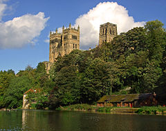 Durham Cathedral | |
|---|---|

| |
| Flag | |
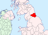
| |
| [Interactive map] | |
| Area: | 1,015 square miles |
| Population: | 1,467,037 |
| County town: | Durham |
| Biggest town: | Sunderland |
| County flower: | Spring gentian [1] |
The County Palatine of Durham is a shire in the north of England. It is the only English county whose common name is prefixed with "County", as is more familiar in Ireland, rather than being suffixed with "shire".
The county is named after its county town, the City of Durham, which lies in the middle of the county. County Durham reaches from the North Sea coast up into the Pennines, separated from Northumberland to the north by the River Tyne and the Derwent and from the North Riding of Yorkshire by the River Tees from its source to its mouth.
Known as "the Land of the Prince Bishops", Durham has history forged by the troubles of the Middle Ages before it became reshaped by the industrial revolution. The county was a county palatine under the rule of the Bishop of Durham from the Middle Ages until the palatine jurisdiction was merged with the Crown in 1836.
The county is heavily urbanised on the coast, in particular around the mouths of the Rivers Tyne, Wear and Tees. The biggest towns are the City of Sunderland at the mouth of the Wear, Gateshead and South Shields on the Tyne and Stockton-on-Tees and Darlington on the Tees.
Durham's growth was driven by coal mining, iron mining and the industry they brought. From ancient days, "sea coal" has been collected where it is washed up on the sea coast,[1] but more importantly in modern times have been the coal mines dug through the rich seams beneath the county. Since mining declined in the 1980s, County Durham has been promoted more as a tourist destination.[2]
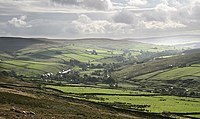
History
Early mediæval period
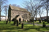
The lands of County Durham were part of the Kingdom of Northumbria from its foundation until the Viking incursions. At the height of Northumbrian power it becaome a centre of learning and ecclesiastical development, in particular at the Monasteries of Monkwearmouth and Jarrow, whose remains survive. The 7th century church at Escomb remains a complete example of a church from the high days of Northumbria.
In 866 Ivar the Boneless captured York and reduced the Northumbrian kingdom to just Durham and Northumberland. The lands north of the Tees were outside the immediate control of the Norse Kings of York, and place-name evidence suggests that County Durham was not settled by Scandinavians to the extent that Yorkshire was.
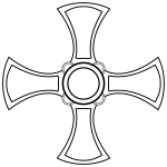
The lands that became County Durham were originally a liberty under the control of the Bishops of Durham. The liberty was known variously as the "Liberty of Durham", "Liberty of St Cuthbert's Land" "The lands of St. Cuthbert between Tyne and Tees" or "The Liberty of Haliwerfolc".[3]
The bishops' special jurisdiction was based on claims that King Ecgfrith of the Northumbrians had granted a substantial territory to St Cuthbert on his election to the see of Lindisfarne in 684. In about 883, a cathedral housing the saint's remains was established at Chester-le-Street and Guthfrith, the Norse King of York granted the community of St Cuthbert the area between the Tyne and the Wear. In 995 the see was moved again to the more defensive position of Durham.
After the Norman conquest, William the Conqueror reformed the Community of St Cuthbert, turning it into a purely monastic concern
A Norman army captured the City of Durham in 1069. There was a rebellion against the new Norman earl, Robert de Comines, who was killed. However, County Durham largely missed the Harrying of the North that was designed to subjugate such rebellions.[4]
The best remains of the Norman period are to be found in Durham Cathedral and in Durham Castle, also in some few parish churches, as at Pittington and Norton near Stockton. The Early English period is found the eastern portion of the cathedral, the churches of Darlington, Hartlepool, and St Andrew, Auckland, Sedgefield, and portions of a few other churches.
The machinery of government itself was slow to extend itself to northern England, and these lands were under constant threat of rebellion from displaced English thanes or of invasion from Scotland. In the twelfth century a shire or county of Northumberland was formed, but the authority of the sheriff of Northumberland and his officials was disputed by the bishops. The crown still regarded Durham as falling within Northumberland until the late thirteenth century. Matters came to a head in 1293 when the bishop and his steward failed to attend proceedings of quo warranto held by the justices of Northumberland. The bishops' case was heard in parliament, where he stated that Durham lay outside the bounds of any English shire and that "from time immemorial it had been widely known that the sheriff of Northumberland was not sheriff of Durham nor entered within that liberty as sheriff. . . nor made there proclamations or attachments".[5] The arguments appear to have been accepted, as by the fourteenth century Durham was accepted as a liberty which received royal mandates direct. In effect it was a private shire, with the bishop appointing his own sheriff.[3] The area eventually became known as the "County Palatine of Durham".
The division of the county into the four wards, Chester-le-Street, Darlington, Easington and Stockton existed in the 13th century, each ward having its own coroner and a three-weekly court corresponding to the hundred court in southern counties. The diocese extended (over County Durham and Northumberland, and was divided into the archdeaconries of Durham and Northumberland.
The term palatinus is applied to the bishop in 1293, and from the 13th century onwards the bishops frequently claimed the same rights in their lands as the king enjoyed in his kingdom.
The palatinate in the Middle Ages
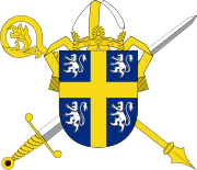
The county claimed a number of small exclaves within Northumberland in which the Bishop exercised jurisdiction by virtue of the connection of the parishes in question with the former see of Lindisfarne; Bedlingtonshire, Islandshire[6] and Norhamshire[7] within Northumberland. It also claimed Craikshire within the North Riding of Yorkshire, an estate granted to Bishop Wilfred in the late 7th century.
Until the 15th century the most important administrative officer in the palatinate was the Steward. Other officers were the sheriff, the coroners, the Chamberlain and the Chancellor. The palatine exchequer was organized in the 12th century. The palatine assembly represented the whole county, and dealt chiefly with fiscal questions. The bishops council, consisting of the clergy, the sheriff and the barons, regulated the judicial affairs, and later created Court of Chancery for the County.
The Prior of Durham ranked first among the bishop's barons. He had his own court, and almost exclusive jurisdiction over his men. There were ten palatinate barons in the 12th century, the most important being the Hyltons of Hylton Castle, the Bulmers of Brancepeth, the Conyers of Sockburne, the Hansards of Evenwood, and the Lumleys of Lumley Castle. The Nevilles owned large estates in the county. Raby Castle, their principal seat, was rebuilt by John Neville, 3rd Baron Neville de Raby in 1377.
King Edward I's quo warranto proceedings of 1293 showed twelve lords enjoying more or less extensive franchises under the bishop. The repeated efforts of the Crown to check the powers of the palatinate bishops culminated in 1536 in the Act of Resumption, which deprived the bishop of the power to pardon offences against the law or to appoint judicial officers. Moreover, indictments and legal processes were in future to run in the name of the king, and offences to be described as against the peace of the king, rather than that of the bishop. In 1596 restrictions were imposed on the powers of the chancery.
During the Wars of the Roses, Henry VI passed through Durham.
The seventeenth century
County Durham was denied representation in Parliament until the reign of Charles II because of its palatinate status. Under King Charles I in 1614, a bill was introduced in Parliament for securing representation to the county and city of Durham and the borough of Barnard Castle, but this was strongly opposed by the bishop, as an infringement of his palatinate rights and the bill failed. Cromwell's parliament of 1654 was the first to summon members from the county.
On the outbreak of the English Civil War, Durham inclined to support the cause of Parliament, and in 1640 the high sheriff of the palatinate guaranteed to supply the Scottish army with provisions during their stay in the county. In 1642 the Earl of Newcastle formed the western counties into an association for the king's service, but in 1644 the palatinate was again overrun by the Scottish army, and after the Battle of Marston Moor fell entirely into the hands of the parliament.
In 1646, Parliament declared the palatinate abolished and in 1649 abolished bishops. After the Restoration in 1660, all laws passed by Parliament without the King's assent were declared invalid and so the Palatinate was restored to the bishop. Indeed, it continued with much the same power until 5 July 1836, when the Durham (County Palatine) Act 1836 vested the palatine jurisdiction in the crown.[8] However the Restoration Parliament did confirm the right of the county's freeholders to elect two members to Parliament and two further members from the City of Durham.
By the Reform Act of 1832 the county returned two members for two divisions, and the boroughs of Gateshead, South Shields and Sunderland acquired representation. The boroughs of Darlington, Stockton-on-Tees and Hartlepool returned one member each from 1868 until the Redistribution Act of 1885.
The Industrial Revolution
The coal and iron deposits of Durham became the focus of intense interest when the furnaces of the industrial cities grew hungry for coal and the forges sought iron. Over the course of the nineteenth century the coal mines in particular multiplies and new pit villages sprung up across the county.
Durham remained an intensive coal mining area until the international price collapse in the 1980s when many mines closed, the focus of the Miners' Strike of 1984-85.
Culture
Mining and heavy industry
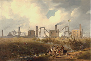
A substantial number of colliery villages were built throughout the county in the nineteenth century to house the growing workforce, which included large numbers of migrant workers from the rest of the UK.[9] Sometimes the migrants were brought in to augment the local workforce but, in other cases, they were brought in as strike breakers, or "blacklegs". Tens of thousands of people migrated to County Durham from Cornwall (partly due to their previous experience of tin mining) between 1815 and the outbreak of the First World War, so much so that the miners' cottages in east Durham called "Greenhill" were also known locally as "Cornwall", and Easington Colliery still has a Cornish Street.[10] Other migrants included people from South Wales, Scotland and Ireland.[11] Coal mining had a profound effect on trade unionism, public health and housing, as well as creating a related culture, language, folklore and sense of identity that still survives today.[12]
The migrants also were employed in the railway, ship building, iron, steel and roadworking industries, and the pattern of migration continued, to a lesser extent, up until the 1950s and 1960s. Gateshead was once home to the fourth-largest Irish settlement in England, Consett]'s population was 22% Irish [13] and significant numbers of Irish people moved to Sunderland, resulting in the city hosting numerous events on St Patrick's Day due to the Irish heritage.[14]
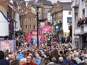
The culture of coal mining found expression in the Durham Miners' Gala, which was first held in 1871,[15],developed around the culture of trade unionism. Coal mining continued to decline and pits closed. The UK miners' strike of 1984/5 caused many miners across the county to strike. Today no deep-coal mines exist in the county and numbers attending the Miners' Gala decreased over the period between the end of the strike and the 21st century. However recent years have seen numbers significantly grow, and more banners return to the Gala each year as former colliery communities restore or replicate former banners to march at the Gala parade.
Art
In 1930, the Spennymoor Settlement (otherwise known as the Pitman's Academy) opened. The settlement, initially funded by the Pilgrim Trust, aimed to encourage people to be neighbourly and participate in voluntary social service.[16] The settlement operated during the Great Depression, when unemployment was widespread and economic deprivation rife; Spennymoor was economically underprivileged. The settlement provided educational and social work, as well as hope; this included providing unemployed miners with on outlet for their creativity, a poor person's lawyer service, the town's first library and the Everyman Theatre. The output included paintings, sewing, socially-significant plays, woodwork and sculptures. Several members went on to win adult scholarships at Oxford University [16] when such a route would normally be closed to the underprivileged. Former members include artists Norman Cornish and Tom McGuinness, writer Sid Chaplin OBE and journalist Arnold Hadwin OBE. The Spennymoor Settlement at its home in the Everyman Theatre (Grade-II listed) is still operating, administered by the current trustees, offering community events and activities, including Youth Theatre Group, an Art Group and various classes, as well as offering community accommodation facilities.
Several Durham miners have been able to turn their former mining careers into careers in art. For example, Tom Lamb, as well as the aforementioned Tom McGuinness and Norman Cornish. Their artworks depict scenes of life underground, from the streets in which they lived and of the people they loved; through them, we can see, understand and experience the mining culture of County Durham.
In 2017, The Mining Art Gallery opened in Bishop Auckland.[17] The gallery, created in a former bank, shows hundreds of paintings from within County Durham and beyond, including such other North-Eastern mining artists as Robert Olley, as well as contributions from outside the region.
In 2019, 100 years after his birth, a permanent tribute to the work of the artist Norman Stansfield Cornish MBE was opened within the Town Hall, and a Cornish Trail around the town was established to include areas of the town depicted in Cornish's artwork.
Music
As with neighbouring Northumberland, County Durham has a rich heritage of Northumbrian music, dating back from the Northumbrian Golden Age of the 7th and 8th centuries. Bede made references to harp-playing, and abundant archeological evidence has been found of wooden flutes, bone flutes, panpipes, wooden drums and lyres (a six-string form of harp).[18] North-East England has a distinctive folk music style that has drawn from many other regions, including southern Scotland, Ireland and the rest of northern England, that has endured stably since the 18th century.[19] Instruments played include, in common with most folk music styles, stringed instruments such as the guitar and fiddle, but also the Northumbrian smallpipe, which is played and promoted by people including the Northumbrian Pipers' Society throughout the North East, including County Durham, with the society having an active group in Sedgefield.[20] Contemporary folk musicians include Jez Lowe and Ged Foley.
In 2018, The Arts Council funded the Stories of Sanctuary project in the city of Durham. The project aims to assist people living in the city to share their stories about seeking sanctuary in the North East through photography, stories, poetry and music. The art is based on a history of sanctuary in Durham, from St Cuthbert's exile, through to the miners' strike of 1984, and to refugees escaping civil war in the Middle East. The music produced as part of the project includes contributions from singer-songwriter Sam Slatcher and viola player Raghad Haddad from the National Syrian Orchestra.[21]
Other notable performers/songwriters who were born or raised in the county include Eric Boswell, Jeremy Spencer, Alan Clark, Martin Brammer, Robert Blamire, Thomas Allen, Zoe Birkett, John O'Neill and Karen Harding.
Flag
- Main article: Flag of County Durham
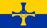
County Durham has its own flag, registered with the Flag Institute on 21 November 2013.[22]
Katie, Holly and James Moffatt designed the flag and entered their design into a competition launched by campaigner Andy Strangeway, who spoke of the flag as "free, public symbol for all to use, especially on 20th March each year, which is not only County Durham Day but also St Cuthbert’s birthday.” [23]
The flag consists of St Cuthbert's cross counterchanged with the county's blue and gold colours.
Economy
Employment
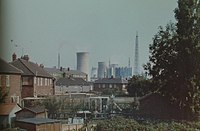
The proportion of the population working in agriculture fell from around 6% in 1851 to 1% in 1951; currently less that 1% of the population work in agriculture.[24] There were 15,202 people employed in coal mining in 1841, rising to a peak of 157,837 in 1921.[24]
As at 2001, Chester-le-Street district has the lowest number of available jobs per working-age resident (0.38%).[25]
Economic history
The economic history of Durham revolves around the rise and fall of the mining industry. At its height, the mines employed almost the whole of the non-agricultural population, with large numbers of pit villages being founded throughout the county.
In the twelfth century, King Stephen is recorded as owning a mine in Durham, which he granted to Bishop Pudsey, and in the same century colliers are mentioned at Coundon, Bishopwearmouth and Sedgefield. Cockfield Fell was one of the earliest Landshale collieries in Durham. Richard II granted to the inhabitants of Durham licence to export the produce of the mines, and by the Victorian period, the majority was shipped from the Port of Sunderland complex constructed in the 1850s. The port was the largest in Durham and the fourth biggest in Britain.
Among other early industries lead-mining was carried on in the western part of the county
Gateshead had a considerable tanning trade and in the nineteenth century, Sunderland became the world's largest shipbuilding town, constructing a third of Britain's tonnage.
In agriculture, mustard-growing is a local speciality.
Places to see
| Key | |
| Cathedral/Abbey/Priory | |
| Accessible open space | |
| Amusement/Theme Park | |
| Castle | |
| Country Park | |
| English Heritage | |
| Forestry Commission | |
| Heritage railway | |
| Historic House | |
| Museum (free/not free) | |
| National Trust | |
| Zoo | |
- County Hall
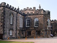
 Auckland Castle, Bishop Auckland
 Barnard Castle

 Beamish Museum, in Stanley
 Binchester Roman Fort
 Bowes Museum, in Barnard Castle
- Causey Arch, near Stanley
- Durham Cathedral and Castle, a World Heritage Site
- Durham Dales
 Durham Light Infantry Museum, Aykley Heads, Near Durham
- Escomb Saxon Church, at Escomb near Bishop Auckland
 Finchale Priory, near Durham
 Hamsterley Forest
 Hardwick Hall Country Park near Sedgefield
 High Force and Low Force waterfalls, on the River Tees
 Jarrow Priory remains
 Killhope Wheel, part of the North of England Lead Mining Museum in Weardale
 Monkwearmouth Priory remains
 Shildon Locomotion Museum (railway museum)
 Raby Castle, near Staindrop
 Tanfield Railway, in Tanfield
References
- ↑ England’s Northeast Mediaeval Coal and Industry: Newcastle and the North East 1100AD - 1500AD
- ↑ Durham County Council - History and Heritage of County Durham. Retrieved 30 November 2007.
- ↑ 3.0 3.1 Jean Scammell, The Origin and Limitations of the Liberty of Durham in The English Historical Review, Vol. 81, No. 320. (Jul., 1966), pp. 449-473.
- ↑ Douglas, D.C. William the Conqueror: The Norman Impact Upon England
- ↑ C. M. Fraser, Edward I of England and the Regalian Franchise of Durham in Speculum, Vol. 31, No. 2. (Apr., 1956), pp. 329-342
- ↑ Vision of Britain - Islandshire (historic map). Retrieved 1 December 2007.
- ↑ Vision of Britain - Norhamshire (historic map). Retrieved 1 December 2007.
- ↑ Durham (County Palatine) Act, 1836 (6 & 7 Will.4 C.19)
- ↑ durhamrecordoffice.org.uk
- ↑ http://www.coalzoom.com/article.cfm?articleid=13984
- ↑ https://co-curate.ncl.ac.uk/irish-migration-to-north-east-england
- ↑ durhamintime.org.uk
- ↑ https://consettmagazine.com/2015/11/07/our-irish-immigrant-roots-consett-history-21687/
- ↑ http://www.sunderlandecho.com/lifestyle/sunderland-s-irish-links-celebrated-on-st-patrick-s-day-1-4356261
- ↑ www.minersadvice.co.uk/yourview22_moving_on_seamlessly.htm
- ↑ 16.0 16.1 spennymoorsettlement.co.uk
- ↑ www.theguardian.com/artanddesign/2017/sep/11/museum-of-miners-art-to-open-as-part-of-bishop-auckland-culture-drive
- ↑ Gething, Paul (2012). Northumbria: The Lost Kingdom. The History Press. ISBN 978-0-7524-9089-2.
- ↑ S. Broughton, M. Ellingham, R. Trillo, O. Duane, V. Dowell, World Music: The Rough Guide (Rough Guides, 1999), p. 67.
- ↑ https://www.northumbrianpipers.org.uk/event/cleveland-branch/
- ↑ https://storiesofsanctuary.co.uk/
- ↑ Flag Institute - County Durham
- ↑ https://britishcountyflags.com/2013/11/21/county-durham-flag/
- ↑ 24.0 24.1 National Statistics - 200 years of the Census in... Durham. Retrieved 2 December 2007.
- ↑ Hastings, D., Local area labour market statistical indicators incorporating the Annual Population Survey, National Statistics - Labour Market Trends, (2006). Retrieved 2 December 2007.
Outside links
| Counties of the United Kingdom |
|---|
|
Aberdeen • Anglesey • Angus • Antrim • Argyll • Armagh • Ayr • Banff • Bedford • Berks • Berwick • Brecknock • Buckingham • Bute • Caernarfon • Caithness • Cambridge • Cardigan • Carmarthen • Chester • Clackmannan • Cornwall • Cromarty • Cumberland • Denbigh • Derby • Devon • Dorset • Down • Dumfries • Dunbarton • Durham • East Lothian • Essex • Fermanagh • Fife • Flint • Glamorgan • Gloucester • Hants • Hereford • Hertford • Huntingdon • Inverness • Kent • Kincardine • Kinross • Kirkcudbright • Lanark • Lancaster • Leicester • Lincoln • Londonderry • Merioneth • Middlesex • Midlothian • Monmouth • Montgomery • Moray • Nairn • Norfolk • Northampton • Northumberland • Nottingham • Orkney • Oxford • Peebles • Pembroke • Perth • Radnor • Renfrew • Ross • Roxburgh • Rutland • Selkirk • Shetland • Salop • Somerset • Stafford • Stirling • Suffolk • Surrey • Sussex • Sutherland • Tyrone • Warwick • West Lothian • Westmorland • Wigtown • Wilts • Worcester • York |