List of county tripoints: Difference between revisions
Jump to navigation
Jump to search
| (4 intermediate revisions by the same user not shown) | |||
| Line 26: | Line 26: | ||
|[[Argyllshire]]||[[Dunbartonshire]]||[[Perthshire]]||{{wmap|56.324|-4.786|zoom=14}} | |[[Argyllshire]]||[[Dunbartonshire]]||[[Perthshire]]||{{wmap|56.324|-4.786|zoom=14}} | ||
|- | |- | ||
|[[Ayrshire]]||[[Dumfriesshire]]||[[Lanarkshire]]||{{wmap|55.463|-3.986|zoom=14}} | |[[Ayrshire]]||[[Dumfriesshire]]||[[Lanarkshire]]||{{wmap|55.463|-3.986|zoom=14}} at Threeshire Hill | ||
|- | |- | ||
|[[Ayrshire]]||[[Wigtownshire]]||[[Kirkcudbrightshire]]||{{wmap|55.051|-4.634|zoom=14}} | |[[Ayrshire]]||[[Wigtownshire]]||[[Kirkcudbrightshire]]||{{wmap|55.051|-4.634|zoom=14}} | ||
|- | |- | ||
|[[Ayrshire]]||[[Kirkcudbrightshire]]||[[Dumfriesshire]]||{{wmap|55.305|-4.112|zoom=14}} at the summit of Meikledodd Hill | |[[Ayrshire]]||[[Kirkcudbrightshire]]||[[Dumfriesshire]]||{{wmap|55.305|-4.112|zoom=14}} at the summit of Meikledodd Hill | ||
|- | |||
|[[Ayrshire]]||[[Renfrewshire]]||[[Lanarkshire]]||{{wmap|55.679|-4.249|zoom=14}} | |||
|- | |- | ||
|[[Banffshire]]||[[Morayshire]]||[[Inverness-shire]]||{{wmap|57.296|-3.496|zoom=14}} | |[[Banffshire]]||[[Morayshire]]||[[Inverness-shire]]||{{wmap|57.296|-3.496|zoom=14}} | ||
| Line 172: | Line 174: | ||
|[[Gloucestershire]]||[[Somerset]]||[[Wiltshire]]||{{wmap|51.429|-2.294|zoom=14}} as marked by the Three shire stone | |[[Gloucestershire]]||[[Somerset]]||[[Wiltshire]]||{{wmap|51.429|-2.294|zoom=14}} as marked by the Three shire stone | ||
|- | |- | ||
|[[Gloucestershire]]||[[Warwickshire]]||[[Worcestershire]]||{{wmap|52.130|-1.852|zoom=14}} | |[[Gloucestershire]]||[[Warwickshire]]||[[Worcestershire]]||{{wmap|52.130|-1.852|zoom=14}} as marked by the Three Shire Elms | ||
|- | |- | ||
|[[Gloucestershire]]||[[Worcestershire]]||[[Herefordshire]]||{{wmap|52.020|-2.352|zoom=14}} | |[[Gloucestershire]]||[[Worcestershire]]||[[Herefordshire]]||{{wmap|52.020|-2.352|zoom=14}} | ||
| Line 213: | Line 215: | ||
|- | |- | ||
|[[Midlothian]]||[[Selkirkshire]]||[[Roxburghshire]]||{{wmap|55.649|-2.861|zoom=14}} | |[[Midlothian]]||[[Selkirkshire]]||[[Roxburghshire]]||{{wmap|55.649|-2.861|zoom=14}} | ||
|- | |||
|[[Montgomeryshire]]||[[Radnorshire]]||[[Shropshire]]||{{wmap|52.453|-3.231|zoom=14}} | |||
|- | |- | ||
|[[Northamptonshire]]||[[Warwickshire]]||[[Oxfordshire]]||{{wmap|52.168|-1.331|zoom=14}} as marked by the Three shire stones | |[[Northamptonshire]]||[[Warwickshire]]||[[Oxfordshire]]||{{wmap|52.168|-1.331|zoom=14}} as marked by the Three shire stones | ||
| Line 248: | Line 252: | ||
|[[County Carlow|Carlow]]||[[County Wexford|Wexford]]||[[County Wicklow|Wicklow]]||{{wmap|52.709|-6.620|zoom=14}} | |[[County Carlow|Carlow]]||[[County Wexford|Wexford]]||[[County Wicklow|Wicklow]]||{{wmap|52.709|-6.620|zoom=14}} | ||
|- | |- | ||
|[[County Carlow|Carlow]]||[[County Laois|Laois]]||[[County Kilkenny|Kilkenny]]||{{wmap|52.793|-7.060|zoom=14}} | |[[County Carlow|Carlow]]||[[County Laois|Laois]]||[[County Kilkenny|Kilkenny]]||{{wmap|52.793|-7.060|zoom=14}} south of Three Counties Bridge | ||
|- | |- | ||
|[[County Carlow|Carlow]]||[[County Kildare|Kildare]]||[[County Laois|Laois]]||{{wmap|52.880|-6.939|zoom=14}} | |[[County Carlow|Carlow]]||[[County Kildare|Kildare]]||[[County Laois|Laois]]||{{wmap|52.880|-6.939|zoom=14}} | ||
Latest revision as of 09:48, 9 August 2021
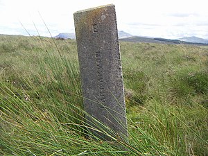
This list of county tripoints shows where the borders of three counties meet. For each tripoint the counties are ordered with the first alphabetically given first, and the counties listed anti-clockwise around the point from there.
Great Britain


