List of county tripoints: Difference between revisions
Jump to navigation
Jump to search
No edit summary |
|||
| Line 3: | Line 3: | ||
==Great Britain== | ==Great Britain== | ||
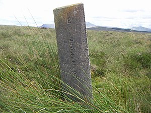
[[File:Three shire stone - geograph.org.uk - 909128.jpg|thumb|right|Caernarfonshire, Merionethshire and Denbighshire Three shire stone]] | |||
[[File:Three Shire Stone - geograph.org.uk - 457076.jpg|thumb|right|Gloucestershire, Somerset and Wiltshire Three shire stone]] | |||
[[File:Three Shires Stone - geograph.org.uk - 833827.jpg|thumb|right|Northamptonshire, Bedfordshire and Huntingdonshire Three shire stone]] | |||
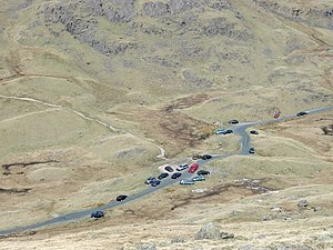
[[File:Three Shire Stone, Wrynose Pass - geograph.org.uk - 20673.jpg|thumb|right|Lancashire, Westmorland and Cumberland Three shire stone at the Wynrose Pass]] | |||
[[File:Bridge at Three Shire Heads - geograph.org.uk - 982349.jpg|thumb|right|Three Shire Heads Bridge and waterfall, at the junction of Cheshire, Derbyshire and Staffordshire]] | |||
{| class="sortable wikitable vatop" style=" margin-right:2em;" | {| class="sortable wikitable vatop" style=" margin-right:2em;" | ||
! County 1 | ! County 1 | ||
| Line 69: | Line 74: | ||
|[[Buckinghamshire]]||[[Surrey]]||[[Middlesex]]||{{wmap|51.435|-0.523|zoom=14}} | |[[Buckinghamshire]]||[[Surrey]]||[[Middlesex]]||{{wmap|51.435|-0.523|zoom=14}} | ||
|- | |- | ||
|[[Caernarfonshire]]||[[Merionethshire]]||[[Denbighshire]]||{{wmap|52.961|-3.834|zoom=14}} | |[[Caernarfonshire]]||[[Merionethshire]]||[[Denbighshire]]||{{wmap|52.961|-3.834|zoom=14}} as marked by the Three shire stone | ||
|- | |- | ||
|[[Cambridgeshire]]||[[Essex]]||[[Suffolk]]||{{wmap|52.066|0.405|zoom=14}} | |[[Cambridgeshire]]||[[Essex]]||[[Suffolk]]||{{wmap|52.066|0.405|zoom=14}} | ||
| Line 159: | Line 164: | ||
|[[Gloucestershire]]||[[Oxfordshire]]||[[Warwickshire]]||{{wmap|51.987|-1.666|zoom=14}} also meeting a detached part of [[Worcestershire]] at the [[Four shire stone]] | |[[Gloucestershire]]||[[Oxfordshire]]||[[Warwickshire]]||{{wmap|51.987|-1.666|zoom=14}} also meeting a detached part of [[Worcestershire]] at the [[Four shire stone]] | ||
|- | |- | ||
|[[Gloucestershire]]||[[Somerset]]||[[Wiltshire]]||{{wmap|51.429|-2.294|zoom=14}} | |[[Gloucestershire]]||[[Somerset]]||[[Wiltshire]]||{{wmap|51.429|-2.294|zoom=14}} as marked by the Three shire stone | ||
|- | |- | ||
|[[Gloucestershire]]||[[Warwickshire]]||[[Worcestershire]]||{{wmap|52.130|-1.852|zoom=14}} | |[[Gloucestershire]]||[[Warwickshire]]||[[Worcestershire]]||{{wmap|52.130|-1.852|zoom=14}} | ||
Revision as of 15:28, 25 March 2015
This list of county tripoints shows where the borders of three counties meet. For each tripoint the counties are ordered with the first alphabetically given first, and the counties listed anti-clockwise around the point from there.
Great Britain


