Skyrack

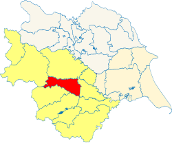
Skyrack is a wapentake in the West Riding of Yorkshire. It is bounded by Claro to the north; by Barkston Ash to the east; by Agbrigg and Morley to the south; and by Staincliffe to the west. Including that part of the city of Leeds north of the River Aire, it had a population of 528,144 in 2011.
The name "Skyrack" is apparently derived from scir ac or "shire oak", which may suggest an oak tree used as a meeting place. An ancient oak, said to be the Shire Oak, stood to the north of St Michael's Church in Headingley until 1941.
The wapentake comprises the ancient parishes of:
*: In Claro wapentake.
†: Remainder in Claro wapentake.
‡: Burley, Chapel Allerton, Headingley, Kirkstall, Leeds and Potter Newton townships. Remainder in Morley wapentake.
§: Baildon, Bramhope, Burley in Whafedale, Esholt, Hawksworth, Menston, Otley, Pool. Remainder in Claro wapentake.
|
East Riding: Buckrose • Dickering • Harthill • Holderness • Howdenshire • Ouse and Derwent • North Riding: Allertonshire • Birdforth • Bulmer • East Gilling • Hallikeld • Hang East • Hang West • Langbaurgh • Pickering Lythe • Ryedale • West Gilling • Whitby Strand • West Riding: Agbrigg and Morley (Agbrigg, Morley) • Ainsty • Barkston Ash • Claro • Osgoldcross • Skyrack • Staincliffe and Ewcross (Staincliffe, Ewcross) • Staincross • Strafforth and Tickhill |
