Grand Union Canal


The Grand Union Canal, stretching from Birmingham to the River Thames, is part of the British canal system. At 286.3 miles, it is by far the longest canal in the United Kingdom.
The main line of the Grand Union Canal connects London and Birmingham, this line stretching for 137 miles, with 166 locks (map).[1] It also has arms reaching out from the main line to other towns, including Leicester, Slough, Aylesbury, Wendover and Northampton.[2]
The name "Grand Union Canal" was also used for part of what is now part of the Leicester Line of the modern Grand Union: this latter is now generally referred to as the "Old Grand Union Canal" in order to avoid ambiguity.
The Grand Union Canal as such is not a creation of the great days of canal-building but an amalgamation effected in the 20th century. It was created as a commercial venture, and joined together several canals which were dug in the nineteenth century, with new works of the twentieth.
Route
Thames to the Chilterns

One end of the Grand Union Canal (Grand Junction Canal - Main Line) is at Brentford on the River Thames in Middlesex, where the canal follows the engineered course of the River Brent. The double Thames Lock at Brentford acts as the demarcation point between the Thames, administered by the Port of London Authority, and the River Brent/Grand Union Canal, administered by British Waterways. The locks on the canal are numbered south from Braunston, for example Thames Lock is lock number 101.
From the Thames Lock, the canal and the River Brent are one and the same, and the waterway is semi-tidal until the double Gauging Lock (lock 100) at Brentford is reached. Just upstream of the Gauging Lock was a large canal basin, now known as Brentford Lock, from which the canal continues to follow the course of the River Brent through two more locks. The river and canal part company at the base of the Hanwell flight of locks (92-97), before two more locks take the canal to Norwood Green. It then heads westward over level ground through Southall, Hayes and West Drayton until it reaches the valley of the River Colne where it swings northwards to Cowley through Uxbridge.
Three miles from Norwood on this long level is Bulls Bridge Junction, once the site of the Grand Union Canal Carrying Company's main dockyard. At Bulls Bridge, the Paddington Arm branches off to the north and runs 12 miles to join the Regents Canal at Little Venice. Just before Uxbridge is Cowley Peachey junction, where the Slough Arm branches off westward.
At Cowley, the canal begins to climb the valley of the River Colne following a north-westerly course. After Uxbridge, there are many disused gravel workings in the valley so the canal is surrounded by lakes as it passes Denham and Harefield before veering north-east to Rickmansworth.
From Rickmansworth, the canal follows the valley of the River Gade, a tributary of the Colne. After passing the site of Croxley paper mill, the canal skirts Watford through Cassiobury Park, passes under the M25 motorway and approaches Kings Langley. The canal here passes the site of the former Ovaltine factory, which was once supplied with raw materials by canal.
By now the locks are becoming more frequent as the climb into the Chiltern Hills steepens. The original four locks here were replaced in 1819 by five shallower ones to alleviate problems with water supply to the nearby paper mills. This realigned the canal to the south of its former course; the locks here are still referred to, without irony, as "The New 'Uns" by traditional boaters, and the term has been passed on to a new generation of canal users.
Chilterns to Braunston

After Kings Langley and Apsley, the site of more former paper mills, the canal passes Hemel Hempstead and Boxmoor Common. From here the canal follows the course of the River Bulbourne through Bourne End with the well-known swingbridge at Winkwell, and the "Port of Berkhamsted". At Cow Roast Lock the canal reaches the 3-mile long summit level at Tring in the Chiltern Hills, having risen through 54 locks since Brentford.
At the north-west end of the summit level is Bulbourne Works, where lock gates were manufactured until 2003 for the southern canal network. Half a mile further on, the canal reaches the top of the Marsworth flight of seven locks, which begin the descent to the Vale of Aylesbury. The Wendover Arm branches off westwards from the summit level under a bridge adjacent to Marsworth Top Lock and is currently navigable for just over a mile to moorings and a winding hole. There is a restoration project to extend it back to Wendover. This part of the canal in parlance used by natives and canal staff was "the withered arm" and in fact was only really "opened" to allow the pumping station there to pump water into the summit. A few hundred yards beyond the bottom lock of the flight, the Aylesbury Arm branches off to the south west.
The Grand Union crosses the wide valley gradually, descending by interspersed locks past the villages of Cheddington, Horton and Slapton until it reaches Leighton Buzzard. Traditionally this section of the canal is called "Slapton Fields" or just "The Fields" by boaters.

A few miles further on the Grand Union Canal enters Milton Keynes at the outskirts of Bletchley at Fenny Stratford Lock, which is unusual in lowering the level by only 12 inches. The next stretch of 11 miles on the level takes the canal through the new town of Milton Keynes, where there is a marina. (There is a plan to dig a new arm from here to the Great Ouse at Bedford). North of the town centre, the canal traverses the modern New Bradwell Aqueduct, the first to be built on the Grand Union in over 100 years. Leaving Milton Keynes at Wolverton, the canal runs on a high embankment before passing over the Great Ouse at Cosgrove "Iron Trunk" aqueduct.

After rising through Cosgrove Lock, (and passing the start of the abandoned Buckingham Arm) another long level section brings the canal to the bottom of the Stoke Bruerne flight of seven locks. At the top of this flight is the Stoke Bruerne Canal Museum followed shortly by Blisworth Tunnel, which at 3,056 yards (1¾ miles) is one of the longest on the canal network.
Once clear of the tunnel, the canal passes Blisworth village and reaches Gayton Junction where the Northampton Arm branches off to the east. This arm has seventeen narrow locks as it descends to join the navigable River Nene. The long level stretch continues past several villages including Nether Heyford and Weedon Bec and is very rural in character.
At Whilton, the canal reaches the bottom of the Buckby flight of seven locks which raise it to Braunston summit although the village of that name is still five miles distant. Beyond the top lock is Norton Junction where the Leicester Line heads off north. A few miles further on the canal passes through the 2,040-yard Braunston Tunnel, which pierces a low range of hills that are part of the Northamptonshire uplands.
The canal then drops down the Braunston flight of six locks until it reaches Braunston Junction, just over 93 miles from Brentford.
The Birmingham "Main Line"
At Braunston Junction, the Oxford Canal diverges north and south. The north section leads to Rugby and Coventry; the southward fork carries both the Oxford Canal and the Grand Union for five miles to Napton Junction. Here, the Grand Union heads north towards Birmingham, while the Oxford Canal veers south towards Banbury and Oxford.
Shortly after Napton Junction, the Grand Union reaches three locks at Calcutt, which begin the descent to the Warwickshire River Avon. After a three-mile level, the canal descends into the valley of the River Leam by the Stockton flight of ten locks (often known as 'the Itchington Ten'). Above the eighth lock down the flight, a short arm (now used as pleasure craft moorings) used to serve Southam cement works.
From the bottom of the locks, a three-mile level leads to the four Bascote locks. The top two form a 'riser' or staircase. Six more interspersed locks lead to Radford, after which a 5-mile level takes the canal through Leamington Spa to Warwick. Between these two towns, the canal crosses the River Avon and the former Great Western Railway on aqueducts.
At Warwick, the canal rises by two locks to Budbrooke Junction (formerly the junction with the then-independent Warwick and Birmingham Canal). To the left is the restored Saltisford Canal Arm, a short stretch that used to run under the railway to the original canal basin complex and terminus of the Warwick and Birmingham Canal - the basin was filled-in in the 1970s. The Canal used to serve the oldest gas works in the world and several unusual hexagonal buildings remain opposite Sainsburys.[3]
After half a mile the mainline reaches the bottom of the Hatton flight of 21 locks that lift the canal up out of the Avon Valley. The first ten locks are spaced out but from the middle lock the flight is tightly spaced.
Three miles from Hatton Top Lock the canal passes through Shrewley Tunnel, with its separate horse tunnel, and then passes Rowington village to Kingswood Junction where a short spur connects with the Stratford-upon-Avon Canal. Another three miles lead to the Knowle flight of five locks. Finally, an 11-mile level takes the canal through Elmdon Heath, Solihull, Acocks Green, and Tyseley to the heart of Birmingham.
The main line may be considered to terminate at Bordesley Junction. From here, there are two routes, both part of the Grand Union Canal. The original line of the Warwick and Birmingham Canal leads to the Digbeth Branch Canal of the Birmingham Canal Navigations at the Warwick Bar, while the later line of the Birmingham and Warwick Junction Canal leads to the Birmingham and Fazeley Canal (and Tame Valley Canal) at Salford Junction, which in turn has connections to the Coventry Canal and the Trent and Mersey Canal.
The Leicester Line

Formed by amalgamations of once-independent canals, the 'Leicester Line' of the Grand Union Canal runs north from Norton Junction for about 35 miles until it reaches Leicester, where it joins the River Soar to provide a link to the River Trent and to the Trent and Mersey Canal. It includes notable tunnels south of Crick (1,528 yards) and north of Husbands Bosworth (1,166 yards). The village of Crick is home to a popular annual boat show.
The stretch of the canal which passes through the centre of Leicester known as the 'Mile Straight' is home to Leicester Rowing Club a rowing and sculling club formed in 1882. The club hosts their annual regattas on the River Soar typically held in mid-April which sees competitors from all over Britain race over a 765-yard course. The club insignia is based on the mythical Wyvern and rowers compete in the club's colours of black and white.

Also on this section are the well-known features of Foxton Locks and Watford Locks, both of which feature staircase locks. Beside Foxton locks is the site of a long-abandoned inclined plane boat lift. This was constructed as part of a project to create a wide-beam canal route to connect the northern and southern parts of the canal system, something which does not exist to this day. Funding to deal with the narrow locks at Watford was not forthcoming and the scheme was aborted. From Foxton Junction, at the bottom of the locks, the canal is wide-beam to Leicester and onwards, as it was originally intended to link the Soar at Leicester with the River Nene at Northampton. However, the canal never went further than the basin at Market Harborough.
Arms
The Grand Union Canal has several branches, usually termed 'arms':
Paddington Arm

The Paddington Arm (5 miles from Brentford) leads to the Paddington Basin and, just northwest of the Basin at 'Little Venice', it connects to the Regent's Canal, all in Middlesex.
Slough Arm
The Slough Arm branches off from Cowley Peachey. It runs 5 miles to the west, crossing through southern Buckinghamshire the short distance to Slough (to a basin beside Stoke Road). The Packet Boat Marina is on this arm, just after its branch off.
Wendover Arm
The Wendover Arm' reaches out to Wendover, Buckinghamshire. It branches of the main canal at Marsworth, in the Hertfordshire Chilterns about 35 miles from Brentford, as does the Aylesbury Arm.
The Wendover Arm is not currently navigable for its full length but is being restored by the Wendover Arm Trust[4]. At Wendover the end of the canal has long been a disappointing dead-end ditch, overgrown with trees and with little water in evidence. It is little known. The Trust hopes to refill the arm and restore it to use as far as Wendover.
Aylesbury Arm
The Aylesbury Arm also branches off at Marsworth, and thence descends through sixteen narrow locks for 4 miles to Aylesbury in Buckinghamshire.
Northampton Arm
The Northampton Arm branches off from Gayton Junction (about 60 miles from Brentford). It links to the River Nene.
Saltisford Canal Arm
The Saltisford Canal Arm, the northernmost arm of the Grand Union, branches off at Warwick.
This arm, now restored, is close to the centre of Warwick, and is now a short branch of the Grand Union Canal, though it was originally the mainline line of the Warwick and Birmingham Canal (1799). It leads to the terminus and a basin complex built to originally handle timber. When the Warwick and Napton Canal opened, this section was bypassed but served as the town's wharf area. The Saltisford Canal Trust have restored most of the surviving canal over the last 25 years, including major piling works and restoration of a warehouse in 2007. The last 150 yards were lost in the 1970s and are now built on except for a bridge now isolated in a car park. The restored section is now the mooring for narrowboats and a waterside park open to the public.
Over 800 visiting narrowboats come by water to Warwick each year and moor on the arm.[5]
Leicester Line arms
On the Leicester Line there are two arms. One is a mile long and leads to the village of Welford. The other leaves the main canal at the bottom of Foxton Locks and runs 5 miles to Market Harborough.
History

In the second half of the 19th century, competition from the railways had taken a large share of traffic from the canals, and in the early part of the 20th century improvements in roads and vehicle technology meant that the lorry was also becoming a threat to the commercial viability of canals. Tolls had been reduced to compete with the railways, but there was little scope for further reduction. The Regent's Canal and Grand Junction Canal agreed that amalgamation and modernisation were the only way to remain competitive.
The present Grand Union Canal came into being on 1 January 1929, and was extended in 1932. It was formed from the amalgamation of several different canals:
- Middlesex and London area:
- Regent's Canal – original company
- Hertford Union Canal – bought by the Regent's Canal in 1857
- Main Line
- Warwick and Napton Canal – bought by the Regent's Canal in 1927
- Warwick and Birmingham Canal – bought by the Regent's Canal in 1927
- Birmingham and Warwick Junction Canal – bought by the Regent's Canal in 1927
- Grand Junction Canal – bought by the Regent's Canal in 1927
- Leicester Line
- Old Grand Union Canal – bought by the Grand Junction in 1894
- Leicestershire and Northamptonshire Union Canal – bought by the Grand Junction in 1894
- Leicester Navigation – bought by the Grand Union in 1932
- Loughborough Navigation – bought by the Grand Union in 1932
- Erewash Canal – bought by the Grand Union in 1932
A 5-mile section of the Oxford Canal forms the main line of the Grand Union between Braunston and Napton. Although the Grand Union intended to buy the Oxford Canal and Coventry Canal, this did not take place.
The Grand Junction Canal, which has become the section of the main line between Brentford and Braunston, was built as a 'wide' or 'broad' canal - that is, its locks were wide enough to accommodate two narrowboats abreast or a single wide barge up to 14 feet in beam. However, the onward sections from Braunston to Birmingham had been built as 'narrow' canals – that is, the locks could accommodate only a single narrowboat. An Act of Parliament of 1931 was passed authorising a key part of the modernisation scheme of the Grand Union, supported by Government grants. The narrow locks (and several bridges) between Napton and Camp Hill Top Lock in Birmingham were rebuilt to take widebeam boats or barges up to 12 feet 6 inches in beam, or two narrowboats. The canal was dredged and bank improvements carried out: the depth was increased to 5 feet 6 inches to allow heavier cargoes, and the minimum width increased to 26 feet to enable two boats of 12 feet 6 inches to pass. Lock works were completed in 1934 when the Duke of Kent opened the new broad locks at Hatton, and other improvements finished by 1937.
However, these improvements to depth and width were not carried out between Braunston and London. Camp Hill Locks in Birmingham were not widened, as it would have been very expensive and of little point, since they lead only to further flights of locks not in the ownership of the Grand Union. A new basin and warehouse were constructed at Tyseley, above Camp Hill, to deal with this. Although the Grand Union company had a number of broad boats built to take advantage of the improvements, they never really caught on and the canal continued to be operated largely by pairs of narrow boats, whose journeys were facilitated by the newly widened locks in which they could breast up.
The three sections between Norton junction and the River Trent (collectively known as the "Leicester Line") are mixed in size. From Norton to Foxton, the route is a narrow canal. From below Foxton to Leicester it is a wide canal. From Leicester to the Trent, the route is effectively the River Soar and the locks and bridges are wide. Another Act of 1931 authorised the widening of the locks at Watford and Foxton, but with Government grants for this section not forthcoming, the work was not carried out.
The Grand Union Canal was nationalised in 1948, control transferring to the British Transport Commission, and in 1962 to the British Waterways Board, later British Waterways. Commercial traffic continued to decline, effectively ceasing in the 1970s, though lime juice was carried from Brentford to Boxmoor until 1981, and aggregates on the River Soar until 1996.
Leisure traffic has taken over, and the canal is now as busy as it ever was, with leisure boating complemented by fishing, towpath walking and "gongoozling"; enjoyment of the passing scene form the towpath. Some freight traffic has returned in latter years with the carriage of aggregates from Denham to West Drayton in barges and narrow boats, and the opening of a new wharf for re-cyclables and aggregates at Old Oak Common.
Current developments
The Bedford and Milton Keynes Partnership plans to build an 85-mile canal connecting the Grand Union at Milton Keynes to the River Great Ouse at Bedford, at an estimated cost of £170 million. The project is supported by British Waterways, the Bedford & Milton Keynes Waterway Trust, other waterways campaign groups, and also local councils. The first element of the canal was completed in 2009 and efforts are continuing to obtain funding to complete the scheme.[6]
The new waterway would create a new cruising ring connecting through from the Grand Union to the waterways of East Anglia which are beneficial to leisure cruising as boat hirers are able to take circular routes. The project was first discussed in 1810 when its promoters included Samuel Whitbread.
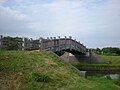
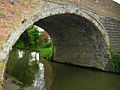
Pictures
-
 Brentford Locks
 -
 Wood bridge across the canal at Northolt
 -
 Canal near Northolt
 -
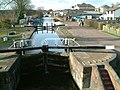 A lock at Apsley
 -
 Canal near Bugbrooke
 -
 Canal near Nether Heyford
 -
 Bull's Bridge Junction, near Heston, of the canal
 -
 The Grand Union Canal at the confluence with the River Brent.


Outside links
- Official page with guides, maps, etc.
- Grand Union Canal, with map, pictures and history
- Part of the history of the constituent canals which in 1929-32 were amalgamated to make the Grand Union Canal
- Canalplan AC Gazetteer
- Subject Guide on Canals in London
New waterway links
- LDWA information on the Grand Union Canal
- Bedford and Milton Keynes Waterway Trust Campaign group for the new canal
- First British canal for 100 years announced The Guardian newspaper article
- Route chosen for £150m link canal BBC News story