Tarn Hows
| Tarn Hows | |
|
National Trust | |
|---|---|
 Tarn Hows | |
| Grid reference: | SD326995 |
| Information | |
| Website: | Coniston and Tarn Hows |


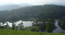
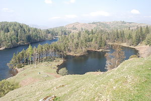
Tarn Hows is an area of the Lake District, in Lancashire, containing a picturesque tarn of the same name. The tarn lies approximately 2 miles northeast of Coniston and about a mile and half northwest of Hawkshead. It is a spot well renowned for its natural beauty; the lake shining at the foot of wooded slopes on all sides.
Tarn Howes is one of the most popular tourist destinations in the area. It is managed by the National Trust as part of its estaes in Lancashire North of the Sands, acquired from one of its early benefactors; Beatrix Potter.
Tarn Hows is fed at its northern end by a series of valley and basin mires and is drained by Tom Gill which cascades down over several small waterfalls to Glen Mary Bridge: named by John Ruskin who felt that Tom Gill required a more picturesque name and so gave the area the title 'Glen Mary'.
History
The Tarn Hows area originally contained three much smaller tarns, Low Tarn, Middle Tarn and High Tarn.
William Wordsworth's Guide Through the District of the Lakes (1835 edition) recommends walkers to come this way but passes the tarns without mention.
Until 1862 much of the Tarn Hows area was part of the open common grazing of Hawkshead parish. The remaining enclosed land and many of the local farms and quarries were owned by the Marshall family of Monk Coniston Hall (known as Waterhead House at the time). James Garth Marshall (1802–1873) who was the Member of Parliament for Leeds (1847–1852) and third son of the industrialist John Marshall, gained full possession of all of the land after an inclosure act of 1862 and embarked on a series of landscape improvements in the area including expanding the spruce, larch and pine plantations around the tarns; demolition of the Water Head Inn at Coniston; and the construction of a dam at Low Tarn that created the larger tarn that is there today.
By 1899 Tarn Hows was already an important beauty spot. H S Cowper mentions "Tarn Hows, beloved by skaters in winter and picnic parties in summer. Here comes every day at least one charabanc load of sightseers from Ambleside or Windermere". A wooden boat house that was still standing in the 1950s at the south east corner of the tarn probably dated from this period. In 1913 G D Abraham said "Tarn Hows is set wildly among larches and heather slopes, more like a highland lake than the other waters in Lakeland... more suitable for pedestrians than motorists".
In 1930 the Marshall family sold 4,000 acres of their land to Beatrix Heelis of Sawrey (better known as the children's author Beatrix Potter) for £15,000. She then sold the half of this land containing the tarn to the National Trust and bequeathed the other half to them in her will.
Tarn Hows was designated a Site of Special Scientific Interest in 1965.
The National Trust have made a number of more recent changes to the area including moving the car parks to a less obtrusive place in the 1960s and general footpath and road improvements to minimize the damage caused by the visitors. In May 2008 a building designed to harmonise with the landscape was opened, providing toilets and an information display under a sedum green roof.
Name
The name of "Tarn Hows" is form Old Norse, menaing "The hills by the pool(s)", form 'tjǫrn (tarn) and haugr (hill). There are five or six low hills, most of which form an intake. The pools, now amalgamated through damning, used to be separated by Tarn Moss and called 'The Tarns (High, Middle and Low Tarn)."[1] The Old Norse tjǫrn gives us the word 'tarn' for a lake up a mountain.[2];
Outside links
- Coniston and Tarn Hows - National Trust
- Tarn Hows, Guide to the Lake District
References
- ↑ Whaley, Diana (2006). A dictionary of Lake District place-names. Nottingham: English Place-Name Society. pp. lx,423 p.336. ISBN 0904889726.
- ↑ Whaley, 2006, p.420 and 430
- Wordsworth, W. (1835). Guide Through the District of the Lakes.
- Cowper, H.S. (1899). Hawkshead. Bemrose, London.
- Abraham, G.D (1913). Motor Ways In Lakeland. Methuen.
- Scott, J. (2001). A History of Rose Castle. Unpublished.
54°23′N 3°02′W / 54.383°N 3.033°WCoordinates: 54°23′N 3°02′W / 54.383°N 3.033°W
| Major waters of the Lake District | ||
|---|---|---|
| Cumberland: | Bassenthwaite Lake • Burnmoor Tarn • Buttermere • Cogra Moss • Crummock Water • Derwent Water • Devoke Water • Ennerdale Water • Loweswater • Thirlmere • Wast Water | |
| Cumb. / Westm.: | Ullswater | |
| Westmorland: | Grasmere • Haweswater • Rydal Water | |
| Lancs. / Westm.: | Windermere • Elter Water | |
| Lancashire: | Coniston Water • Esthwaite Water • Seathwaite Tarn • Tarn Hows | |