Linga Holm
| Linga Holm | |
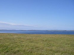
 North from Linga Holm towards Sanday | |
|---|---|
| Location | |
| Location: | 59°7’48"N, 2°40’12"W |
| Grid reference: | HY615275 |
| Area: | 141 acres |
| Highest point: | 33 feet |
| Data | |
| Population: | Uninhabited |
Linga Holm is an uninhabited island of Orkney, of approximately 141 acres lying 750 yards west of Stronsay.
The island has several names; Linga Holm is its common name today though it has also been called Midgarth and the Holm of Midgarth.[1] The name "Linga Holm" is derived from the Old Norse Lyngholm.
History
In common with many other Orkney islands, Midgarth contains numerous archaeological remains. These include Pictish houses and ancient cairns.
Although it is currently uninhabited, a household of six was recorded in 1841.[2][3]
Wildlife
Linga Holm is thought to be the third largest breeding ground for the Atlantic grey seal in the world, and is an important nesting site for greylag geese.
Outside links
References
- ↑ John Maurius Wilson, The Imperial Gazetteer of Scotland: Or, Dictionary of Scottish Topography, 1854
- ↑ Haswell-Smith, Hamish (2004). The Scottish Islands. Edinburgh: Canongate. ISBN 1841954543.
- ↑ FreeCEN Orkney
| Islands of Orkney |
|---|
|
Inhabited islands: |