Brixton Hundred


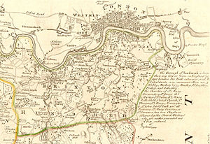
The Brixton Hundred is in the north-east of Surrey, a hundred now encompassing the most urbanised parts of the county, its area entirely absorbed by the metropolitan conurbation grown out of London. Its name is from the town of Brixton.
The metropolitan parts of Surrey are neatly comprised in the Brixton, Wallington and Kingston Hundreds, and of these the Brixton Hundred, along the Thames from Sheen to Rotherhithe, contains some of the county's most wealthy areas and its most deprived.
The City of London stands opposite Southwark in this hundred, joined by London Bridge, along which bridge has passed a the commerce which brought wealth and eventually its counterpart to the Brixton Hundred, and across which the metropolitan growth spread which swiftly subsumed the whole hundred and moved on to Surrey's further fields. Now there are many bridges over the river joining the Surrey towns of the Brixton Hundred to those of London.
Parishes and places
The hundred contains the ancient parishes of:
- Battersea (including the detached part of Penge);
- Bermondsey (also later Rotherhithe);
- Camberwell;
- Hatcham chapelry in Deptford parish (otherwise in Kent);
- Lambeth;
- Walworth;
- Streatham;
- Barnes;
- Merton
- Mortlake (also later Wimbledon and Putney);
- Tooting and
- Wandsworth.[1]
The northern boundary with Middlesex is the River Thames. Within Surrey it is bounded by Wallington Hundred to the south and Kingston Hundred to the west.[2] In the east its boundary is with Kent (the Blackheath Hundred).
History
The name "Brixton" is first recorded as Brixiges stan in 1062, meaning Beorhtsige's stone, which stone might have been where early hundred meetings took place.[3] Gower suggests that the stone was located at the boundary of Streatham, Clapham and Lambeth parishes.
A nearby location on Brixton Hill became the location for the hundred gallows. Brixton Hill had been known as Bristowe Causeway long before the modern Brixton area was developed. The Surrey House of Correction, now known as Brixton Prison, was opened there in 1820.
In 1831, the hundred was recorded with an area of 30,400 acres.[4] Most of the hundred (except Barnes, Merton, Mortlake and Wimbledon) was included in 1829 in the Metropolitan Police District by the Metropolitan Police Act 1829 and in 1840 the rest of the hundred was included by the Metropolitan Police Act 1839.
In 1851 the hundred is recorded as being treated for administrative purposes as comprising an Eastern division (including Lambeth) of 22,186 acres and a population of 314,815 and Western division (including Wandsworth) of 7,699 acres and a population of 9,552. The population in 1861 is recorded as 409,504.[5] In 1887 the hundred's area was measured at 29,714 acres, with a population of 825,155.[6]

References
- ↑ British History Online - The hundred of Brixton
- ↑ Map of Brixton hundred
- ↑ Brixges Stane, the Meeting Place of the Brixton Hundred in Surrey, Graham Gower, Local History Publications 1996 ISBN 978-1-873520-20-8
- ↑ Vision of Britain - Brixton hundred - area (historic map)
- ↑ John Marius Wilson's Imperial Gazetteer of England and Wales , (1870-72)
- ↑ John Bartholomew, Gazetteer of the British Isles, (1887)
| Hundreds of Surrey |
|---|
|
Blackheath • Brixton • Copthorne • Effingham (half) • Elmbridge • Farnham • Godalming • Godley • Kingston • Reigate • Tandridge • Wallington • Woking • Wotton |