River Lea: Difference between revisions
Created page with 'right|thumb|300px|The Lea at Hertford [[File:Bridge over The River Lea at Nazeing - geograph.org.uk - 108985.jpg|right|thumb|200…' |
No edit summary |
||
| Line 3: | Line 3: | ||
The '''River Lea''' is a substantial river of the [[Home Counties]], expending most of its length in [[Hertfordshire]], and a major tributary of the [[River Thames]]. It flows 42 miles from source to mouth. | The '''River Lea''' is a substantial river of the [[Home Counties]], expending most of its length in [[Hertfordshire]], and a major tributary of the [[River Thames]]. It flows 42 miles from source to mouth. | ||
The Lea rises in the north of [[Luton]] in southern [[Bedfordshire]], which town is named from the river; it was ''Ligtun'' in Anglo-Saxon times. It crosses the width of [[Hertfordshire]], watering the county town, [[Hertford]] and becomes a boundary river, between Hertfordshire and [[Essex]] and then between at Essex and [[Middlesex]], its natural course forming the whole | The Lea rises in the north of [[Luton]] in southern [[Bedfordshire]], which town is named from the river; it was ''Ligtun'' in Anglo-Saxon times. It crosses the width of [[Hertfordshire]], watering the county town, [[Hertford]] and becomes a boundary river, between Hertfordshire and [[Essex]] and then between at Essex and [[Middlesex]], its natural course forming the whole border between those counties. It enters the tidal Thames at [[Leamouth]], and in its last, tidal reach, the Lea id known as Bow Creek. | ||
==Name== | ==Name== | ||
| Line 16: | Line 16: | ||
The '''River Lea''' rises in Marsh Farm at [[Leagrave]] in [[Luton]] in the [[Chiltern Hills]]. The source is usually said to be at Well Head inside Waulud's Bank at Marsh Farm, but there the River Lea is also fed by a stream that starts 2 miles further west in [[Houghton Regis]]. | The '''River Lea''' rises in Marsh Farm at [[Leagrave]] in [[Luton]] in the [[Chiltern Hills]]. The source is usually said to be at Well Head inside Waulud's Bank at Marsh Farm, but there the River Lea is also fed by a stream that starts 2 miles further west in [[Houghton Regis]]. | ||
From its source, the Lea It flows generally | From its source, the Lea It flows generally south-east to enter [[Hertfordshire]] a little north of [[Harpenden]]. It flows across the width of Hertfordshire, through [[Batford]] on the edge of Harpenden, to the meadows between [[Welwyn Garden City]] and [[Hatfield, Hertfordshire|Hatfield]], and on to [[Hertford]]. At Hertford the Lea is joined by the [[River Mimram]]. Here it changes from a shallow river to a deep canal at Hertford Castle Weir and turns south-east. | ||
Thence the Lea flows on to [[Ware, Hertfordshire|Ware]] and between [[St Margarets, Hertfordshire]] and [[Stanstead Abbotts]] and south to [[Hoddesdon]]. | Thence the Lea flows on to [[Ware, Hertfordshire|Ware]] and between [[St Margarets, Hertfordshire]] and [[Stanstead Abbotts]] and south to [[Hoddesdon]]. | ||
At Hoddesdon, the Lea accepts the waters of the [[River Stort]] and assumes the latter river's role, marking the western | At Hoddesdon, the Lea accepts the waters of the [[River Stort]] and assumes the latter river's role, marking the western border of [[Essex]] below this point. The Lea from here flows due south and remains the border between Essex and Hertfordshire henceforth until the end of Hertfordshire. It flows by the long conurbation of Lea Valley towns including Hoddesdon, [[Broxbourne]] and [[Cheshunt]], while on the Essex bank there are few places. At [[Waltham Abbey]] (Essex), and [[Waltham Cross]] (Hertfordshire) the Lea leaves Hertfordshire and from here to its mouth on the Thames its natural course forms the border between Essex and [[Middlesex]]. | ||
Between Essex and Middlesex the Leavalley is busy with industry and the legacy of industry. Towns stand either side and a series of reservoirs fill the valley, moving the Lea out of its original course. On the other hand, the Lea Valley Country Park provides a fine green corridor along the river and its canal. At its lowest end the Lea gives birth to the [[Bow Back Rivers]]; a network of canals fed by its waters and the tidal waters of the Thames. | Between Essex and Middlesex the Leavalley is busy with industry and the legacy of industry. Towns stand either side and a series of reservoirs fill the valley, moving the Lea out of its original course. On the other hand, the Lea Valley Country Park provides a fine green corridor along the river and its canal. At its lowest end the Lea gives birth to the [[Bow Back Rivers]]; a network of canals fed by its waters and the tidal waters of the Thames. | ||
| Line 52: | Line 52: | ||
|} | |} | ||
The Lea is tidal below Mill Meads (Between [Bromley-by-Bow]] in Middlesex and [[West Ham]] in Esssex). A tide mill stands on the river here. | The Lea is tidal below Mill Meads (Between [[Bromley-by-Bow]] in Middlesex and [[West Ham]] in Esssex). A tide mill stands on the river here. | ||
==Border river== | ==Border river== | ||
The River Lea forms the | The River Lea forms the border between the counties of [[Middlesex]] and [[Essex]]. In the Treaty of Wedmore the Lea between King Alfred and Guthrum the Dane, the Lea was used as part of the boundary of the Danelaw: the West Saxons held the lands west of the river, including all Middlesex, and the Danes the east, including all Essex. It also forms part of the border between [[Essex]] and [[Hertfordshire]]. | ||
However, the actual | However, the actual border can be hard to place; the course of the river has been diverted by canalisation, in particular the creation of the Lee Navigation canal, and the several reservoirs dug in the Lea Valley. | ||
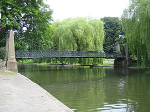
[[File:WardownLake.jpg|thumb|right|Pedestrian suspension bridge across the boating lake created by the river in Wardown Park, Luton]] | [[File:WardownLake.jpg|thumb|right|Pedestrian suspension bridge across the boating lake created by the river in Wardown Park, Luton]] | ||
Revision as of 15:15, 14 April 2017
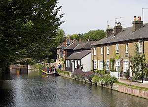
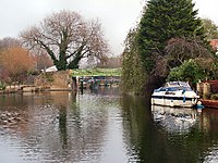
The River Lea is a substantial river of the Home Counties, expending most of its length in Hertfordshire, and a major tributary of the River Thames. It flows 42 miles from source to mouth.
The Lea rises in the north of Luton in southern Bedfordshire, which town is named from the river; it was Ligtun in Anglo-Saxon times. It crosses the width of Hertfordshire, watering the county town, Hertford and becomes a boundary river, between Hertfordshire and Essex and then between at Essex and Middlesex, its natural course forming the whole border between those counties. It enters the tidal Thames at Leamouth, and in its last, tidal reach, the Lea id known as Bow Creek.
Name
The River Lea was first recorded by name in the 9th century, although its name is believed to be much older. Spellings from the Anglo-Saxon period include Lig(e)an in 880 and Lygan in 895, and in the early medieval period it is usually Luye or Leye. It seems to be derived from a British language root lug-meaning 'bright or light' which is also the derivation of a name for a deity, so the meaning may be 'bright river' or 'river dedicated to the god Lugus'.[1][2]
The spelling Lea predominates west, upstream of Hertford, but both spellings are used from Hertford to the River Thames. The Lee Navigation was established by Acts of Parliament and only that spelling is used in this context. The Lee Valley Regional Park Authority also uses this spelling for leisure facilities. However, the spelling Lea is used for road names, locations and other infrastructure in Middlesex and Essex, such as Leamouth, Lea Bridge, the Lea Valley Walk and the Lea Valley Railway Lines. This latter spelling is also used in geology, archaeology, etc. to refer to the Lea Valley.
The river lends it name to a number of towns and village: Luton and Leyton both mean "Lea village". Also on its course are Limbury and Leagrave (Luton suburbs now), Lea Valley village and Leasey Bridge, Lemsford, Leytonstone, and ultimately Leamouth.
Course
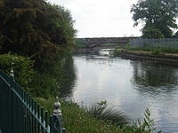
The River Lea rises in Marsh Farm at Leagrave in Luton in the Chiltern Hills. The source is usually said to be at Well Head inside Waulud's Bank at Marsh Farm, but there the River Lea is also fed by a stream that starts 2 miles further west in Houghton Regis.
From its source, the Lea It flows generally south-east to enter Hertfordshire a little north of Harpenden. It flows across the width of Hertfordshire, through Batford on the edge of Harpenden, to the meadows between Welwyn Garden City and Hatfield, and on to Hertford. At Hertford the Lea is joined by the River Mimram. Here it changes from a shallow river to a deep canal at Hertford Castle Weir and turns south-east.
Thence the Lea flows on to Ware and between St Margarets, Hertfordshire and Stanstead Abbotts and south to Hoddesdon.
At Hoddesdon, the Lea accepts the waters of the River Stort and assumes the latter river's role, marking the western border of Essex below this point. The Lea from here flows due south and remains the border between Essex and Hertfordshire henceforth until the end of Hertfordshire. It flows by the long conurbation of Lea Valley towns including Hoddesdon, Broxbourne and Cheshunt, while on the Essex bank there are few places. At Waltham Abbey (Essex), and Waltham Cross (Hertfordshire) the Lea leaves Hertfordshire and from here to its mouth on the Thames its natural course forms the border between Essex and Middlesex.
Between Essex and Middlesex the Leavalley is busy with industry and the legacy of industry. Towns stand either side and a series of reservoirs fill the valley, moving the Lea out of its original course. On the other hand, the Lea Valley Country Park provides a fine green corridor along the river and its canal. At its lowest end the Lea gives birth to the Bow Back Rivers; a network of canals fed by its waters and the tidal waters of the Thames.
The river passes:
| Middlesex | Essex |
|---|---|
| Enfield Lock | Sewardstone |
| Ponders End | |
| Edmonton | Chingford |
| Tottenham | Walthamstow |
| Upper Clapton | Leyton |
| Hackney Wick | |
| Bow | Stratford |
| Bromley-by-Bow (past Fish Island) | West Ham |
| - and finally enters the Thames at: | |
| Leamouth | Canning Town |
The Lea is tidal below Mill Meads (Between Bromley-by-Bow in Middlesex and West Ham in Esssex). A tide mill stands on the river here.
Border river
The River Lea forms the border between the counties of Middlesex and Essex. In the Treaty of Wedmore the Lea between King Alfred and Guthrum the Dane, the Lea was used as part of the boundary of the Danelaw: the West Saxons held the lands west of the river, including all Middlesex, and the Danes the east, including all Essex. It also forms part of the border between Essex and Hertfordshire.
However, the actual border can be hard to place; the course of the river has been diverted by canalisation, in particular the creation of the Lee Navigation canal, and the several reservoirs dug in the Lea Valley.
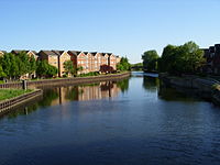
The man-made river
For much of its distance the river runs within or as a boundary to the Lee Valley Park. Between Tottenham and Hackney the Lea feeds Tottenham Marshes, Walthamstow Marshes and Hackney Marshes (the latter now drained). In their early days, Tottenham Hotspur and Leyton Orient played their matches as football amateurs on the Marshes.
South of Hackney Wick the river's course is split, running almost completely in man made channels (originally created to power water mills, the Bow Back Rivers) flowing through an area that was once a thriving industrial zone.
Just downstream of Enfield Island Village, a housing development on the site of the old ordnance factory, the river is joined by the River Lee Flood Relief Channel. The man-made, concrete-banked watercourse is known as the River Lee Diversion at this point as it passes to the east of a pair of reservoirs: the King George V Reservoir at Ponders End / Chingford and William Girling Reservoir at Edmonton; and to the West of the Banbury Reservoir at Walthamstow. At Tottenham Hale there is a connected set of reservoirs; Lockwood Reservoir, High Maynard Reservoir, Low Maynard Reservoir, Walthamstow Reservoirs, East Warwick Reservoir and West Warwick Reservoir. It also passes the Three Mills, a restored tidal mill near Bow.
River history
In the Roman era, Old Ford, as the name suggests, was the ancient, most downstream, crossing point of the River Lea. This was part of a pre-Roman route that followed the modern Oxford Street, Old Street, through Bethnal Green to Old Ford and thence across a causeway through the marshes, known as Wanstead Slip (now in Leyton). The route then continued through Essex to Colchester. At this time, the Lea was a wide, fast flowing river, and the tidal estuary stretched as far as Hackney Wick.[3] Evidence of a late Roman settlement at Old Ford, dating from the 4th and 5th centuries, has been found.
In 894, a force of Danes sailed up the river to Hertford,[4] and in about 895 they built a fortified camp, in the higher reaches of the Lea, about 20 miles north of London. King Alfred the Great saw an opportunity to defeat the Danes and ordered the lower reaches of the Lea drained, at Leamouth. This left the Danes' boats stranded, but also increased the flow of the river and caused the tidal head to move downriver to Old Ford.
In 1110, Matilda, King Henry I's queen, reputedly took a tumble at the ford, on her way to Barking Abbey and ordered a distinctively bow-shaped, three-arched, bridge to be built over the River Lea (The like of which had not been seen before), at Stratforde-atte-Bow. During the Middle Ages, Temple Mills, Abbey Mills, Old Ford and Bow were the sites of water mills (mainly in ecclesiastic ownership) that supplied flour to the bakers of Stratforde-atte-Bow, and hence bread to the City. It was the channels created for these mills that caused the Bow Back Rivers to be cut through the former Roman stone causeway at Stratford.
Improvements were made to the river from 1424, with tolls being levied to compensate the landowners, and in 1571, there were riots after the extension of the River was promoted in a private bill presented to the House of Commons. By 1577, the first lock was established at Waltham Abbey and the river began to be actively managed for navigation.
The New River was constructed in 1613 to take clean water to London, from the Lea and its catchment areas in Hertfordshire and bypass the polluting industries that had developed in the Lea's downstream reaches.[5] The artificial channel further reduced the flow to the natural river and by 1767 locks were installed below Hertford Castle Weir on the canalised part of the Lea, now the Lee Navigation with further locks and canalisation taking place during the succeeding centuries. In 1766, work also began on the Limehouse Cut to connect the river, at Bromley-by-Bow, with the Thames at Limehouse Basin.[5]
The River Lea flows through the old brewing and malting centre of Ware, and consequently transport by water was for many years a significant industry based there. Barley was transported into Ware, and beer out via the river, in particular to London. Bargemen born in Ware were given the "freedom of the River Thames" — avoiding the requirement of paying lock dues — as a result of their transport of fresh water and food to London during the Great Plague of 1665–66. A local legend says that dead bodies were brought out of London at that time via the river for burying in Ware, but there is no evidence for this.[6]
The Waterworks River, a part of the tidal Bow Back Rivers, was widened by 26 feet and canalised to assist with construction of the Olympic Park for the 2012 Summer Olympics. In 2009, Three Mills Lock was installed on the Prescott Channel to maintain water levels on the Lea, within the park at a depth of 6 feet. This has allowed access by 350–ton barges to ensure that at least 50% of the material required for construction could be delivered, or removed by water.
Literature
The poem A Tale of Two Swannes is set along the River Lee. It was written by William Vallans and published in 1590.[7] The river also features in the early chapters of The Compleat Angler by Izaak Walton.
A guide to walking along the river valley was written by Leigh Hatts.[8]
A documentary about the river was presented by Griff Rhys Jones and broadcast by the BBC in 2009.[9]
Outside links
| ("Wikimedia Commons" has material about River Lea) |
- Peter Marshall, The Lea Valley, photographs from 1980 to 2008
- UK Urban Exploration Forums, River Lea through Luton, photographs of the underground culvert in March 2009
- Wikipaddle, River Lea (Hertford Loop), an article from a kayaking and canoeing perspective
- Art:
- Trolling for Pike in the River Lee, 1831, by James Pollard at Tate Britain
- Fly Fishing in the River Lee near the Ferry Boat Inn, 1831, by James Pollard at Tate Britain
References
- ↑ J.E.B. Glover, Allen Mawer, F.M.Stenton (1938). The Place-Names of Hertfordshire. Cambridge University Press.
- ↑ Mills. A.D. Oxford Dictionary of London Place Names (2001) p133 ISBN 0-19-860957-4 Retrieved 28 October 2008
- ↑ {{Brithist|22742|'Bethnal Green: Communications', A History of the County of Middlesex: Volume 11: Stepney, Bethnal Green (1998), pp. 88-90]
- ↑ Hadfield, Charles (1968). The Canal Age. Plymouth: Latimer Trend & Company. pp. 15, 19. ISBN 0-7153-8079-6.
- ↑ 5.0 5.1 Enfield.gov.uk River Lee History
- ↑ "Ware - The Story so Far - 3 of 3". Ware Online. http://www.wareonline.co.uk/history/history3.asp. Retrieved 2 March 2010.
- ↑ English Poetry 1579-1830, William Vallans:A Tale of Two Swannes.
- ↑ L. Hatts, The Lea Valley Walk, Cicerone Press, 2nd edition, 2007, ISBN 978-1-85284-522-3.
- ↑ BBC One, Rivers with Griff Rhys Jones: The Lea, first broadcast 16 August 2009.
