Vale of Glamorgan: Difference between revisions
| Line 80: | Line 80: | ||
*Map: {{wmap|51.390|-3.392}} | *Map: {{wmap|51.390|-3.392}} | ||
[[Category:Glamorgan]] | [[Category:Glamorgan]] | ||
Latest revision as of 09:08, 15 April 2016

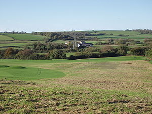
The Vale of Glamorgan is the southern bulge of Glamorgan, a fertile lowland away from the harsh mountains of the north of the county and spreading inland from the coast on the Bristol Channel. It is the southernmost part of Wales.
This is a rich agriculture area, and has a rich history and geography with many small towns, villages and beaches.
Places in the Vale include:
- Barry and Barry Island
- Barry Tourist Railway
- Porthkerry Park
- St Donat's Castle
- Cosmeston Lakes Country Park
- Cosmeston Mediæval Village
The largest town is Barry. Other towns include Penarth, Llantwit Major and Cowbridge.
Geography

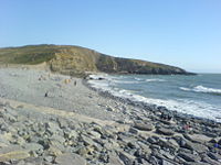
The coastline has been designated the 'Glamorgan Heritage Coast', stretching between Llantwit Major and Ogmore-by-Sea. Its yellow-grey cliffs are unique on the Celtic Sea coastline as they are formed of a combination of liassic limestone, shale and carboniferous sandstone/limestone. They were formed 200 million years ago when this area (as well as Cornwall, Brittany and Ireland) lay underneath a warm, shallow, equatorial sea during the beginning of the Jurassic age. Today the cliffs contain elements of Jurassic age sea-creatures. The stratification of overlapping shale, sandstone and limestone was caused by a geological upheaval known as the Variscan orogeny, which literally pushed the cliffs out of the sea, contorting them as they did so.
As the cliffs and land contain elements of calcium carbonate found in the limestone, it allows farmers in the vale to grow crops which would be difficult elsewhere in the western counties whose soil is predominantly acidic as most of the west country is made of poor quality Devonian soils. The liassic limestone and carboniferous sandstone is also used in the vale for building materials; in previous centuries it was taken by sloops across the Bristol Channel to north Cornish ports such as Bude, Boscastle and Port Isaac to fertilise Cornwall's poor slate soils for the farming communities; while the hard Devonian slate of Cornwall was brought back as a roofing material for houses in the Vale.
As the Glamorgan Heritage Coast faces westwards out to the Atlantic, it bears the brunt of brutal on-shore (west, south-westerly) winds; ideal for surfing, but a nightmare for ships trying to sail up the Bristol Channel into Cardiff. Just like North Cornwall or South-West Ireland, the fierce Atlantic gales created ideal conditions for pre-meditated shipwrecking, which up until 100 years was very common along the coast (although shipwrecking was common across all the Celtic Sea). Nash Point, Southerndown and Ogmore-by-Sea have some of the highest numbers of shipwreck victims on the coast of Wales; as recently as 1962 an oil tanker, the BP Driver crashed into Nash Point during a violent westerly storm, was torn to shreds by the brutal reefs and eventually sank, although thanks to a courageous effort by various Bristol Channel lifeboats and helicopters the crew were saved.
Villages


Outside links
| ("Wikimedia Commons" has material about Vale of Glamorgan) |
