Harcamlow Way: Difference between revisions
Created page with "right|thumb|350px|On the Harcamlow Way near Takeley, Essex {{county|Cambridgeshire}} The '''Harcamlow Way''' i..." |
|||
| Line 26: | Line 26: | ||
*Phoebe Taplin: 'Country Walks Around Cambridge' (2014) ISBN 9781841656816 | *Phoebe Taplin: 'Country Walks Around Cambridge' (2014) ISBN 9781841656816 | ||
*Harcamlow Way booklet (Essex CC, 1980) | *Harcamlow Way booklet (Essex CC, 1980) | ||
[[Category:Long-distance footpaths in the United Kingdom]] | |||
[[Category:Footpaths in Cambridgeshire]] [[Category:Footpaths in Essex]] [[Category:Footpaths in Hertfordshire]] | |||
Revision as of 21:08, 28 July 2017

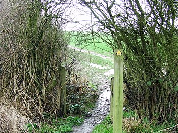
The Harcamlow Way is a waymarked walking route running in a figure-of-eight from Harlow to Cambridge and back again, hence its peculiar portmanteau name. On the way it runs through Essex, Hertfordshire and Cambridgeshire. The total route is 141 miles long, and it has been reckoned that it can be walked in eight days.
The Harcamlow Way is one of the earliest of the waymarked walking trails in this part of the country, which is now knee-deep in them. It was developed by Fred Matthews and Harry Bitten of the west Essex Ramblers’ Association in the 1970s and began to appear on Ordnance Survey maps.
The walk is mainly on tracks and green lanes, taking in the wide tracts of unspoilt countryside in eastern Hertfordshire, western Essex and southern Cambridgeshire, and dropping into many pretty villages on the way, passing many places of historic interest.
The route


The walk, staring clockwise, heads north out of Harlow and straight over the county border into Hertfordshire, heading for Bishop's Stortford and thence to Manuden and on to Newport, Essex, which is the crossing-over point of the two loops. North of Newport, it goes north-east to Audley End and through Saffron Walden town centre, then north-east to Ashdon and across into Cambridgeshire at Bartlow and on to Horseheath. After following for a little way a Roman road north-westwards, it heads north to Balsham and then north-west along the Fleam Dyke to Fulbourn and into the Litle Wilbraham Fen, and drops into Cambridge from the north, along the River Cam.
After wandering among the colleges, the route heads west out of Cambridge to Coton and beyond before going south again, through Kingston and the Wimpole Hall Estate, parallel to Ermine Street. It takes ancient Ashwell Street to Melbourn, then south across the Icknield Way back into Essex.
In Essex the southbound trail passes through Chrishall and Chrishall Common (past Essex's highest point) and Langley, to Arkesden and back to Newport, where the loops cross.
Deeper into Essex there is a tangle of footpaths and bridleways. The Harcamlow Way here runs to Debden and Thaxted, then south to Takeley and south-west to the county border with Hertfordshire on the River Stort opposite Sawbridgeworth, which river it follows down back to Harlow.
Outside links
References
- Phoebe Taplin: 'Scenic Walks in Hertfordshire and Essex' (2014) ISBN 9781841655734
- Phoebe Taplin: 'Country Walks Around Cambridge' (2014) ISBN 9781841656816
- Harcamlow Way booklet (Essex CC, 1980)