Bartlow
| Bartlow | |
| Cambridgeshire | |
|---|---|
 Bartlow St Mary | |
| Location | |
| Location: | 52°4’59"N, -0°18’58"E |
| Data | |
| Population: | 102 (2001) |
| Post town: | Cambridge |
| Postcode: | CB21 |
| Dialling code: | 01223 |
| Local Government | |
| Council: | South Cambridgeshire |
Bartlow is a little village in the south-eastern corner of Cambridgeshire, spilling over into Essex. It lies about 12 miles south-east of Cambridge and seven miles west of Haverhill in Suffolk. The River Granta runs through the village, where it is joined by the River Bourn.
History
At 385 acres Bartlow, is one of the smallest parishes in Cambridgeshire. The southern border of the civil parish is an artificial straightened line which would otherwise lie along the border with Essex. It also has borders with the neighbouring parishes of Castle Camps and Shudy Camps to the east, Horseheath to the north, and Linton to the west.[1]
Though the area has been occupied since Roman times, there is no record of Bartlow itself as a village until 1232, largely because the settlement south of the River Granta with its Roman burial mounds was part of Ashdon Parish nearby in Essex.
Recorded as Berkelawe in 1232, the name "Bartlow" is Old English or Norse and means "Birch (tree) mounds".[2]
Bartlow Hills
Near Bartlow but across the border in Essex are the Bartlow Hills, a Roman tumuli cemetery with three remaining mounds. There were originally seven Bartlow mounds. The tallest at 50 feet in height is the largest barrow north of the Alps.
For centuries the mounds were believed to cover the bodies of those killed at the Battle of Ashingdon in 1016, but excavation demonstrated that they are the graves of a wealthy family and date from the 1st or 2nd century AD. Excavations in the 19th century found large wooden chests, decorated vessels in bronze, glass and pottery and an iron folding chair, most of which were lost in a later fire at Bartlow Hall. A small Roman villa, occupied until the late 4th century, was situated north of the mounds and was excavated in 1852.[1]
Church
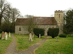
It has long been maintained that the church in Bartlow was built by King Cnut near the site of the Battle of Ashingdon (Assandun), but no evidence for a building of that age has been found. The present parish church, dedicated to St Mary, consists of a chancel, a nave with north porch, and a circular west tower. The tower is all that remains of what is believed to be the original church and dates from the late-11th or early-12th century. The nave and chancel were built in the 14th century.[1]
Bartlow St Mary is one of only two existing round-tower churches in Cambridgeshire, the other one being in Snailwell.[3]
The church is also known for its 15th-century wall-paintings whose fragments include depictions of St Christopher, St Michael weighing souls, and St George's dragon.
Village life
The village has one remaining pub; The Three Hills pub was open by 1847 and is housed in a 17th-century building. Bartlow was listed as having two alehouses in 1682.[1]
Railways
The railway reached the village in 1865 when the Stour Valley line from Great Shelford to Haverhill opened, running along the southern edge of the parish, with a secondary line on the Saffron Walden Railway branching at Bartlow opening in 1866. Bartlow railway station was open at the railway bridge on Ashdon Road until closing when the Haverhill line was axed in 1967. The station is now a private house called Booking Hall.[1]
Outside links
| ("Wikimedia Commons" has material about Bartlow) |
References
- ↑ 1.0 1.1 1.2 1.3 1.4 A History of the County of Cambridge and the Isle of Ely, Volume 6 – pages 30–36
- ↑ A. D. Mills (2003). "A Dictionary of British Place-Names". http://www.encyclopedia.com/doc/1O40-Bartlow.html.
- ↑ Bartlow St. Mary - Round-tower Churches