Beltisloe: Difference between revisions
No edit summary |
No edit summary |
||
| Line 15: | Line 15: | ||
*[[Colsterworth]] (Twyford)<sup>*</sup> | *[[Colsterworth]] (Twyford)<sup>*</sup> | ||
*[[Edenham]] | *[[Edenham]] | ||
*[[Gunby]] | *[[Gunby, Kesteven|Gunby]] | ||
*[[Irnham]] | *[[Irnham]] | ||
*[[Lenton]] | *[[Lenton, Lincolnshire|Lenton]] | ||
*[[Little Bytham]] | *[[Little Bytham]] | ||
*[[North Withan]] | *[[North Withan]] | ||
Revision as of 15:10, 7 January 2020

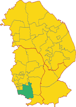
Beltisloe is a wapentake in the Parts of Kesteven, the south-west division of Lincolnshire, adjacent to the borders with Leicestershire and Rutland. It had a population of 6,355 in 2011. It is bounded by Ness to the south-east; by Aveland to the east; and by Winnibriggs and Threo snd the Soke of Grantham to the north. To the south lies Rutland; and to the west, Leicestershire.
It comprises the following ancient parishes:
*: Remainder in the Soke of Grantham.
| Wapentakes of Lincolnshire |
|---|
|
Holland: Elloe • Kirton • Skirbeck • Kesteven: Aswardhurn • Aveland • Beltisloe • Boothby Graffoe • Flaxwell • Grantham Soke • Langoe • Loveden • Ness • Winnibriggs and Threo • Lindsey: West Riding: Aslacoe • Corringham • Manley • Lawress • Well • North Riding: Bradley Haverstoe • Ludborough • Walshcroft • Yarborough • South Riding: Bolingbroke • Calceworth • Candleshoe • Gartree • Hill • Horncastle • Louth Eske • Wraggoe |