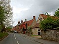
Castle Bytham
| Castle Bytham | |
| Lincolnshire | |
|---|---|
 Castle Bytham village pond | |
| Location | |
| Grid reference: | SK989185 |
| Location: | 52°45’21"N, -0°32’8"W |
| Data | |
| Population: | 768 (2011) |
| Post town: | Grantham |
| Postcode: | NG33 |
| Dialling code: | 01780 |
| Local Government | |
| Council: | South Kesteven |
| Parliamentary constituency: |
Grantham and Stamford |
Castle Bytham is a village of around 300 houses in Kesteven, the south-western part of Lincolnshire. About a mile to the east stands Little Bytham: the two villages used to be called West and East Bytham respectively.
The nearest town is Stamford, and the village is very close to the Rutland border.
The population of Castle Byham was recorded at 768 in 317 households in the 2011 census.
At one time the village was an important commercial centre for the surrounding agricultural communities, but it is now largely a commuter village, although a number of farming families remain with a much reduced workforce.[1]
Churches

The Parish church, St James, was built in the 12th century, and restored in 1900.[2] and is one of a group of parishes in the rural deanery of Beltisloe. It contains an unusual memento of the Restoration: a ladder, formerly used in the tower, with a carved inscription which reads "THIS WARE THE MAY POVL 1660"[3] (see photograph), suggesting that May celebrations were held in the village (as they were throughout the country) to mark the return to the throne of King Charles II.
There was at one time a Methodist chapel in High Street (now a private house), served by visiting ministers from Stamford. After its closure in 1972, the Methodist Circuit still sent a preacher to the village for a few years, service taking place in the parish church.
History

The name 'Bytham' is first recorded in 1067 (as a monastery that rapidly translated to Vaudey Abbey), and comes from the Old English word bythme meaning '(At the) valley bottom' or 'broad valley'.[4] In the Domesday Book of 1086 the village is known as West Bytham [5] (Westbitham).[6] The 'Castle' prefix came later when the castle was built.
Morkery Wood housed a former bomb dump during the Second World War for the nearby airfields. In the early hours of 19 November 1942 Handley Page Halifax BB209 NP-G[7] of No. 158 Squadron RAF, from RAF Rufforth in Yorkshire, crashed near Stocken Hall Farm (in the wood). It had been hit by flak south-east of Paris coming back from a raid on Turin in Italy.[8] Half the aircrew were in the RCAF.
Castle
Overlooking the village is an 11th-century Norman castle mound of Bytham Castle.[9] The site of the castle in Saxon times was owned by Earl Morcar, the magnate whose sister Ealdgyth was the wife of Harold Godwinson, later King Harold II. Morkery Wood (originally named Morkerhaw) in the parish is named after the Earl Morcar.[10]
The castle, which gave its name to the village, was built soon after the Norman conquest and was given by William the Conqueror to his half-brother Odo, Bishop of Bayeux and Earl of Kent;[3] it was later owned by William le Gros, 1st Earl of Albemarle, and was burnt in the 15th century during the Wars of the Roses.[3]
In 1221, after a siege, the castle was destroyed by King Henry III with the help of Hugh de Mortimer and William de Warenne, 5th Earl of Surrey. It had been defended by William de Forz, 3rd Earl of Albemarle aided by William d'Aubigny, Sir Richard Siward, Henry de Hastings and William de Hastings.
In the 16th century John Leland described remnants of the castle: "yet remained great walls of buildings".[3]
About the village

To the west, on the western side of the A1 road, is South Witham near the source of the River Witham.
The village once had a railway station on the Midland and Great Northern Joint Railway, the remains of which can still be seen. This station was rather unusual, being a single platform in a deep cutting through the village. The line closed in 1959.< ref>Hill, Roger; Vessey, Carey (1995). British Railways Past and Present - 27 Lincolnshire. Past & Present Publishing.</ref>[11] West of the village the line of the railway now forms a road crossing under the A1.
In the south of the parish is Pillowsyke Holt, a piece of woodland near Holywell and in the east are the 30 acres of Lawn Wood[12] which has been a nature reserve since 1995, joining two neighbouring meadows that were donated to Lincolnshire Wildlife Trust in 1993. The meadows are a good site for buttercups and yellow rattle, and are managed to encourage butterflies, including the ringlet, and the meadow brown. The wood is mainly oak and ash, but includes field maple, midland hawthorn and the uncommon wild service tree. Woodland flora such as wood anemone, woodruff and early purple orchid also found there. Fallow deer and red deer are frequently seen in the reserve.[12]
Between the village and the A1 the Lincolnshire Wildlife Trust maintains an important wildlife reserve at Tortoiseshell Wood[13]
West of the village, towards Clipsham, is a Yew Tree Avenue maintained by the Forestry Commission, the trees cut into large topiary forms.
Community
-
 Former school
 -
 Castle Inn public house
 -
 Fox and Hounds public house


Castle Bytham's community supports several events each year in the village hall. Every year Castle Bytham holds a midsummer fair and street market, with stalls, a duck grand prix, dog show, funfair, children's games, beer tents and barbecues. The fair has raised over £40,000 for local causes including a Christmas lunch for pensioners and a children's party, and village infrastructure improvements.
There is a village shop on Pinfold Road. Castle Bytham Post Office was closed in 2008.
There are two remaining public houses in the village: the Fox & Hounds and the Castle Inn. The New Inn on Station Road was converted to housing in the 1960s.[1]
See also
Outside links
| ("Wikimedia Commons" has material about Castle Bytham) |
- The Bythams
- Castle Bytham Village
- Castle Bytham Summer Fair
- Castle Bytham, in South Kesteven and Lincolnshire: A Vision of Britain through Time
- "How DNA saved an 'extinct' breed", BBC News, 20 August 2004
References
- ↑ 1.0 1.1 "SKDC conservation area report". http://www.southkesteven.gov.uk/CHttpHandler.ashx?id=3799&p=0.
- ↑ National Monuments Record: No. 325286 – St James' Church
- ↑ 3.0 3.1 3.2 3.3 Cox, J. Charles: 'Lincolnshire' (Methuen, 1916), p.96
- ↑ Mills, Anthony David: 'A Dictionary of British Place-Names' (Oxford University Press, 2003) ISBN 978-0-19-852758-9
- ↑ Wild, John, (1871); The History of Castle Bytham: Its Ancient Fortress and Manor p. 3; BiblioBazaar (2008) ISBN 0-554-79494-2 / Nabu Press (2010) ISBN 978-1-147-70286-6
- ↑ Castle Bytham in the Domesday Book
- ↑ 1942 Handley-Page Halifax crash
- ↑ Lost Bombers
- ↑ National Monuments Record: No. 325283 – The Castle
- ↑ Cope-Faulkner, Paul (October 2001). "Forest Enterprise Woodlands in Lincolnshire - Morkery Wood - Archaeological Survey (APS Report No 65/01)". Archaeological Project Services. http://archaeologydataservice.ac.uk/catalogue/adsdata/arch-1045-1/dissemination/pdf/1877_MorkeryWood_Castle.pdf. Retrieved 8 June 2012.
- ↑ &resourceID=2 National Monuments Record: No. 506989 – The railway station
- ↑ 12.0 12.1 Lawn Wood, and Bottleneck and Jackson's Meadows: Lincolnshire Wildlife Trust
- ↑ Tortoiseshell Wood and Porter's Lodge Meadows: Lincolnshire Wildlife Trust
- Wild, John; 'The History of Castle Bytham: Its Ancient Fortress and Manor' (1871); (BiblioBazaar 2008) ISBN 0-554-79494-2 / (Nabu Press, 2010) ISBN 978-1-147-70286-6
- Chorlton, Martyn: 'Danger Area: The Complete History of RAF South Witham, 100 MU' (Old Forge Publishing, 2003) ISBN 0-9544507-2-8