Difference between revisions of "Tindale Ward"
From Wikishire
| Line 26: | Line 26: | ||
*[[Newburn]] (Dalton township)<sup>§</sup> | *[[Newburn]] (Dalton township)<sup>§</sup> | ||
*[[Ovingham]] | *[[Ovingham]] | ||
| − | *[[Slaley]] | + | *[[Slaley, Nothumberland|Slaley]] |
*[[St John Lee]] | *[[St John Lee]] | ||
*[[Stamfordham, Northumberland|Stamfordham]] | *[[Stamfordham, Northumberland|Stamfordham]] | ||
Latest revision as of 13:54, 28 February 2021
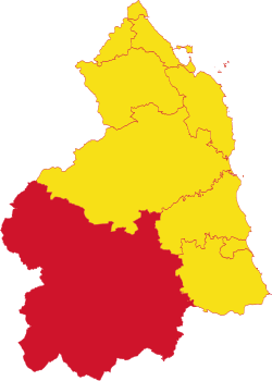
Tindale Ward or Tynedale Ward is one of the Wards of Northumberland, located in the south-west of the county. It is bounded to the south by the River Tyne, which forms the border with County Durham; to the north-west by Roxburghshire; to the south-west by Cumberland; to the east by Castle Ward; to the north-east by Morpeth Ward; and to the north by Coquetdale Ward. It had a population of 63,293 in 2011.
It comprises the following ancient parishes:
- Allendale
- Bellingham
- Birtley
- Bolam (part)*
- Bywell St Peter
- Chollerton
- Corsenside
- Falstone
- Greystead
- Haltwhistle
- Hartburn (part)†
- Haydon
- Heddon-on-the-Wall (part)‡
- Hexham
- Kirkhaugh
- Kirkwhelpington
- Knarsdale
- Lambley
- Masters Close (ex. par.)
- Newbrough
- Newburn (Dalton township)§
- Ovingham
- Slaley
- St John Lee
- Stamfordham
- Shotley
- Simondburn
- Throckrington
- Thorneyburn
- Warden
- Wark
- Whitfield
*: Partly in Castle and Morpeth Wards.
†: Partly in Morpeth Ward.
‡: Partly in Castle Ward.
§: Remainder in Castle Ward.
| Wards of Northumberland |
|---|
|
Bambrough • Castle (including Newcastle) • Coquetdale • Glendale (including Berwick liberties) • Morpeth • Tindale • Bedlingtonshire • Islandshire • Norhamshire |
