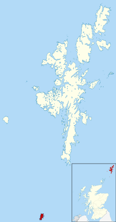
Fair Isle
| Fair Isle | |
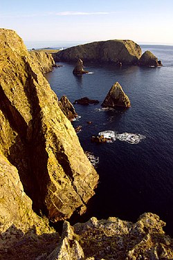 West cliffs, towards Malcolm's Head | |
|---|---|
| Main village: | Stonybreck |
| Location | |
| Location: | 59°32’28"N, 1°37’23"W |
| Grid reference: | HZ209717 |
| Area: | 3 square miles |
| Highest point: | Ward Hill, 712 feet |
| Data | |
| Population: | 69 |
Fair Isle is an island of Shetland lying south of the main group of Shetland and half-way to Orkney. It is famous for its bird observatory and a traditional style of knitting, producing the Fair Isle sweater. Its name is from Old Norse Frjóey, meaning "Sheep Island".
Geography
Fair Isle is the most remote inhabited island in the United Kingdom. It lies 24 miles southwest of Sumburgh Head on Shetland Mainland and 27 miles northeast of North Ronaldsay, Orkney. It has an area of 3 square miles, making it the tenth-largest of the isles of Shetland. The island gives its name to one of the British Sea Areas.[1]
The majority of the seventy islanders live in the crofts on the southern half of the island, with the northern half consisting of rocky moorland. The western coast consists of cliffs of up to 660 feet in height. The population has been decreasing steadily from around four hundred in around 1900. There are no pubs or restaurants on the island, and there is but a single primary school. After the age of eleven, children must attend secondary school in Lerwick and stay in a hostel there in term time.
Bird observatory
Fair Isle has a permanent bird observatory, founded by George Waterston in 1948, because of its importance as a bird migration watchpoint and this provides most of the accommodation on the island.[2] The first Director of the observatory was Kenneth Williamson.[3] It is unusual amongst bird observatories in providing catered, rather than hostel-style, accommodation.
Many rare species of bird have been found on the island, and it is probably the best place in western Europe to see skulking Siberian passerines such as Pechora Pipit, Lanceolated Warbler and Pallas's Grasshopper Warbler. In spring 2008 a Calandra Lark was identified in April, and in May a Caspian Plover was observed, only the fourth such record for the UK.[4] On June 6 a Citril Finch was found and identified by Islander Tommy Hyndman, a first record for Britain. September was highlighted by Brown Flycatcher, Red-flanked Bluetail and Siberian Thrush. Fair Isle can claim to be the best place to find rare birds in Britain with at least 27 first records. Spring 2009 started well with notable birds including White-tailed Eagle, Green-winged Teal, Red-rumped Swallow and a Brown-headed Cowbird (2nd for Britain).
The island is home to an endemic subspecies of Eurasian Wren, the Fair Isle Wren Troglodytes troglodytes fridariensis.
History
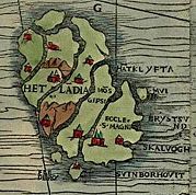
Fair Isle has been occupied since the Bronze Age which is remarkable because of the lack of raw materials on the island, although it is surrounded by rich fishing waters. There are two known Iron Age sites - a promontory fort at Landberg and the foundations of a house underlying an early Christian settlement at Kirkigeo.
Most of the place-names date from after the ninth-century Norse settlement of the Northern Isles. By that time the croft lands had clearly been in use for many centuries.
On 20 August 1588 the flagship of the Spanish Armada, El Gran Grifón, was shipwrecked in the cove of Stroms Heelor, forcing its 300 sailors to spend six weeks living with the islanders. The wreck was discovered in 1970.

Fair Isle was bought by the National Trust for Scotland in 1954 from George Waterston, the founder of the bird observatory.[5][6]
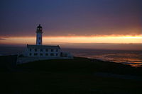
Today about 60 crofters work the land on the island. It has 14 scheduled monuments, ranging from the earliest signs of human activity to the remains of a Second World War radar station. The two automated lighthouses are protected as listed buildings.
The island's historic role as a signal station continues today with its high-technology relay stations carrying vital TV, radio, telephone and military communication links between Shetland, Orkney and the mainland of Great Britain.
Economy
Over the centuries the island changed hands many times. Trading links with northern Europe are reflected in Fair Isle Haa, a traditional Hanseatic trading booth located not far from the South Harbour traditionally used by residents of the southern part of the island. But rent was paid to absentee landlords (who rarely visited) in butter, cloth and fish oil.
Fishing has always been an important industry for the island. In 1702, the Dutch, who were interested in Shetland's herring fisheries, fought a naval battle against the French warships just off the island.
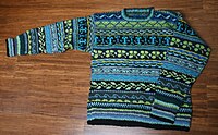
Fair Isle is also famous for its woollen jumpers, with knitting forming an important source of income for the women of the islands. The principal activity for the male islanders is crofting.
Military role
During the Second World War, the Royal Air Force built a radar station on top of Ward Hill at 712 feet above sea level during the Battle of the Atlantic (1939–1945). The ruined buildings and nissen huts are still present. A Heinkel He 111, from the Luftwaffe's weather patrol, crashed on to the island in 1940. Its remains can still be seen.[7]
Electricity supply
Since 1982, two thirds of the community's power has been supplied by wind turbines, and a third by diesel generators. Diesel generators are automatically switched off if wind turbines provide sufficient power.
Fair Isle is not connected to the national grid. The island has two electrical networks. Standard electricity service is provided on one network, and electric heating is delivered by a second set of cables. The electrical heating is mostly provided by excess electricity from the two wind turbines. Remote frequency-sensitive programmable relays control water heaters and storage heaters in the buildings of the community.
Transport
- Fair Isle Airport serves the island with flights to Lerwick and Kirkwall (Kirkwall only seasonal).
- The Good Shepherd IV plies between Fair Isle and Grutness.
Outside links
- Fair Isle community website
- Fair Isle - National Trust for Scotland
- Fair Isle bird observatory
- Latest bird sightings
- Fair Isle Electricity Company Ltd
- Details of its airport
- Photographic tour of the island
- NPR Story on Fair Isle
References
- ↑ "Fair Isle". fairisle.org.uk. http://www.fairisle.org.uk/index.htm. Retrieved 2008-02-09.
- ↑ Okill, David; Shaw, Deryk (2010). "Fair Isle". in Archer, Mike; Grantham, Mark; Howlett, Peter; Stansfield, Steven. Bird Observatories of Britain and Ireland. T & A D Poyser. Archived from the original on 14 May 2011. http://www.webcitation.org/5yg0Dk0ka.
- ↑ "The History of Fair Isle Bird Observatory". fairislebirdobs.co.uk. http://www.fairislebirdobs.co.uk/history.htm. Retrieved 2008-08-01.
- ↑ Hughes, Mark (5 May 2008). "Rare bird sends twitchers on a wild plover chase". London: The Independent. http://www.independent.co.uk/environment/nature/rare-bird-sends-twitchers-on-a-wild-plover-chase-821129.html. Retrieved 2009-07-24.
- ↑ "Case Study: Wind Power on Fair Isle". National Trust for Scotland. http://www.ntseducation.org.uk/students/case-fairIsle.html. Retrieved 2008-05-07.
- ↑ Nicolson, James R (1972). Shetland. Newton Abbot: David & Charles. p. 27.
- ↑ WWII crash
| Islands of Shetland |
|---|
|
Inhabited islands: |
