Hampshire Downs: Difference between revisions
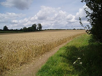
Created page with "right|thumb|350px|Wheatfields on the Hampshire Downs above New Alresford {{county|Hampshire}} The ''..." |
|||
| Line 12: | Line 12: | ||
==Highest hills== | ==Highest hills== | ||
[[Walbury Hill]] is the highest point on the Hampshire Downs and the [[County top|highest point in the county]]: its summit stands just within Hampshire, but the border of Berkshire runs just below, along its northern flank. Close by to the east | [[Walbury Hill]] is the highest point on the Hampshire Downs and the [[County top|highest point in the county]]: its summit stands just within Hampshire, but the border of Berkshire runs just below, along its northern flank. Close by to the east are [[Combe Hill, Hampshire|Combe Hill]] and [[Pilot Hill, Hampshire|Pilot Hill]], which may be counted as the highest hills wholly in Hampshire. | ||
Prominent hills in the Hampshire Downs include: | Prominent hills in the Hampshire Downs include: | ||
*[[Walbury Hill]] (974 feet) | *[[Walbury Hill]] (974 feet) | ||
*[[Combe Hill, | *[[Combe Hill, Hampshire|Combe Hill]] (961 feet) | ||
*[[Inkpen Hill]] (948 feet) | *[[Inkpen Hill]] (948 feet) | ||
*[[Pilot Hill]] (938 feet) | *[[Pilot Hill]] (938 feet) | ||
Latest revision as of 20:12, 28 September 2022

The Hampshire Downs form a large area of rolling hills in Hampshire and along the border of Berkshire to the north and Wiltshire to the west, forming part of one, large belt of chalk downland that extends from the South Downs in the south-east, north to the Berkshire Downs and the Marlborough Downs of Wiltshire, and westward to the Dorset Downs of Dorset.
The downs have been designated a 'National Character Area' by Natural England. To the north lie the Thames Basin Heaths, to the east the Low Weald (Western Weald), to the south the South Hampshire Lowlands and the South Downs, and, to the west, Salisbury Plain and the West Wiltshire Downs.[1]
The northern boundary of the Hampshire Downs follows a line from just north of Walbury Hill on the border of Hampshire and in Berkshire to Basingstoke and Farnham, forming a ridge and dramatic escarpment which rises to over 950 feet, overlooking the Thames Basin. In the east the boundary runs from Farnham to Alton, then swings southwards to Petersfield, forming an escarpment at the western edge of the Weald, including an area known as the East Hampshire Hangers. In the south the boundary runs westwards to Winchester, south to Twyford and Otterbourne, then west-northwest to Michelmersh; and in the west from Michelmersh through the Wallops to Ludgershall in Wiltshire, and back to Walbury Hill.[1]
The main rivers of the Hampshire Downs are the Test and Itchen. The main towns in the area are Andover, Alton, Basingstoke and Winchester.
By a fair reckoning of the extent of these hill, 20% of the Hampshire Downs, known as the North Hampshire Downs, falls within the 'North Wessex Downs Area of Outstanding Natural Beauty', and around 6% within the South Downs National Park.[1]
Highest hills
Walbury Hill is the highest point on the Hampshire Downs and the highest point in the county: its summit stands just within Hampshire, but the border of Berkshire runs just below, along its northern flank. Close by to the east are Combe Hill and Pilot Hill, which may be counted as the highest hills wholly in Hampshire.
Prominent hills in the Hampshire Downs include:
- Walbury Hill (974 feet)
- Combe Hill (961 feet)
- Inkpen Hill (948 feet)
- Pilot Hill (938 feet)
- Sidown Hill (873 feet)
- Beacon Hill (856 feet)
- Wheatham Hill (817 feet)
- Watership Down (778 feet)
- Ladle Hill (761 feet)
- Holybourne Hill (738 feet)
- Red Hill (725 feet)
- Goleigh Hill (722 feet)
- King's Hill (715 feet)
- Noar Hill (702 feet)
- Selborne Hill (692 feet)
- Farleigh Hill (682 feet)
- Farley Mount (584 feet)
- St Catherine's Hill (318 feet)
Location
- Location map: 51°8’24"N, 1°14’24"W
References
- ↑ 1.0 1.1 1.2 NCA 130: Hampshire Downs - Key Facts & Data at www.naturalengland.org.uk. Accessed on 3 Apr 2013.