River Tweed: Difference between revisions
| (One intermediate revision by the same user not shown) | |||
| Line 11: | Line 11: | ||
Major towns through which the Tweed flows include [[Peebles]], [[Galashiels]], [[Melrose]], [[Kelso]], [[Coldstream]] and [[Berwick-upon-Tweed]], where it flows into the [[North Sea]]. | Major towns through which the Tweed flows include [[Peebles]], [[Galashiels]], [[Melrose]], [[Kelso]], [[Coldstream]] and [[Berwick-upon-Tweed]], where it flows into the [[North Sea]]. | ||
It rises on Tweedsmuir in [[Peeblesshire]] and begins a twisting course through that shire. Peebleshire's alternative name is "Tweeddale" after its river. The river flows through [[Peebles]] and [[Innerleithen]]; there are no other | It rises on Tweedsmuir in [[Peeblesshire]] and begins a twisting course through that shire. Peebleshire's alternative name is "Tweeddale" after its river. The river flows through [[Peebles]] and [[Innerleithen]]; there are no other sizeable towns on its upper course. | ||
Having spent its first 36 miles, a third of its course in Tweeddale, the Tweed enters [[Selkirkshire]] and spends a few miles watering the north of that county, accepting the waters of the [[Gala Water]] a little below [[Galashiels]]. | Having spent its first 36 miles, a third of its course in Tweeddale, the Tweed enters [[Selkirkshire]] and spends a few miles watering the north of that county, accepting the waters of the [[Gala Water]] a little below [[Galashiels]]. | ||
| Line 17: | Line 17: | ||
The Tweed then enters northern [[Roxburghshire]] and flows for 26 miles in that shire, serving as a boundary river for some twelve miles at either end of this reach. Within Roxburghshire the Tweed is joined by the waters of the Bowden and at [[Kelso]] the [[River Teviot]]. The Allan and the [[Eden Water]] join its swelling waters too in Roxburghshire. The Tweed passes the site of [[Old Roxburgh]], the unfortunate burgh which gave its name to the shire before the fratricidal wars of the Middle Ages destroyed it. Henry of Huntingdon reports that in his age, the twelfth century, the Tweed this high up marked the boundary between the kingdoms of England and Scotland and Roxburgh was a border town, though at peace in his day. | The Tweed then enters northern [[Roxburghshire]] and flows for 26 miles in that shire, serving as a boundary river for some twelve miles at either end of this reach. Within Roxburghshire the Tweed is joined by the waters of the Bowden and at [[Kelso]] the [[River Teviot]]. The Allan and the [[Eden Water]] join its swelling waters too in Roxburghshire. The Tweed passes the site of [[Old Roxburgh]], the unfortunate burgh which gave its name to the shire before the fratricidal wars of the Middle Ages destroyed it. Henry of Huntingdon reports that in his age, the twelfth century, the Tweed this high up marked the boundary between the kingdoms of England and Scotland and Roxburgh was a border town, though at peace in his day. | ||
Between Birgham (Berwickshire) and Carham (Northumberland) the Tweed, by now a broad and noble stream, forms the boundary river between [[Berwickshire]] and [[Northumberland]]. So it continues for many miles, becoming tidal at the Union Bridge below Horncliffe and above [[Paxton, Berwickshire|Paxton House]] and soon enters the Liberties of [[ | Between Birgham (Berwickshire) and Carham (Northumberland) the Tweed, by now a broad and noble stream, forms the boundary river between [[Berwickshire]] and [[Northumberland]]. So it continues for many miles, becoming tidal at the Union Bridge below Horncliffe and above [[Paxton, Berwickshire|Paxton House]] and soon enters the Liberties of [[Berwick upon Tweed|Berwick]], where it divides Berwick from Tweedmouth and thereafter enters the North Sea. | ||
==Catchment of the River Tweed== | ==Catchment of the River Tweed== | ||
| Line 44: | Line 44: | ||
==Outside links== | ==Outside links== | ||
[[File:Old Low level bridge across the River Tweed - geograph.org.uk - 181163.jpg| | [[File:Old Low level bridge across the River Tweed - geograph.org.uk - 181163.jpg|thumb|230px|Old Bridge, Berwick and Tweedmouth]] | ||
*[http://www.waterscape.com/canals-and-rivers/river-tweed British Waterways: River Tweed] | *[http://www.waterscape.com/canals-and-rivers/river-tweed British Waterways: River Tweed] | ||
*[http://www.rtc.org.uk/ The River Tweed Commission website] | *[http://www.rtc.org.uk/ The River Tweed Commission website] | ||
Latest revision as of 12:46, 17 March 2017
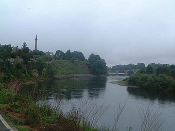
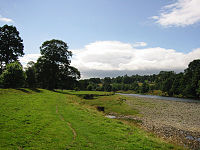
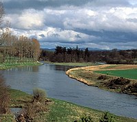
The River Tweed, or Tweed Water is 97 miles long and flows primarily through the counties of Peebles, Selkirk, Roxburgh and Berwick before entering the liberties of Berwick-upon-Tweed in Northumberland, its tidal waters dividing that town from Tweedmouth on the south bank.
The Tweed rises on Tweedsmuir at Tweed's Well near where the Clyde, draining northwest, and the Annan draining south also rise. "Annan, Tweed and Clyde rise oot the ae hillside" as the local saying has it.
The Tweed drains a broad region; all the north-eastern part of the Middle Shires, forming a luxuriant pastoral region in the four shires and in northern Northumberland. The Tweed is one of the great salmon rivers of Britain too.
Course
Major towns through which the Tweed flows include Peebles, Galashiels, Melrose, Kelso, Coldstream and Berwick-upon-Tweed, where it flows into the North Sea.
It rises on Tweedsmuir in Peeblesshire and begins a twisting course through that shire. Peebleshire's alternative name is "Tweeddale" after its river. The river flows through Peebles and Innerleithen; there are no other sizeable towns on its upper course.
Having spent its first 36 miles, a third of its course in Tweeddale, the Tweed enters Selkirkshire and spends a few miles watering the north of that county, accepting the waters of the Gala Water a little below Galashiels.
The Tweed then enters northern Roxburghshire and flows for 26 miles in that shire, serving as a boundary river for some twelve miles at either end of this reach. Within Roxburghshire the Tweed is joined by the waters of the Bowden and at Kelso the River Teviot. The Allan and the Eden Water join its swelling waters too in Roxburghshire. The Tweed passes the site of Old Roxburgh, the unfortunate burgh which gave its name to the shire before the fratricidal wars of the Middle Ages destroyed it. Henry of Huntingdon reports that in his age, the twelfth century, the Tweed this high up marked the boundary between the kingdoms of England and Scotland and Roxburgh was a border town, though at peace in his day.
Between Birgham (Berwickshire) and Carham (Northumberland) the Tweed, by now a broad and noble stream, forms the boundary river between Berwickshire and Northumberland. So it continues for many miles, becoming tidal at the Union Bridge below Horncliffe and above Paxton House and soon enters the Liberties of Berwick, where it divides Berwick from Tweedmouth and thereafter enters the North Sea.
Catchment of the River Tweed
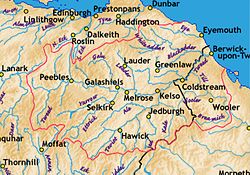
Tweed tributaries include:
Geography
The Tweed valley is interesting area when it comes to looking at the glacial history of Britain. The valley floor on which the river currently flows is a drumlin field and is the relic of a paleo ice stream that flowed through the area during the last Ice Age.
Outside links
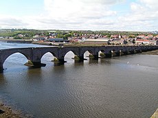
- British Waterways: River Tweed
- The River Tweed Commission website
- The Tweed Foundation
- Tweed Forum website
Conservation
- River Tweed: Special Area of Conservation (SAC)
- SEPA (Scottish Environment Protection Agency): River Level Data
Maps and geographical studies
- River Tweed map
- Gazetteer for Scotland: River Tweed
- Paper describing palaeo-icestream and landforms in the Tweed Valley http://www.geos.ed.ac.uk/homes/s0350775/everestetal2005.pdf
- Map and aerial photo sources for Tweed's Well and Tweedmouth