Cuckoo Way: Difference between revisions
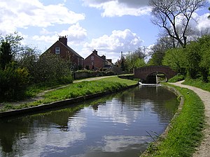
Created page with "right|thumb|300px|Beside the Chesterfield Canal at Shireoaks {{county|Nottinghamshire}} The '''Cuckoo Way''' is a..." |
No edit summary |
||
| Line 5: | Line 5: | ||
The western end of the path is in [[Chesterfield]] town centre, in [[Derbyshire]], and the eastern end at [[West Stockwith]] in the [[Isle of Axholme]] in northernmost [[Nottinghamshire]], where the canal meets the final, canalised reach of the [[River Trent]]. | The western end of the path is in [[Chesterfield]] town centre, in [[Derbyshire]], and the eastern end at [[West Stockwith]] in the [[Isle of Axholme]] in northernmost [[Nottinghamshire]], where the canal meets the final, canalised reach of the [[River Trent]]. | ||
From Chesterfield, the path runs east alongside the Chesterfield Canal, which here runs beside the [[River Rother, Yorkshire|River Rother]], splitting away for a while between [[New Brimington]] and [[Staveley]], and at Staveley the canal is cut short. The path then follows footpaths that take it generally along or close to the route the canal followed (hence the appearance by the path of ‘Canal Cottages’ by dry land) and on through [[Killamarsh]], hereafter coming across traces of the waterway in the shape of ponds and some extant sections. Immediately north of Killamrsh, the route enters the [[West Riding of Yorkshire]]. | From Chesterfield, the path runs east alongside the Chesterfield Canal, which here runs beside the [[River Rother, Yorkshire|River Rother]], splitting away for a while between [[New Brimington]] and [[Staveley, Derbyshire|Staveley]], and at Staveley the canal is cut short. The path then follows footpaths that take it generally along or close to the route the canal followed (hence the appearance by the path of ‘Canal Cottages’ by dry land) and on through [[Killamarsh]], hereafter coming across traces of the waterway in the shape of ponds and some extant sections. Immediately north of Killamrsh, the route enters the [[West Riding of Yorkshire]]. | ||
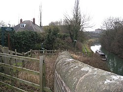
[[File:Kiveton Park - Chesterfield Canal - geograph.org.uk - 1137312.jpg|right|thumb|250px|At Kiveton Park, with a 'Cuckoo Way' sign]] | [[File:Kiveton Park - Chesterfield Canal - geograph.org.uk - 1137312.jpg|right|thumb|250px|At Kiveton Park, with a 'Cuckoo Way' sign]] | ||
Latest revision as of 15:55, 28 February 2021

The Cuckoo Way is a canal walk 46 miles long in Derbyshire, Yorkshire and Nottinghamshire, which runs for the most part along the towpath of the Chesterfield Canal or along paths parallel to it. Its name is from the local nickname for the canal: the Cuckoo Dyke. The canal is largely disused.
The western end of the path is in Chesterfield town centre, in Derbyshire, and the eastern end at West Stockwith in the Isle of Axholme in northernmost Nottinghamshire, where the canal meets the final, canalised reach of the River Trent.
From Chesterfield, the path runs east alongside the Chesterfield Canal, which here runs beside the River Rother, splitting away for a while between New Brimington and Staveley, and at Staveley the canal is cut short. The path then follows footpaths that take it generally along or close to the route the canal followed (hence the appearance by the path of ‘Canal Cottages’ by dry land) and on through Killamarsh, hereafter coming across traces of the waterway in the shape of ponds and some extant sections. Immediately north of Killamrsh, the route enters the West Riding of Yorkshire.

The route then follows eastwards to Kiverton Park where the Chesterfield Canal remains in water.
From Kiverton Park, the Cuckoo Way follows the canal to a remarkable series of 23 locks known as the Giant's Staircase,[1] of which 20 locks are found in just one mile, believed to be the most per mile on the whole canal sytem. While it may take five and a half hours to pass the locks of the Giant’s Staircase by canal boat,[2] on foot on the Cuckoo Way it is somewhat quicker. Below the Statircase the canal and path go on to cross into Nottinghamshire at Shireoaks.
From Shireoaks the canal and path head east and through the town centre of Worksop, the 'Capital of the Dukeries', with the canal this time running beside the River Ryton.
Following on, the canal and path reach Retford, then heading north past Clarborough and Hayton to the final stretch to Misterton and West Stockwith and the Trent.
See also
- The Cuckoo Trail in Sussex
- The Cuckoo Walk in Yorkshire
Outside links
- ↑ The Giant's Staircase at the Chesterfield Canal on Atlas Obscura]
- ↑ 'Rare opportunity to cruise up the 23 locks of the Giant’s Staircase on the Chesterfield Canal' by Stephanie Bateman in The Star 19 April 2017