Huney
| Huney | |
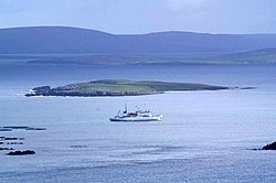
 Huney from Unst | |
|---|---|
| Location | |
| Location: | 60°44’24"N, -0°48’36"W |
| Grid reference: | HP648063 |
| Area: | 50 acres |
| Highest point: | 62 feet |
| Data | |
| Population: | 0 |
Huney is an uninhabited island due east of the island of Unst in Shetland. The island is located some half a mile southwest of the Balta and has an area of just 50 acres. Huney is linked to Unst at an extremely low tide by a sandy tombolo called the Yei of Huney. It is uninhabited.[1]
The First World War British E class submarine E49 was sunk in the channel between Huney and Balta with the loss of all hands on 12 March 1917. The submarine was heading out of Balta Sound on patrol when it struck a mine laid by a German U-boat. The wreck is now a designated war grave. Idle local legend reports ghostly appearances around the vicinity of the submarine's grave, which may discourage settlement on the island.
References
- ↑ Haswell-Smith, Hamish (2004). The Scottish Islands. Edinburgh: Canongate. ISBN 1841954543.
| Islands of Shetland |
|---|
|
Inhabited islands: |