Glossop
| Glossop | |
| Derbyshire | |
|---|---|
 Glossop from the Snake Pass | |
| Location | |
| Grid reference: | SK0393 |
| Location: | 53°26’37"N, 1°56’56"W |
| Data | |
| Population: | 32,428 (2001) |
| Post town: | Glossop |
| Postcode: | SK13 |
| Dialling code: | 01457 |
| Local Government | |
| Council: | High Peak |
| Parliamentary constituency: |
High Peak |
Glossop is a market town in Derbyshire, within the Peak District which stands on the Glossop Brook, a tributary of the River Etherow. The town is in the hills, at between 500 and 1,000 feet above mean sea level, and promotes itself as "the gateway to the Peak District National Park". It had a total resident population of 32,428 in 2001 according to the census of that year.
The town is about 15 miles east of the City of Manchester, and near Derbyshire's borders with Cheshire, Lancashire and Yorkshire. Glossop's transport links to Manchester make it a popular town for commuters to Manchester and its surrounding towns.
Glossop has been a small hamlet and a parish recorded in the Domesday Book of 1086, and the manor given by William I of England to William Peverel. The area now known as Glossop approximates to the villages that used to be called Glossopdale, on the lands of the Howard family, Dukes of Norfolk. Originally known as a centre of wool processing, Glossop rapidly expanded in the late 18th century when it specialised in the production and printing of calico, a coarse cotton. Under the benign patronage of the Howards and other mill-owning families the villages became a mill town with many chapels and churches, its fortunes tied to the cotton industry.
Architecturally the area is dominated by buildings constructed of the local sandstone. There remain two significant former cotton mills and the Dinting railway viaduct. Strong competition between various denominations has left a legacy of chapels, churches and their associated schools in the town and associated villages of Glossopdale.
Name
The name Glossop is from Old English though the exact origin is uncertain. It may be Glott's Hope, where hope means a valley (the suffix is commonplace in the northern shires) or a piece of land enclosed by marshes.[1] Glott may be the name of a chieftain otherwise unknown.
Because of its size and location, Glossop had many definitions. The village of Glossop is now called Old Glossop. Howard Town and Milltown gained importance. They were named New Town and then Glossop, and all grew together under the common name of Glossop.
Glosssopdale and around

The Glossop Brook forms Glossopdale, which has filled up with today's town. The Shelf Brook leads from Shelf Moor on Bleaklow down Doctor's Gate through Old Glossop to the Glossop Brook. The valley was used by the Romans for a road, and currently contains a bridleway.
The north slope of Holden Clough and the Hurst Brook is used by the A57 road known as the Snake Pass. The Snake Pass crosses the Pennine Way near Doctor's Gate Culvert (1,680 feet above sea level) before descending to the east to Ladybower Reservoir along the northern side of the River Ashop valley. Here one road leads east over Hallam Moor into Sheffield.
To the north of Glossop is Longdendale where the River Etherow forms the boundary between Derbyshire and Cheshire, the valley filled with a chain of reservoirs. Cheshire's most easterly village, Tintwistle, is on the oppside side of the dale.
History
Early and Roman
There is evidence of a Bronze Age burial site on Shire Hill (near Old Glossop) and other possibly prehistoric remains at Torside (on the slopes of Bleaklow). The prehistoric earthworks of Torside Castle are visible on Harrop Moss just north west of Bleaklow Head above the Longdendale Valley.
The Romans arrived in the hills in 78 AD and soon a road over the Pennines that descended into the Etherow valley along Doctor's Gate. In the late 1st century they built a fort, Ardotalia, on high ground above the river in present-day Gamesley. The site of this fort was rediscovered in 1771 by an amateur historian, John Watson and it subsequently acquired the name "Melandra Castle". The extensive site has been excavated, revealing fort walls, a shrine and the fort headquarters. The area has been landscaped to provide parking and picnic areas.
Middle Ages
King William I awarded the manor of Glossop to William Peveril, who began construction of Glossop Castle, but the entire estate was later confiscated. In 1157 Henry II gave the manor of Glossop to Basingwerk Abbey, which gained for it a market charter in 1290,[2] and one for Charlesworth in 1328.
In 1433, the monks leased all of Glossopdale to the Talbot family, later Earls of Shrewsbury. In 1494, an illegitimate son of the family, Dr John Talbot, was appointed vicar of Glossop and founded a school, and paved the Roman road over the moors; this is known as Doctor's Gate.[3]
At the Dissolution of the Monasteries in 1537 the manor of Glossop was given to the Talbot family. In 1606 it came into the ownership of the Howard family, the Dukes of Norfolk, who held it for the next 300 years. Glossop was usually given to the second son of the family.
The land was too wet and cold to be used for wheat, but was ideal for the hardy Pennine sheep, so agriculture was predominantly pastoral.[3] Most of the land was owned by the Howards and was leasehold and it was only in Whitfield that there was any freehold land. The few houses were solid, built of the local stone, and allowed for the development of home industries such as wool spinning and weaving.
Industrial and civic history
The mediæval economy was based on sheep pasture and the production of wool by farmers who were tenants of the Abbot of Basingwerk and later the Talbot family. During the Industrial Revolution of the 18th century Glossop became a centre for cotton spinning. A good transport network between Liverpool and Glossop brought in imported cotton which was spun by a labour force with wool spinning skills. The climate of Glossopdale provided abundant soft water that was used to power mills and finish the cloth, and also gave the humidity necessary to spin cotton under tension. Initial investment was provided by the Dukes of Norfolk. By 1740, cotton in an unspun form had been introduced to make fustians and lighter cloths.[4]
Mills
The first mills in Glossop were woollen mills. In 1774, Richard Arkwright opened a mill at Cromford. He developed the factory system and patented machines for spinning cotton and carding. In 1785, his patents expired and many people copied Arkwright's system and his patents, exemplified by the Derwent Valley Mills. By 1788 there were over 200 Arkwright-type mills in Britain.[5] At the same time there were 17 cotton mills in Derbyshire, principally in Glossop. By 1831 there were at least 30 mills in Glossopdale, none of which had more than 1000 spindles. The mill owners were local men: the Wagstaffs and Hadfields were freeholders from Whitfield; the Shepleys, Shaws, Lees, Garlicks and Platts had farmed the dale. The Sidebottoms were from Hadfield, the Thornleys were carpenters, and John Bennet and John Robinson were clothiers.[4]
John Wood of Marsden came from Manchester in 1819 and bought existing woollen mills which he expanded. These were the Howard Town mills. Francis Sumner was a Roman Catholic whose family had connections with Matthew Ellison, Howard's agent. He built Wren Nest Mill. The Sidebottoms built the Waterside mill at Hadfield. In 1825, John Wood installed the first steam engine and power looms. Sumner and Sidebottom followed suit and the three mills, Wren Nest, Howardtown and Waterside, became very large vertical combines (a vertical combine was a mill that both spun the yarn and then used it to weave cloth). With the other major families, the Shepleys, Rhodes and Platts, they dominated the dale. In 1884, the six had 82% of the spinning capacity with 892,000 spindles and 13,571 looms. Glossop was a town of very large calico mills. The calico printing factory of Edmund Potter (located in Dinting Vale) in the 1850s printed 2,500,000 pieces of printed calico, of which 80% was for export. The paper industry was created by Edward Partington who, as Olive and Partington, bought the Turn Lee Mill in 1874 to produce high-quality paper from wood pulp by the sulphite method. He expanded rapidly with mills in Salford and Barrow in Furness. He merged his business with Kellner of Vienna and was created Lord Doverdale in 1917. He died in 1925; his factories in Charlestown created nearly 1,000 jobs.[4]
The age of munificence

Lord Bernard Edward Howard, 12th Duke of Norfolk rebuilt the old parish church in 1831 and built All Saints Roman Catholic chapel in 1836 (being himself of that persuasion). He improved the Hurst Reservoir in 1837, and built the town hall, whose foundation stone was laid on Coronation Day 1838.
The Sheffield, Ashton-Under-Lyne and Manchester Railway came to Dinting in 1842, but it was the 13th Duke of Norfolk who built the spur line to Howard Town, so that coal could be brought from the colleries at Dukinfield. Glossop railway station bears the lion, the symbol of the Norfolks,[4] and many of the street- and placenames in Glossop derive from the names and titles of the Dukes of Norfolk, such as Norfolk Square, and a cluster of residential streets off Norfolk Street that were named after Lord Henry Charles Fitzalan Howard, the 13th Duke of Norfolk, the first Romanist MP since the reformation.
A two-storey Township Workhouse was built between 1832 and 1834 on Bute Street (SK043952). Its administration was taken over by Glossop Poor Law Union in December 1837. The workhouse buildings included a 40-bed infirmary, piggeries, and casual wards for vagrants. The workhouse later became Glossop Public Assistance Institution and from 1948 the N.H.S. Shire Hill Hospital.[6]
The mill owners, Anglican, Methodist, Roman Catholic and Unitarian, built reading rooms and chapels. They worked together and worshipped together with their workers. The Woods, Sidebottoms and Shepleys were Anglicans and Tory, and they dominated every vestry, which was the only form of local government before 1866. They built four churches, St James's, Whitfield in 1846, St Andrew's Hadfield in 1874, Holy Trinity Dinting in 1875 and St Luke's Glossop. Francis Sumner and the Ellisons and Norfolks were Roman Catholics and built St Charles's Hadfield and St Mary's Glossop. The smaller mill owners were Non-conformists and congregated at Littlemoor Independent Chapel built in Hadfield in 1811, but they later built a further eleven chapels.[4]
For decades there was rivalry between Edward Partington, his friend Herbert Rhodes, and the Woods and Sidebottoms. The Woods built the public baths and laid out the park. Partington built the library. Partington built the cricket pavilion, so Samuel Hill-Woods sponsored the football club that for one season, 1899-1890, played in League Division One. He went on to be chairman of a London club, Arsenal FC. He was MP for High Peak from 1910–1929. Edward's son, Oswald, was MP for High Peak from 1900–1910. Ann Kershaw Woods devoted herself to Anglican education and had schools built.[4]
Cotton famine and industrial relations
In 1851, 38% of the men and 27% of the women were employed in cotton; the only alternative employment was agriculture, building, or labouring on the railway. Consequently, the town was vulnerable to interruptions in the supply of cotton or the export trade.
The American Civil War caused the Lancashire Cotton Famine of 1861–4. The mill owners met together and put in place a relief programme through which they supplied food, clogs and coal to their employees. Howard increased the workforce on his estate, and public works (such as improving the domestic water supply) were undertaken. The mill owners advanced money to the workers until the cotton returned.
The relationship between the owners and men was one of paternal benevolence. They lived in the same community and worshipped in the same churches. The mill owners were the local aldermen, the church elders, and led the sports teams. In the Luddite and Chartist times and the period following the Peterloo Massacre, Glossop was virtually unaffected, despite its proximity to Hyde, a radical hotbed. When radical striking unionists did stop the mills, it was incomers from Ashton-under-Lyne who did it. The main rivalry in Glossop was not based on class, but on church affiliation.[4]
Twentieth century

The decline of cotton spinning has resulted in the closure of many of the town's mills. The Howard family sold the Glossop Estate in 1925 and donated large areas to the people of Glossop. Manor Park was the location of the family's Manor House and gardens.
The Great Depression of 1929 hit Glossop very hard: in 1929 the unemployment rate was 14%, and in 1931 it was 55%. In Hadfield it reached 67%. National initiatives to improve housing and employment conditions largely failed, and mills fell empty and decayed. Unemployment remained at 36% in 1938. The Second World War changed this: military stores, metals, machine tools, munitions, rubber and essential industries moved into the empty factories and left Glossop with a more diverse range of industries.
In spite of the post-war Barlow Report[7] and government intervention, no significant employer moved into Glossop.[4]
Gamesley underwent considerable change in the 1960s, when a large council estate was built, mainly to house people from Manchester. These housing areas, called 'Overspill estates', were also built in other towns surrounding Manchester.
Historic Glossop

Historically, the ancient parish of Glossop consisted of the ten townships of the manor: Glossop, Hadfield, Padfield, Dinting, Simmondley, Whitfield, Chunal, Charlesworth, Chisworth, Ludworth and nine more: Mellor, Thornsett, Rowarth, Whittle, Beard, Ollersett, Hayfield, Little Hayfield, Phoside, Kinder, Bugsworth, Brownside and Chinley. Within the parish were the chapelries of Hayfield and Mellor.[8] The ancient parish was in the Hundred of High Peak; it was about 16 miles in length and 5 miles wide, with an area of 31,876 acres.[9] Beard, Ollerset, Thornsett and Whittle later formed the town of New Mills, while Hayfield, Little Hayfield, Phoside and Kinder joined the parish of Hayfield. The chapelry of Mellor included Mellor, Chisworth, Ludworth, Whittle and part of Thornsett.[10]
The Manor of Glossop was made up of the territory that includes Hadfield, Padfield, Dinting, Simmondley, Whitfield, Chunal, Charlesworth, Chisworth, Ludworth and the village of Glossop, now called Old Glossop.[11] It had an area of 11,308 acres, of which more than 8,000 acres were classed as moorland.[9]

The Municipal Borough of Glossop (1866–1974) contained the land within two miles of the Town Hall in Howard Town and a sliver to the north bounded by the River Etherow, an area of 3,052 acres. It is cited as an example of a 'millocracy' as two thirds of the elected councillors were mill owners.[12] The remaining parishes of Charlesworth, Chisworth and Ludworth formed Glossopdale Rural District until 1934.
The present town is centred on Howardtown, the township founded by the Howards, Dukes of Norfolk. The previous hamlet of Glossop is now known as Old Glossop.
Geology

Directly beneath Glossop lie areas of Carboniferous millstone grit, shales and sandstone. Glossop is on the edge of the Peak District Dome, at the southern edge of the Pennine anticline. The Variscan uplift has caused much faulting and Glossopdale was the product of glacial action in the last glaciation period that exploited the weakened rocks. The steep-sided valleys of the cloughs cause significant erosion and deposition. The layers of sandstone, mudstones and shale in the bedrock act as an aquifer to feed the springs. The valley bottoms have a thin deposit of boulder clay. The brooks are fed by the peaty soils of the moors thus are acid (pH5.5–7.0); this means the instream wildlife is dependent on food sources from outside the channel.[13]
Economy
Glossop was a product of the wealth of the cotton industry. Glossop's economy was linked closely with a spinning and weaving tradition which had evolved from developments in textile manufacture during the Industrial Revolution. Before the first world war, Glossop had the headquarters of an international paper empire, the largest calico printworks in the world, a large bleach works, and six spinning-weaving combines with over 600,000 spindles and 12,000 looms and two niche manufacturers: grindstones and industrial belts. In the 1920s, these firms were refloated on the easily available share capital and thus were victims of the stockmarket crash of 1929. Their product lines were vulnerable to the new economic conditions.[4]
Glossop today benefits from its position a the edge of the Peak District wilds: to the east are the open moorlands of the Dark Peak. The local economy benefits from the many thousands of tourists who visit the Park each year and who use Glossop as the Gateway to the Peak.
Churches
The Parish Church is All Saints, which is mostly of the 20th century and very little remains of the previous churches on this site.
The first mention of a church in Glossop is in the charter of 1157 conferring the manor of Glossop on Basingwerk Abbey. Although the dedication of the church to All Saints may indicate an Anglo-Saxon origin, no trace of such a church has been found. The first recorded vicar is William, of 1252. At this time the church was probably aisleless. It was altered in the 15th century when the nave was rebuilt with arcades, aisles and a still extant arch at the east end of the north aisle. In 1554 a new and taller tower with a broach spire was built 3 feet west of the old tower, incorporating the east wall of the previous tower. The nave was completely rebuilt in 1831, with removal and replacement of much of the old fabric including the tracery of the aisle windows. The work was carried out by the firm of E. W. Drury of Sheffield, the cost far exceeding the initial estimate of £700. When the nave was rebuilt in 1914 it was discovered that the arch leading to the chancel had been partly made up of plaster, the wall supported by this arch had not been bonded into the existing chancel walls, and the "oak" roof bosses were also plaster. Between the pillars of the nave sleeper walls had been built to a higher level than the pillar bases. These walls appear to have been needed to counteract the effects on the church structure of a combination of excess drainage from the nearby hillside and the numerous burials inside the church. The pillars of the new nave of 1914 were superimposed on the bases of the old pillars, and the floor built up to cover the sleeper walls.
The tower and chancel were demolished and rebuilt in 1853–55, the new tower also having a broach spire. The chancel was again rebuilt in 1923, completing the architect C. M. Hadfield's plan of 1914.[14] The present church has a nave of 5 bays, 74 feet long by 48 feet wide, with north and south aisles, and a chancel of 40 feet by 20 feet with a north aisle dedicated as St Catherine's Chapel.[15]
Sights of the town


Wren Nest Mill on the High Street West was built c. 1800–10, with further extensions in 1815 and 1818, the latter incorporating an octagonal tower.[16] The present building is a small part of the original complex, which in its heyday employed 1,400 workers operating 123,000 spindles and 2541 looms. It ceased trading in 1955.[17] Wood's Mill, Howardtown Mills and Milltown Mills are a group of small mills. Bridge End Mill was originally built in 1782 as a fulling mill. Today one mill building is being restored, and the Milltown mills lie idle.
Glossop Town Hall and Market House was designed in Italianate style by Sheffield architects Weightman and Hadfield. The foundation stone was laid on 28 June 1838, the Coronation Day of Queen Victoria. The buildings were opened on 10 July 1845. Cost of construction exceeded £8,500. The facilities included a lock-up with four cells heated by hot water.[9] Dinting Viaduct was built in 1845, and later reinforced with additional piers.[16] A bizarre accident occurred in 1855, when an MS&LR passenger train was stopped by signalling on the viaduct at night. Two men and a woman mistook the parapet of the viaduct for the station platform at Hadfield, alighted from the train and fell 75 feet to their deaths.[18]
Open spaces
Two public open spaces in Glossop have been given the Green Flag award: Manor Park close to the town centre, which commands spectacular views of the surrounding countryside, and Howard Park, which was described by the Award organisation as "a good example of visionary layout from the Victorian era retaining many original features".[19][19] Harehills Park, with its riverside footpath and mature trees, has been identified by Glossop Vision as a strategic open space, and was donated by the 2nd Lord Howard of Glossop as a First World War memorial.
-
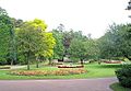 Manor Park's rose garden
 -
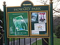 Notice board at the North Road entrance to Howard Park
 -
 Howard Park duck pond, in winter
 -
 Norfolk Square, opposite the Town Hall


Big Society
Sport
Glossop North End were members of the Football League between 1898 and 1915, and around the turn of the 19th to 20th century played in Division One. The team now plays in the North West Counties Football League Premier Division. In the 2008–09 season they reached the final of the FA Vase at Wembley Stadium on 10 May 2009, and to mark this achievement, Arsenal (with whom they retain connections due to Arsenal chairman Peter Hill-Wood's grandfather Sir Samuel Hill-Wood having owned and bankrolled Glossop during their run in the Football League) invited them to their state-of-the-art London Colney training ground during their stay in London, to prepare for the final.[20] Glossop lost 2–0 to Northern League First Division side Whitley Bay.
Performing arts
The Partington Players are an amateur theatre group established in 1954. They have a 120-seat venue in the centre of the town. The group runs six plays each season.
Glossop Operatic and Dramatic Society is an amateur musical/drama society established in 1976.
Glossop & District Choral Society is a community choir founded in 1949 by Margaret Lomas.
Events
- Glossop Carnival and Bank Holiday Markets, held annually
- The Glossop Victorian Weekend, though discontinued in 2009 due to lack of local support. It included many activities, including a Grand Victorian Costume Competition and a Shop Window Competition.
- Glossop Beer Festival
In recent years, Glossop has become quite well known musically for staging jazz and world music festivals.
Clubs
Glossop has a range of other cultural activities including Peak Film Society, an innovative new film club. Many other activities, including the Glossop Folk Club, take place at Glossop Labour Club.
Glossop has a thriving indoor and outdoor market where you can buy a wide selection of goods. The indoor market is open every Thursday, Friday and Saturday, whilst the outdoor market is open every Friday and Saturday. The Outdoor Market is joined by the Local Produce Market on the 2nd Saturday of every month throughout the year. In 2012 as part of the Christmas festivities there will be a Celebration of Christmas commencing on 30 November with the switch on of the towns lights with a small market to be held in the square and local schools will be singing carols. There will be a Christmas Market held on 1 December on the Outdoor market ground and adjacent car park together with non stop entertainment throughout the day.
Glossop in literature and popular culture
Hilaire Belloc wrote about Glossop in a letter to a Miss Hamilton in 1909:
"Do you know the filthy village of Glossop? It is inhabited entirely by savages. I tried every inn in the place and found each inn worse than the last. It stinks for miles. Rather than sleep in such a den I started walking back to Manchester with a huge bag...."[21]
Glossop is mentioned in the satirical book, England, Their England by A. G. Macdonell. The town and its fictional newspaper, the Glossop Evening Mail are described as the lowest rung in the journalistic profession.
The television comedy The League of Gentlemen is filmed in neighbouring Hadfield. Students from Glossopdale Community College have appeared as extras in two shows. In one they were the audience to the Legz Akimbo theatre group in a "right-on" play, and in the second they appeared as German students on an exchange programme with their teacher, Herr Lipp.
Local media
- Glossop Gazette
- Glossop Community Radio which aims to become the towns first ever, dedicated radio station. Glossop Life magazine, and Glossop Advertiser. The Glossop Chronicle published its last edition on Thursday 13 September 2012.
References
- ↑ Wilkinson, P. (November 1998), 'Finding Beowulf in Kent's landscape', British Archaeology, Council for British Archaeology, York, Issue 39 .
- ↑ "The Domesday Book Online – Derbyshire F-R". Domesdaybook.co.uk. http://www.domesdaybook.co.uk/derbyshire2.html.
- ↑ 3.0 3.1 Davies, Peggy (December 1999). Annals of Glossop. Glossop, Derbyshire: Glossop Heritage Centre. pp. 5, 6.
- ↑ 4.0 4.1 4.2 4.3 4.4 4.5 4.6 4.7 4.8 Birch, A.H. (1959). "2". Small Town Politics, A Study of Political Life in Glossop. Oxford University Press. pp. 8–38.
- ↑ Derwent Valley Mills Partnership (2000). Nomination of the Derwent Valley Mills for inscription on the World Heritage List. Derwent Valley Mills Partnership. pp. 28, 94–97
- ↑ Higginbotham, P. (2007), Workhouses of the Midlands, Tempus, Stroud. pp. 31–32. ISBN 978-0-7524-4488-8
- ↑ Royal Commission on the Distribution of the Industrial Population (the Barlow Commission),1943
- ↑ Index of Probate Documents of the Ancient Parish of Glossop by Lee, Clarke & McKenna (Derbyshire FHS, ISBN 0-947964-26-6)
- ↑ 9.0 9.1 9.2 Glossop, Derbyshire:White's History, Gazetteer and Directory of the County of Derby, 1857 (GENUKI)
- ↑ Topographical and Historical Account of Derbyshire (Magna Britannia Vol. 5) Glossop – by Daniel and Samuel Lysons, 1817 (GENUKI)
- ↑ Book of Glossop by Hanmer & Winterbottom (Barracuda Books 1991, ISBN 0-86023-484-3)
- ↑ British Political History, 1867–1990: Democracy and Decline.Malcolm Pearce,
- ↑ Radcliffe, Gemma (2004). "Management Plan for Glossop Brook". University of Manchester, Masters Thesis: 54, 55. http://www.merseybasin.org.uk/projects.asp?docid=107&page=1&pagesize=10&confirmed=1&id=335.. Retrieved 10 July 2008.
- ↑ Pevsner, N.; Williamson, E. 1986, The Buildings of England:Derbyshire, 2nd. ed., Penguin, Middlesex. pp 218–219.
- ↑ Parochial Church Council (N.D.), A Guide To The Parish Church Of All Saints, Glossop., British Publishing Company, Gloucester. pp 5–17.
- ↑ 16.0 16.1 Pevsner, Nikolaus. 1986. The Buildings of England:Derbyshire. pp 319–320. Harmondsworth, Middx. Penguin. ISBN 0-14-071008-6. Page 219.
- ↑ Quayle, Tom (2006). The Cotton Industry in Longdendale and Glossopdale. Stroud,Gloucestershire: Tempus. p. 126. ISBN 0-7524-3883-2.
- ↑ Rivington, F. & J., (1856) The Annual Register or a View of the History and Politics of the year 1855, Longman & Co. London. Page 149.
- ↑ 19.0 19.1 "Howard Park, Glossop". High Peak Borough Council. http://www.highpeak.gov.uk/culture/parks/howard/howard_park.asp. Retrieved 21 February 2011.
- ↑ Ghosts of Arsenal's ruling family escort Glossop to FA Vase final – Conn, David in The Observer, 10 May 2009
- ↑ Speaight, R. 1957. Life of Hilaire Belloc. Farrar, Straus and Company, New York. cited in Smith, J.H. 2008. The WEA in Glossop 1907–2007. A Branch History. Workers' Educational Association, Glossop Branch. Glossop.
Outside links
| ("Wikimedia Commons" has material about Glossop) |