East Burra
| East Burra | |
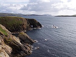
 The south end of East Burra | |
|---|---|
| Location | |
| Location: | 60°5’16"N, 1°18’16"W |
| Grid reference: | HU388339 |
| Area: | 2 square miles |
| Data | |
| Population: | 66 |
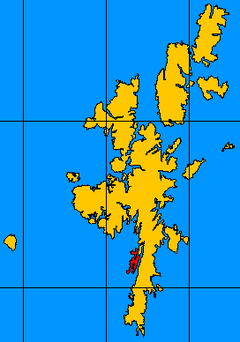
East Burra is one of the Scalloway Islands, a subgroup of Shetland. It is connected by a bridge to West Burra. With an area of two square miles, it is the eleventh largest of the Shetland Islands.
East Burra has a much smaller population than West Burra and no substantial settlement; rather, there are a few hamlets and a scattering of individual croft houses. It is known for its Neolithic remains including a burnt mound, and for sea caves. The roofless, plain, Old Haa (manor or laird's house) of Houss is a prominent feature. From Houss, it is possible to walk the mile or so to the cliffs at the southern end of the island. From there, the island of South Havra, nowadays home only to sheep and seabirds, can be clearly seen.
East Burra is linked to the Mainland by way of West Burra and Trondra by a series of bridges.
References
| The Scalloway Islands |
|---|
|
East Burra • Hildasay • Oxna • Papa • South Havra • Trondra • West Burra • West Head of Papa |
| Islands of Shetland |
|---|
|
Inhabited islands: |
