Mainland, Shetland
| Mainland | |
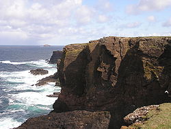
 The cliffs of Eshaness | |
|---|---|
| Main town: | Lerwick |
| Location | |
| Grid reference: | HU414553 |
| Area: | 374 square miles |
| Highest point: | Ronas Hill (1,476 feet) |
| Data | |
| Population: | 17,550 |
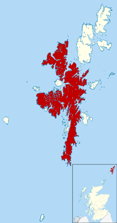
Mainland is the main island of Shetland. It contains Shetland's only burgh, Lerwick, and is the centre of Shetland's ferry and air connections.
Mainland has an area of 374 square miles, making it the largest island of Shetland and the third-largest off-shore island of the British Isles (exceeded only by Lewis with Harris and Skye).
Mainland can be broadly divided into four sections:
- The long southern peninsula, south of Lerwick, which has a mixture of moorland and farmland and contains many important archaeological sites.
- The Central Mainland has more farmland and some woodland plantations.
- The West Mainland
- The North Mainland:
The Northmavine peninsula is the land north of the narrow isthmus at Mavis Grind. It is wild, with much moorland and coastal cliffs. North Mainland contains Sullom Voe, whose oil terminal is an important source of employment for the islanders.
References
| Islands of Shetland |
|---|
|
Inhabited islands: |
