Antrim Hills: Difference between revisions
No edit summary |
|||
| Line 1: | Line 1: | ||
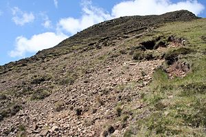
[[File: | [[File:Trig point at summit of Trostan - geograph.org.uk - 642884.jpg|right|thumb|350px|The summit of Trostan, the highest of the Antrim Hills]] | ||
{{county|Antrim}} | {{county|Antrim}} | ||
The '''Antrim Hills''' fill the eastern side of [[County Antrim]] pressing the villages of North-East Antrim against the sea, and extending to the north coast, ending in the cliffs that form the distinctive geography of this coast. | The '''Antrim Hills''' fill the eastern side of [[County Antrim]] pressing the villages of North-East Antrim against the sea, and extending to the north coast, ending in the cliffs that form the distinctive geography of this coast. | ||
Latest revision as of 14:49, 5 November 2017

The Antrim Hills fill the eastern side of County Antrim pressing the villages of North-East Antrim against the sea, and extending to the north coast, ending in the cliffs that form the distinctive geography of this coast.
Cut through these hills are the famed Nine Glens of Antrim, and it is by the name "Glens of Antrim" that the whole range is frequently known.
The hills are a single basalt massif of volcanic origin and some prominent hills are described as volcanic plugs, extinct (notwithstanding certain tales) for millions of years.
These hills reach their highest point on the summit of Trostan, Antrim's county top, at 1,804 feet.


The mountains
Notable hills and mountains in the range are:
| Hill | Height |
|---|---|
| Agnew's Hill | 1,555 feet |
| Big Collin | 1,158 feet |
| Black Hill | 1,250 feet |
| Carnanmore | 1,243 feet |
| Carncormick | 1,430 feet |
| Carnearny | 1,047 feet |
| Collin Top | 1,407 feet |
| Croaghan | 1,368 feet |
| Crockalough | 1,319 feet |
| Crockaneel | 1,322 feet |
| Cross Slieve | 676 feet |
| Douglas Top | 1,319 feet |
| Knocklayd | 1,686 feet |
| Lannimore Hill | 679 feet |
| Long Mountain | 705 feet |
| Mid Hill | 1,444 feet |
| Skerry Hill | 1,506 feet |
| Slemish | 1,437 feet |
| Slieveanorra | 1,667 feet |
| Slievenahanaghan | 1,371 feet |
| Slievenanee | 1,781 feet |
| Soarns Hill | 1,322 feet |
| Tievebulliagh | 1,319 feet |
| Trostan | 1,804 feet |
Geology and habitat
The Antrim Hills are part of a broad band of basalt that stretches across the county. Cut through it by the action of its rivers are the famous Nine Glens of Antrim. The hills are part of a single basalt extrusion formed by ancient volcanic activity, which has been traced over 640 square miles (1,650 km²) and includes the Giant's Causeway (and the cliffs of the Causeway Coast), the Antrim Hills and the Belfast Hills to the south.[1]
There is a sharp difference in the landscape between the high, bleak hills and the fertile glens.
The southern part of the hills, south of Glenariff, is known as the 'Garron Plateau', which has been designated a Special Area of Conservation because it constitutes the largest area of intact upland blanket bog in Ulster and is one of the last untouched wild areas in Northern Ireland. High on this plateau the soil is harsh and the climate cold and wet. There are high, flat areas of peat bog, barely drained and pockmarked with scattered lochans. The Garron Plateau is home to many species of peatland flora and fauna.
The glens are fertile and farmed, and in places there are forestry plantations.
North of Glenariff the land rises steeply to the slopes of Lurigethan, exposing the raw basalt of the hills.[1] In this part are some of the most prominent hills, including Trostan, the county top, Slieveanorra and Knocklayd.
Two areas totalling 66,948 acres in the hills have been designated the 'Antrim Hills Special Protection Area.[2]