Carn a' Chlamain: Difference between revisions
Created page with '{{Infobox hill |name=Carn a' Chlamain |gaelic=Càrn a' Chlamhain |county=Perthshire |range=Grampian Mountains |SMC=6 |picture=Carn_a'_Chlamain.JPG |picture caption=Càrn a' Chlam…' |
No edit summary |
||
| (2 intermediate revisions by 2 users not shown) | |||
| Line 3: | Line 3: | ||
|gaelic=Càrn a' Chlamhain | |gaelic=Càrn a' Chlamhain | ||
|county=Perthshire | |county=Perthshire | ||
|range= | |range=Tarf and Tilt Hills | ||
|SMC=6 | |SMC=6 | ||
|picture=Carn_a'_Chlamain.JPG | |picture=Carn_a'_Chlamain.JPG | ||
|picture caption=Càrn a' Chlamain from Glen Craoinidh | |picture caption=Càrn a' Chlamain from Glen Craoinidh | ||
|height=3,159 feet | |height=3,159 feet | ||
| | |latitude=56.860896 | ||
|longitude=-3.78112 | |||
|os grid ref=NN915758 | |os grid ref=NN915758 | ||
}} | }} | ||
'''Carn a' Chlamain''' is a mountain amongst the [[Grampian Mountains]] in the [[Atholl]] region of [[Perthshire]]. It reaches a height of 3,159 feet at its summit, and so it qualifies as a [[Munro]]. | '''Carn a' Chlamain''' is a mountain amongst the [[Tarf and Tilt Hills]] of the [[Grampian Mountains]] in the [[Atholl]] region of [[Perthshire]]. It reaches a height of 3,159 feet at its summit, and so it qualifies as a [[Munro]]. | ||
The mountain's name is from the Gaelic, in which it is known as ''Càrn a' Chlamhain'', and means means "Hill of the Kite" (or Buzzard). | The mountain's name is from the Gaelic, in which it is known as ''Càrn a' Chlamhain'', and means means "Hill of the Kite" (or Buzzard). | ||
The mountain can be found roughly 8½ miles north of [[Blair Atholl]], in the Forest of Atholl. It is the highest point of an undulating plateau lying | The mountain can be found roughly 8½ miles north of [[Blair Atholl]], in the Forest of Atholl. It is the highest point of an undulating plateau lying north-east of [[Glen Tilt]]. The [[River Tarf]], a tributary of the Tilt, rises on the north-western slopes before curving round the northern side of the plateau, whilst a further Tilt tributary marks the plateau's western boundary. | ||
==Ascents and summit== | ==Ascents and summit== | ||
The summit of Carn a' Chlamain is a prominent boulder covered dome rising up from the surrounding moorland. | The summit of Carn a' Chlamain is a prominent boulder covered dome rising up from the surrounding moorland. | ||
The hill is almost invariably climbed from [[Glen Tilt]]. The most common route starts at Forest Lodge in Glen Tilt, from where a stalker's path climbs the steep side of the glen in a succession of zig-zags before crossing the plateau to the summit. As there is no public vehicular access to Forest Lodge the | The hill is almost invariably climbed from [[Glen Tilt]]. The most common route starts at Forest Lodge in Glen Tilt, from where a stalker's path climbs the steep side of the glen in a succession of zig-zags before crossing the plateau to the summit. As there is no public vehicular access to Forest Lodge the six miles from Old Blair must been undertaken on foot or bicycle. | ||
One alternative route to the summit follows the southeast ridge; this may be joined about | One alternative route to the summit follows the southeast ridge; this may be joined about two miles down the glen from Forest Lodge. | ||
==References== | ==References== | ||
{{Munro books}} | {{Munro books}} | ||
{{DEFAULTSORT:Carn A Chlamain}} | |||
{{Munro}} | {{Munro}} | ||
Latest revision as of 08:20, 22 September 2018
| Carn a' Chlamain | |||
| Perthshire | |||
|---|---|---|---|
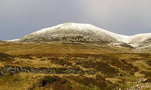
 Càrn a' Chlamain from Glen Craoinidh | |||
| Range: | Tarf and Tilt Hills | ||
| Summit: | 3,159 feet NN915758 56°51’39"N, 3°46’52"W | ||
Carn a' Chlamain is a mountain amongst the Tarf and Tilt Hills of the Grampian Mountains in the Atholl region of Perthshire. It reaches a height of 3,159 feet at its summit, and so it qualifies as a Munro.
The mountain's name is from the Gaelic, in which it is known as Càrn a' Chlamhain, and means means "Hill of the Kite" (or Buzzard).
The mountain can be found roughly 8½ miles north of Blair Atholl, in the Forest of Atholl. It is the highest point of an undulating plateau lying north-east of Glen Tilt. The River Tarf, a tributary of the Tilt, rises on the north-western slopes before curving round the northern side of the plateau, whilst a further Tilt tributary marks the plateau's western boundary.
Ascents and summit
The summit of Carn a' Chlamain is a prominent boulder covered dome rising up from the surrounding moorland.
The hill is almost invariably climbed from Glen Tilt. The most common route starts at Forest Lodge in Glen Tilt, from where a stalker's path climbs the steep side of the glen in a succession of zig-zags before crossing the plateau to the summit. As there is no public vehicular access to Forest Lodge the six miles from Old Blair must been undertaken on foot or bicycle.
One alternative route to the summit follows the southeast ridge; this may be joined about two miles down the glen from Forest Lodge.
References
- The Munros, Scottish Mountaineering Trust, 1986, Donald Bennett (Editor) ISBN 0-907521-13-4
- In the Hills of Breadalbane, V.A. Firsoff, no ISBN
- The Munros, Scotland's Highest Mountains, Cameron McNeish, ISBN 1-84204-082-0
- The Magic Of The Munros, Irvine Butterfield, ISBN 0-7153-2168-4
- Hamish's Mountain Walk, Hamish Brown, ISBN 1-898573-08-5
| Munros in SMC Area SMC Section 6 - Glen Garry to Braemar |
|---|
|
An Sgarsoch • An Socach • Beinn Dearg • Beinn Iutharn Mhòr • Beinn a' Ghlò • Càrn a' Chlamain • Carn a' Gheoidh • Càrn an Fhidhleir • Carn an Righ • Carn Aosda • Càrn Bhac • Beinn a' Ghlò • Beinn a' Ghlò • Glas Tulaichean • The Cairnwell |