Sàil Chaorainn: Difference between revisions
Created page with '{{Infobox hill |name=Sàil Chaorainn |county=Inverness-shire |range=Glen Shiel Hills |SMC=11 |picture=View towards Sàil Chaorainn - geograph.org.uk - 1042114.jpg |picture captio…' |
No edit summary |
||
| (One intermediate revision by one other user not shown) | |||
| Line 7: | Line 7: | ||
|picture caption=View towards Sàil Chaorainn | |picture caption=View towards Sàil Chaorainn | ||
|height=3,287 feet | |height=3,287 feet | ||
| | |latitude=57.191263 | ||
|longitude=-5.091381 | |||
|os grid ref=NH133154 | |os grid ref=NH133154 | ||
}} | }} | ||
| Line 15: | Line 16: | ||
{{commons}} | {{commons}} | ||
{{DEFAULTSORT:Sail Chaorainn}} | |||
{{Munro}} | {{Munro}} | ||
Latest revision as of 18:02, 31 May 2017
| Sàil Chaorainn | |||
| Inverness-shire | |||
|---|---|---|---|
 View towards Sàil Chaorainn | |||
| Range: | Glen Shiel Hills | ||
| Summit: | 3,287 feet NH133154 57°11’29"N, 5°5’29"W | ||
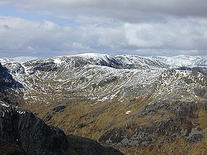
Sàil Chaorainn or Sail Chaoruinn is a mountain in the Glen Shiel Hills, the district packed with high hills where Ross-shire and Inverness-shire meet near the west coast. Sàil Chaorainn itself stands in Inverness-shire and reaches a height of 3,287 feet at its summit, and so it qualifies as a Munro.
Sàil Chaorainn is in the landscape between Loch Cluanie to the south and Loch Affric to the north, on a spur ridge running north from Sgurr nan Conbhairean.
| ("Wikimedia Commons" has material about Sàil Chaorainn) |
| Munros in SMC Area SMC Section 11 - Glen Affric and Kintail |
|---|
|
A' Chràlaig • A' Ghlas-bheinn • An Socach • Aonach Meadhoin • Beinn Fhionnlaidh • Ben Attow • Carn Eige • Carn Ghluasaid • Ciste Dhubh • Mam Sodhail • Mullach Fraoch-choire • Mullach na Dheiragain • Sail Chaorainn • Saileag • Sgùrr a' Bhealaich Dheirg • Sgùrr Fhuaran • Sgùrr na Càrnach • Sgùrr na Ciste Duibhe • Sgùrr nan Ceathramhnan • Sgùrr nan Conbhairean • Toll Creagach • Tom a' Choinich |
