River Lee Navigation

|length_mi=27.5 The Lee Navigation is a canalised river 27½ miles long incorporating the River Lea (also called the River Lee along the sections that are navigable). It was built between 1767 and 1771 to the design of the engineer Edward Rubie.
The canal runs from Hertford Castle Weir to the River Thames at Bow Creek. It has 21 locks, the highest being Hertford Lock and the lowest Bow Locks.
The Lee Navigation is so named by acts of Parliament and is so marked on Ordnance Survey maps. (The spelling ‘Lee’ seems to have been adopted by constructed elements and human features such as the canal system and Lee Valley Park. The spelling ‘Lea’ is more usual for the natural river.)
Location
- Location map: 51°37’33"N, 0°1’57"W
History
The River Lea is a major tributary of the River Thames. It has a long association with navigation, as the marshes of Walthamstow have produced a dugout canoe from the Bronze Age and parts of a Saxon barge. According to the Anglo-Saxon Chronicle, the river was used by Viking raiders, and King Alfred changed the level of the river to strand Guthrum and his fleet.[1] In more peaceful times, it became important for the transport of grain from Hertfordshire, but navigation of its southernmost tidal reaches of Bow Creek were difficult due to its tortuous meanders.
There is documentary evidence that the river was altered by the Abbot of Waltham to improve navigation in 1190, and in 1221, a pipe was laid across the river, which had to be protected from "the oars or poles of the watermen."[2]
Several Acts of Parliament have been passed over the centuries to improve the navigability of the river, to each of which the Victorians retrospectively appended a short title “River Lee Navigation Act’:
- In the reign of King Henry VI:
- The River Lee Navigation Act 1425 (3 Hen. 6. c. 5),:[3] this was the first act granted for navigational improvement in England.
- The River Lee Navigation Act 1430 (9 Hen. 6. c. 9), both authorised local landowners to act as commissioners, who could make improvements to the river including scouring or dredging, and could recoup the cost of the work by levying tolls.[2]
- In the reign of Queen Elizabeth I:
- The River Lee Navigation Act 1571 (13 Eliz. 1. c. 18)
- In the Georgian Age:
- River Lee Navigation Act 1738 (12 Geo. 2. c. 32)
- River Lee Navigation Act 1767 (7 Geo. 3. c. 51)
- River Lee Navigation Act 1779 (19 Geo. 3. c. 58)
- Lee Navigation Improvement Act 1805 (45 Geo. 3. c. lxix)
- Victorian Age:
- Lee Navigation Improvement Act 1850 (13 & 14 Vict. c. cix)
- River Lee Water Act 1855 (18 & 19 Vict. c. cxcvi)
- Lee Conservancy Act 1868 (31 & 32 Vict. c. cliv)
By 1571, the river was an important route for the carriage of grain to London, and it was the Corporation of London which obtained the Act of that year to authorise improvements. This included making new cuts, and creating towpaths on both sides of the river. Shoals were removed, and a cut, probably the section which is now called Bow River from Old Ford Locks to Bow Locks, was excavated, which was not subject to any tolls. The plan for a branch from the river to the north of London was not implemented.[4] One innovation was the construction of a pound lock at Waltham Abbey in Essex, in 1577. This had mitred gates at each end,[5] and was probably the second lock to be built in England, although it was the first to be built on a river. It inspired Vallens to write a poem entitled "A tale of Two Swannes" about it in 1590. It was 70 feet by 24 feet, with wooden sides.[6] The remainder of the control of levels was carried out by "staunches" or "turnpikes", consisting of a single vertically lifting gate in a weir, through which boats were pulled against the current.
The New River was constructed in the Jacobean period in an attempt to supply clean water from near Ware to the citizens of London: it was completed in 1633. However, the springs at Great Amwell soon proved to be inadequate, and water was drawn from the Lea. The increased extraction of water had a detrimental effect on milling and navigation, and by the early 1700s it had become clear that major work would be needed to produce a solution.[7]
Smeaton's design
The River Lee Navigation Act 1738 arose from a petition to Parliament. While recognising the right of the New River Company to extract water, it also enshrined the rights of the millers and bargemen. To resolve a problem where the New River works had blocked the Manifold Ditch, and boats had been forced to use the mill stream to Ware Mill, the mill was bought by the company, and the associated lock became an official right of way. The previous administration by commissioners was replaced by a body of trustees, which it was hoped would be better able to manage the navigation. Although at least two flash locks were built, including one to assist passage past the mill at Broxbourne, there was still friction between the bargemen and the millers, since the use of a flash lock tended to lower the water level above it, to the detriment of the mill. In 1765, the trustees therefore asked John Smeaton to assess the navigation and make recommendations for its improvement.[8]
Smeaton made a survey of the river and produced a report in 1766, in which he recorded that there were 18 staunches at the time, with a lock at Ware and tidal gates at Bow. He recommended that the staunches should be replaced by pound locks, and that several new cuts should be made. These recommendations formed the basis for a parliamentary Bill, which resulted in the 1767 Act.
The act authorised the construction of several new stretches of canal, including the Edmonton Cut from Flanders Weir at Chingford to the mill stream at Walthamstow, the Hackney Cut from Lea Bridge to Old Ford, and the Limehouse Cut to bypass the tight bends of Bow Creek near the River Thames. Yeoman was also responsible for setting out towing paths, designing 35 roving bridges, and construction of lock gates. For the Limehouse Cut, Yeoman proposed a cut from Bow tidal gates to Dingley's Wharf at Limehouse, which would shorten the distance to London considerably, since it would avoid the long passage around the Isle of Dogs. Mr Dingley, owner of the wharf and a trustee, was awarded part of the contract, and the cut was expected to open on 2 July 1770, but some brickwork failed and had to be repaired. A bridge collapsed in December, but traffic soon developed, and the cut had to be widened to allow barges to pass one another along its entire length. The widening was completed on 1 September 1777. The trustees decided to finance the work with a loan, and advertisements appeared in the London Gazette and other newspapers, indicating that they wished to raise £35,000. The response was huge, with £161,500 being offered, and subscribers were chosen by ballot. Yeoman was overworked, and Edward Rubie was appointed to assist him in February 1769. New cuts and pound locks were opened at Waltham Abbey, Edmonton and Hackney in 1769. In total, 11.0 miles (17.7 km) of new cuts were constructed, with 12 new locks. Some on the locks, such as Homerton Lock and Pickett's Lock, were built on new sections, while others, such as Stanstead Lock, replaced an existing flash-lock. The works were completed to a tight schedule, and with most of it finished, Yeoman resigned in July 1771, although the reasons for his resignation were not recorded.[9]
Development
There were further improvements throughout the 19th century. The 1850 Act authorised new lock cuts at Hoddesdon, Carthagena Lock (Broxbourne), Waltham Marsh, Tottenham, Walthamstow, Hackney, Leyton and Bromley-by-Bow and new locks at Hunter's Gate (Bow Bridge) and Old Ford. The River Lee Water Act 1855 authorised a new lock at Amwell Marsh and the removal of Stanstead Lock. Edmonton Lock was to be removed and Pickett's Lock rebuilt.
The Lee Conservancy Act 1868 formed the Lee Conservancy Board to take over control of the river from the former trustees. They established the Lee Conservancy Police, who policed the Lee until merged with the British Transport Police in 1948.[10]
The Lee Navigation bought the Stort Navigation in 1911,[5] and instituted further improvements, including reconstruction of the locks between Enfield and Hertford, the width being increased from 13 feet to 16 feet: by the 1930s, 130-ton barges could reach Enfield, and 100-ton barges to Ware and Hertford.[5]
The navigation was nationalised in 1948, and control passed to the British Transport Commission.
Commercial traffic effectively ended in the 1980s.
During the 1950s horse-drawn lighters were still journeying as far as Hertford. By 1980 commercial traffic extended no higher than the Enfield Rolling Mills at Brimsdown, with just one tug, the Vassal, regularly at work on the river. Powered by a 120 hp Gardner diesel engine, she would typically tow a train of two lighters loaded with timber from Bow to Hahn's Wharf at Edmonton. There are efforts currently underway to revive commercial traffic on the canal with a plan to transport rubbish for incineration at the Edmonton Incinerator.
Recreation
Much of the Lee Navigation is within Lee Valley Park, a multi-county regional park and open space preserve. Local jurisdictions also maintain parks on the canals in Lee Valley Park.
The Lea Valley Walk, a fifty-mile long-distance public walking path and bicycle trail from the headwaters to the Thames confluence, follows the canal towpaths in the Lee Navigation section.
Pictures
| ("Wikimedia Commons" has material about River Lee Navigation) |
-
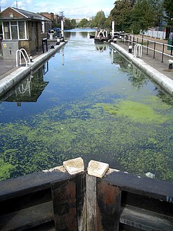 Old Ford Lock, Lee Navigation
 -
 Hertford Basin, the first marina on the Navigation
 -
 Looking west from the North Circular Road at Edmonton
 -
 Carthagena Lock
 -
 Fish and Eels pub at Dobbs Weir
 -
 Workboat Enfield on the river at Tottenham
 -
 Lock-keeper's cottages at Old Ford Lock, used for filming The Big Breakfast
 -
 Ware Welcome Station


Outside links
- Photographs of Edmonton timber wharves (1983)
- Photo of the last horse-drawn barge (1955)
- History of the locks on the Lee & Stort Navigation
- History of the Lee Navigation (1190–1790)
- Love the Lea project
- images & map of mile markers seen along the Lee & Stort Navigations
References
- ↑ Boyes & Russell 1977, p. 13.
- ↑ Jump up to: 2.0 2.1 Boyes & Russell 1977, p. 14
- ↑ Priestley 1831, p. 379
- ↑ Boyes & Russell 1977, p. 16.
- ↑ Jump up to: 5.0 5.1 5.2 Nicholson 2006, p. 100
- ↑ Boyes & Russell 1977, pp. 16–17.
- ↑ Boyes & Russell 1977, p. 17.
- ↑ Boyes & Russell 1977, pp. 18–20.
- ↑ Boyes & Russell 1977, pp. 22–23.
- ↑ Major, Graham (29 July 2013). "Canal Policing after 1948". Website of the British Transport Police History Group. British Transport Police History Group. http://www.btphg.org.uk/?page_id=3620.
- Boyes, John; Russell, Ronald (1977). The Canals of Eastern England. David & Charles. ISBN 978-0-7153-7415-3.
- Cumberlidge, Jane (2009). Inland Waterways of Great Britain (8th Ed.). Imray Laurie Norie and Wilson. ISBN 978-1-84623-010-3.
- Nicholson (2006). Nicholson Guides Vol 1: Grand Union, Oxford & the South East. HarperCollins. ISBN 978-0-00-721109-8.
- Paget-Tomlinson, Edward (1994). The Illustrated History of Canal & River Navigations. Sheffield Academic Press. ISBN 978-1-85075-277-6.
- Priestley, Joseph (1831). Historical Account of the Navigable Rivers, Canals and Railways of Great Britain. Longman, Rees, Orme, Brown & Green. http://www.jim-shead.com/waterways/sdoc.php?wpage=PNRC0381#PNRC381.
- Wisdom, A S (1966). Land Drainage. London: Sweet & Maxwell.