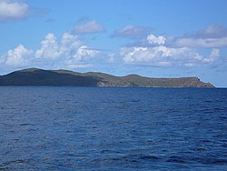
Great Camanoe
| Great Camanoe | |
 Great Caminoe eastern shore | |
|---|---|
| Location | |
| Location: | 18°28’30"N, 64°31’55"W |
| Data | |
Great Camanoe is a small island of the British Virgin Islands, lying just north of Beef Island and northeast of Tortola.
Great Camanoe is primarily a residential island, divided into two communities, Indigo Plantation and The Privateers, on the southern half of the island. Access to the island is by boat only. Visitors often anchor at Lee Bay or Cam Bay, a national park and good snorkeling site.
History and name
A 1793 Spanish map of the Virgin Islands refers to Great Camanoe island as 'Cayman Grande' and Little Camanoe island as 'Caiman Chico'.[1] These names are obvious references to American crocodiles (cayman or caiman) which inhabited the area when the islands were first explored by Christopher Columbus. In Columbus' native Italian, the word cayman is spelled 'caimano'.
References
| The British Virgin Islands |
|---|
|
Anegada • Beef • Bellamy Cay • Buck • Carvel Rock • Cockroach • Cooper • Dead Chest • Diamond Cay • Dog Islands • East Seal Dog • Eustatia • Fallen Jerusalem • Frenchman's Cay • George Dog • Ginger • Great Camanoe • Great Dog • Great Thatch • Great Tobago • Green Cay • Guana • The Indians • Jost Van Dyke • Little Camanoe • Little Jost Van Dyke • Little Thatch • Little Tobago • Marina Cay • Mosquito • Nanny Cay • Necker • Norman • Old Jerusalem • Pelican • Peter • Prickly Pear • Round Rock • Saba Rock • Salt • Sandy Cay • Sandy Spit • Scrub • Tortola • Virgin Gorda • West Dog |