River Tay

The River Tay (Gaelic: Tatha) is a river of the Highlands; the seventh-longest in the United Kingdom at 117 miles from its source to the Firth of Tay, where it opens up into an arm of the North Sea. Despite its great length, the river is contained entirely within Perthshire. Indeed, the extent of Highland Perthshire is closely comparible to the lands drained by the Tay.
The source of the Tay is in the highland region of Perthshire, at the very western edge of the county on the slopes of Ben Lui, then flows easterly across the Highlands, though a series of lochs and down into Strathtay. It is a broad river in Perth, where it becomes tidal, to its mouth at the Firth of Tay, south of Dundee.
The Tay is the largest river in the United Kingdom by volume of discharge, with a mean flow of 37,219 gallons a second.[1] Its drainage basin is approximately 2,000 square miles.
Contents
Course


The Tay drains Perthshire, which takles up much of the lower region of the Highlands.
The river rises on the slopes of Ben Lui, only c. 30 miles from the west coast town of Oban in Argyllshire.[1] It was not until 2011 that a precise source for the river was determined, but in that year the Tay Western Catchments Partnership determined as its source (as based on its 'most dominant and longest' tributary) a small lochan on Allt Coire Laoigh, south of the summit of Ben Lui.[2] It passes through Loch Dochhart then Loch Lubhair and on to Loch Tay.
The river has a variety of names in its upper reaches: for the first few miles below the source the river is known as the River Connonish; then it is called the River Fillan. The name then changes again to the River Dochart until it flows into Loch Tay at Killin. The name "Tay" begins at Loch Tay.
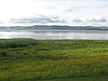
Loch Tay is a ribbon lake in the Perthshire highlands stretching for 14 miles long north-eastwards and a mile to a mile and a half broad; one of the biggest lakes in Britain. The River Tay emerges from the loch at Kenmore, and flows northeast to the village of Strathtay at the head of Strathtay the valley, which is a broader valley where the river is edged by meadow and floodplain; here the Tay turns to flow south-eastwards through Strathtay, no longer in character a Highland river but a river of broad and noble stream.
A little above Dunkeld the Tay is constricted between crags in a picturesque forest, and twists down to Dunkeld to be joined by the River Braan. It divides Dunkeld from Little Dunkeld.
Below Dunkeld, the Tay has left the Highlands. It resumes a south-easterly course, soon passing Birnam Wood, made famous by Shakespeare, then east and then south to Perth.
Perth was, in historical times, the lowest bridging point of the river. Below Perth the river becomes tidal and enters the Firth of Tay. The largest city on the river, Dundee, lies on the north bank of the Firth. On reaching the North Sea, the River Tay with its firth has flowed 120 miles from west to east.
The Tay has several major tributaries, notably the Earn, the Isla, the River Tummel, the Almond and the Lyon.[1]
Floods
A flow of 499,110 gallons a second was recorded on 17 January 1993, when the river rose over 21 feet above its usual level at Perth, and caused extensive flooding in the city. Had it not been for the hydro-electric schemes upstream which impounded runoff, the peak would have been considerably higher.
The highest ever flood at Perth occurred in 1814, when the river rose 23 feet above the usual level, partly caused by a blockage of ice under the Smeaton's Bridge. Other severe flood events occurred in 1210 and 1648 when earlier bridges over the Tay at Perth were destroyed.
The Tay Bridge Disaster
In the 19th century the Tay Rail Bridge was built across the Firth at Dundee as part of the East Coast Main Line, which linked Aberdeen in the north with Edinburgh and, eventually, London to the south.
On the evening of 28 December 1879 a storm was blowing over the bridge. At approximately 7:15 in the evening as a train passed over it, the central navigation spans of the Tay Rail Bridge collapsed and the entire train fell into the Firth, with the loss of 75 passengers and train crew; an incident which shocked the nation. Parliament required answers and a Court of Inquiry was set up, whose report concluded that, "The fall of the bridge was occasioned by the insufficiency of the cross bracing and its fastenings to sustain the force of the gale." They concluded that had the piers and the wind bracing been properly constructed and maintained, the bridge could have withstood the storm that night.
The disaster is one of the most famous bridge failures and to date it is still one of the worst structural engineering failures in the British Isles
The event was commemorated in a poem, The Tay Bridge Disaster by William McGonagall, who has been called the worst poet in history. The disaster has also inspired better literature, in books and on film.
The rail bridge across the Firth was subsequently rebuilt, and in the 1960s a road bridge was built nearby. Neither has yet collapsed.
Places named for the Tay
Several places along the Tay take their names from it, or are believed to have done so:
- Dundee - Dun Tatha, Fort on the Tay
- Broughty - Bruach Tatha, Bank of the Tay
- Taymouth Castle - Near the mouth of Loch Tay
Wildlife and fish

The river is of quite high biodiversity value and is a "Site of Special Scientific Interest" maintaining a flagship population of salmon, Freshwater pearl mussel and native species such as the otter.[1] Freshwater pearl mussels are one of Britain's most endangered species and the River Tay hosts two-thirds of the world's remaining stock.[3]
The Tay is internationally renowned for its Atlantic salmon fishing and is one of the best salmon rivers in the United Kingdom, attracting anglers from all over the world. The largest ever rod caught salmon in Britain which was caught on the Tay by Miss Georgina Ballantine in 1922, weighing 64 lbs, and remains the British Record. The extensive river system has excellent salmon fisheries on many of its tributaries including the Earn, Isla, Ericht, Tummel, Garry, Dochart, Lyon and Eden.[4] Dwindling catches include a 50% reduction in 2009 so the Tay District Salmon Fisheries Board ordered a catch-and-release policy for females all season, and for males until May, beginning with the January 2010 fishing season. Research by the North Atlantic Salmon Conservation Organisation has shown that the number of salmon dying at sea has doubled or trebled over the past 20 years, possibly due to overfishing in the oceans where salmon spend two years before returning to freshwater to spawn. The widespread collapse in Atlantic salmon stocks suggests that this is not solely a local problem for salmon in the River Tay.[5]
The first beaver living wild in Scotland in over 400 years was captured in the River Tay in 2007 because it may have been illegally released or not of the proper genetic stock. However, there is an earlier undocumented sighting of a beaver in the River Earn, a Tay tributary, in May 2001. The Tay watershed beaver may also be escapees from Tayside captive beaver enclosures.[6] The beaver became extinct in Great Britain towards the end of the eighteenth century, the last reference dating to 1789.[7] It is currently estimated that at least 20, and possibly up to 100, beavers live on the Tay River, although these are now targeted for trapping as a pest.[8]
Tay ferries
Until 18 August 1966, a passenger and vehicle ferry service operated across the River Tay between Craigie Pier, Dundee and Newport-on-Tay, Fife. In Dundee, the ferry was popularly known as "the Fifie". The service was discontinued upon the opening of the Tay Road Bridge. Latterly, three vessels operated the service - Paddle Steamer B. L. Nairn and two more modern ferries, Abercraig and Scotscraig.
Pictures
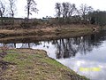
Meeting of the Isla and Tay
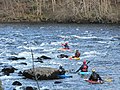
Canoeists on the Tay at Stanley
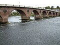
The Tay under Smeaton's Bridge in Perth
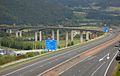
Friarton Bridge, where the M90 motorway crosses the Tay
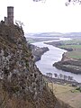
River Tay from Kinnoull Hill in Winter
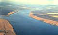
Meeting of Rivers Earn (left) and Tay
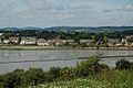
The Tay from Newburgh, Fife
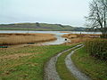
Port Allen, former harbour near Errol
The Tay near Longforgan
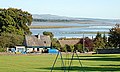
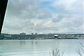
Invergowrie bay
The Tay Rail Bridge
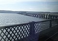
The Tay road bridge looking toward Fife
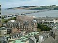
Dundee from Fife
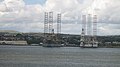
Oil rig maintenance at Stannergate
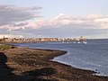
Broughty Ferry from Stannergate
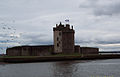
Broughty Castle, Broughty Ferry
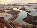
The Tay meandering eastwards, from Kinnoull Hill
_meets_the_River_Tay_-_geograph.org.uk_-_113846.jpg)


Outside links
References
- ↑ 1.0 1.1 1.2 1.3 Template:Cite report
- ↑ BBC News Scotland website, 21 January 2011
- ↑ Template:Cite report
- ↑ "Fish Tay". FishPal. 2011-01-11. http://www.fishpal.com/Scotland/Tay/index.asp?dom=Tay. Retrieved 2011-01-15.
- ↑ Frank Urquhart (2010-01-11). "In Scotland, Anglers Told to Put River Tay Salmon Back". Atlantic Salmon Federation. http://www.asf.ca/news.php?id=491&type=news. Retrieved 2011-01-15.
- ↑ "Wild beaver back in Scotland". http://search.bbc.co.uk/cgi-bin/search/results.pl?tab=av&q=beaver+scotland&scope=all. Retrieved 2007-12-11.
- ↑ Coles, Bryony (2007). Beavers in Britain's Past. Oxford: Oxbow Books. p. 187. ISBN 978-1-84217-2261. http://books.google.com/books?id=hOcHAQAAMAAJ&q=beavers+in+britain's+past&dq=beavers+in+britain's+past&src=bmrr. Retrieved 2011-01-04.
- ↑ Iain Howie (2010-12-03). "Perthshire beavers to be rounded up". Perthshire Advertiser. http://www.perthshireadvertiser.co.uk/perthshire-news/local-news-perthshire/2010/12/03/perthshire-beavers-to-be-rounded-up-73103-27756560/. Retrieved 2010-12-29.