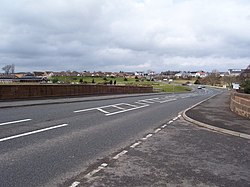
Gretna
| Gretna | |
| Dumfriesshire | |
|---|---|

| |
| Location | |
| Grid reference: | NY320671 |
| Location: | 54°59’38"N, 3°3’43"W |
| Data | |
| Population: | 2,705 (2001) |
| Post town: | Gretna |
| Postcode: | DG16 |
| Dialling code: | 01461 |
| Local Government | |
| Council: | Dumfries and Galloway |
| Parliamentary constituency: |
Dumfriesshire, Clydesdale and Tweeddale |
Gretna is a town in Dumfriesshire, close by the border with Cumberland. Because they are near the border, Gretna and particularly nearby Gretna Green are historically linked to weddings because of the more liberal marriage laws in Scotland. "Gretna" has become a term for a place for quick, easy marriages.[1]
Gretna is on the A74(M) motorway within yards of the border with Cumberland, and near the mouth of the River Esk. The township is distinct from the smaller, next-door village of Gretna Green, famous for runaway marriages. It is roughly equidistant from Eastriggs (Dumfriesshire) to the west and Longtown (Cumberland) to the east, both 5 miles away, and some 13 miles north of Carlisle, the nearest big town.
The name of Gretna is from the Old English language greotna hoh, meaning "grits' hill-spur", or "gravel hill".
History
The Lochmaben Stone is a megalith standing in a field, nearly a mile west of the Sark mouth on the Solway Firth, three hundred yards or so above high water mark on the farm of Old Graitney. It was one of the traditionally recognised meeting places for the Commissioners of the March on the border of England and Scotland.
17th century
Before the Acts of Union 1707, Gretna was a customs post for collecting taxes on cattle crossing the border from England. The Gretna customs post was established in 1612.[2] A drove road was built between Gretna and Annan in 1619, possibly to facilitate the transportation of cattle from Wigtownshire, Kirkcudbrightshire and Dumfriesshire to markets in England.[3]
18th century
Gretna's principal claim to fame arose in 1753 when an Act of Parliament, Lord Hardwicke's Marriage Act, was passed, which provided, among other things, that if both parties to a marriage were not at least 21 years old, consent to the marriage had to be given by the parents. This Act applied only in England and Wales, not in Scotland, whose laws allowed boys to marry at 14 and girls at 12, with or without parental consent. In addition, the Act required procedures that gave notice of an impending marriage to the community. As a result, many elopers fled England, and the first Scottish village they reached was often Gretna. With the construction of a new highway, Gretna Green became easier to reach, and Gretna's appeal as an elopement destination waned.
First World War
HM Factory, Gretna, codenamed Moorside, was a huge cordite munitions factory built nearby on the shore of Solway Firth to supply ammunition to British forces during the First World War. The factory, the biggest munitions factory ever built, stretched for nine miles from Eastriggs along the Solway coast as far as Longtown in Cumberland and two miles across. It took 10,000 navvies to build the factory, and it employed 30,000 workers, mostly women. The workers mixed by hand a devil’s porridge of nitro-glycerine and guncotton into cordite paste, and loaded the extruded cordite strands into shell cases.
Gretna and Eastriggs were built to house the workforce, and many were accommodated nearby in Carlisle. The labourers and workers had such a reputation for drunkenness, which was seen by Government as such a threat to the national interest, that Gretna and the surrounding area became a historical curiosity for a considerable period. Under the Defence of the Realm Act 1914, a State Management Scheme was set up in 1916 to bring the liquor industry, including public houses and the local breweries, under Government control over a wide area stretching as far as Carlisle and Maryport. There were Spiritless Saturdays, and buying anyone else a drink (shouting), and heaters and coolers (drinking beer and spirits in the same pub) were banned. The pub landlords, became civil servants, were instructed to follow a disinterested management policy and not allow people to get drunk in the pubs. The State Management Scheme persisted for many years after the First World War was long over and the munitions factories dismantled. It was not until the early 1970s, when the low prices and unadulterated beer in the Gretna area began to become conspicuous, that the government enterprise was sold off by the government.
References
- Chatsworth, George (1984). A history of British motorways. London: Thomas Telford Limited. ISBN 978-0-7277-0159-6.
- Haldane, A.R.B. (1997). The Drove Roads of Scotland. Edinburgh: Berlinn. ISBN 1-874744-76-9.
- Routledge, Gordon L. (1999).Gretna’s Secret War.
- Ordnance Survey Landranger Map (number 85) - 1:50,000 scale (1.25 inches to 1 mile). ISBN 0-319-22685-9.
- Ordnance Survey Explorer Map (number 323) - 1:25,000 scale (2.5 inches to 1 mile)