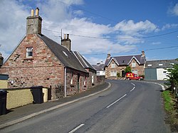
Clintmains
| Clintmains | |
| Berwickshire | |
|---|---|
 Clintmains | |
| Location | |
| Grid reference: | NT612325 |
| Location: | 55°35’7"N, 2°36’58"W |
| Data | |
| Local Government | |
| Council: | Scottish Borders |
| Parliamentary constituency: |
Berwickshire, Roxburgh and Selkirk |
Clintmains is a village by the River Tweed, in the parish of Mertoun in Berwickshire. It is found to the east of Newtown St Boswells.
Places nearby in Berwickshire include Bemersyde House, Dryburgh Abbey, Scott's View and the William Wallace Statue, Bemersyde
The village is on the route of the Borders Abbeys Way.
Outside links
| ("Wikimedia Commons" has material about Clintmains) |
