River Tilt

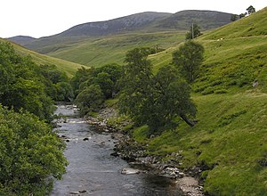
The River Tilt is a mountain river of Perthshire, which runs down from the mountain slopes to join the River Garry at Blair Atholl. On its way, it carves a steep valley; Glen Tilt.
The river rises in numerous burns on the slopes of the mountains known as the Tarf and Tilt Hills, part of the wider extent of the Grampian Mountains.
The Tarf

The main feeder of the River is the Tarf Water, running of the slopes of Beinn Bhreac. The Tarf flows eastward across the higher ground without carving a glen of its own of any note; a broad shallow river.
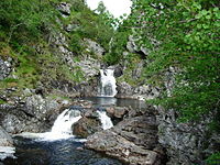
Where the river descends to Glen Tilt it tumbles delightfully down the Falls of Tarf, and the river within the glen, swallowing the Allt Garbh Buidhe and the lesser burns off An Socach, becomes the Tilt.
Glen Tilt
- Main article: Glen Tilt

From the Falls of Tarf, the Tilt runs due south through a delightful precipitous glen, Glen Tilt.
The glen is deep and steep-sided, with little beside it. It takes the river southwest then south from near Gilbert's Bridge.
A well maintained track runs up Glen Tilt, all the way to the Falls of Tarf and a path continues up the glen (by the Allt Garbh Buidhe) to the head of the glen and the watershed, across which lies Aberdeenshire. From here the path leads down to the Linn of Dee on the River Dee above Braemar.
The lower river

The Tilt follows its glen down to near Fenderbridge, where the river receives the River Fender and the land opens out. From here it is about a mile to Blair Atholl, where the Tilt empties into the River Garry. The river drove the famous Blair Atholl Mill in days past.