Halton West: Difference between revisions
Jump to navigation
Jump to search
Created page with "{{Infobox town |name=Halton West |county=Yorkshire |riding=West |picture= |picture caption= |os grid ref=SD844543 |latitude=53.985180 |longitude=-2.239380 |population= |post..." |
No edit summary |
||
| Line 3: | Line 3: | ||
|county=Yorkshire | |county=Yorkshire | ||
|riding=West | |riding=West | ||
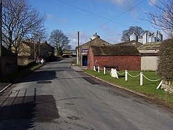
|picture= | |picture=Halton West - geograph.org.uk - 143924.jpg | ||
|picture caption= | |picture caption=Halton West | ||
|os grid ref=SD844543 | |os grid ref=SD844543 | ||
|latitude=53.985180 | |latitude=53.985180 | ||
Latest revision as of 18:34, 23 April 2017
| Halton West | |
| Yorkshire West Riding | |
|---|---|
 Halton West | |
| Location | |
| Grid reference: | SD844543 |
| Location: | 53°59’7"N, 2°14’22"W |
| Data | |
| Post town: | Skipton |
| Postcode: | BD23 |
| Local Government | |
| Council: | Craven |
Halton West is a village beside the River Ribble in the north-west of the West Riding of Yorkshire, in Ribblesdale between the Yorkshire Dales and the Forest of Bowland. At the 2011 Census the population of the wider civil parish was less than 100.
The River Ribble runs by the village, and the Ribble Way long distance footpath passes the west edge of Halton West. Barnoldswick is seven miles to the south and Settle six miles to the north.
Outside links
| ("Wikimedia Commons" has material about Halton West) |
