Aran Fawddwy: Difference between revisions
No edit summary |
|||
| Line 7: | Line 7: | ||
|height=2,969 feet | |height=2,969 feet | ||
|os grid ref=SH862223 | |os grid ref=SH862223 | ||
|latitude=52.786239 | |||
|longitude=-3.688848 | |||
}} | }} | ||
'''Aran Fawddwy''' is a mountain in [[Merionethshire]] which, standing at 2,969 feet, is Merionethshire's [[county top]]. Its eastern slope is marked with a high cliff; part of a chain of crags stretching north to south for several miles either side of Aran Fawddwy. | '''Aran Fawddwy''' is a mountain in [[Merionethshire]] which, standing at 2,969 feet, is Merionethshire's [[county top]]. Its eastern slope is marked with a high cliff; part of a chain of crags stretching north to south for several miles either side of Aran Fawddwy. | ||
| Line 12: | Line 14: | ||
Aran Fawddwy, is only 30 feet short of 3,000 feet. It is the highest peak in the Aran mountain range and indeed the highest mountain in [[Great Britain]] south of [[Snowdon]]. The other two prominent summits in the Aran range are [[Glasgwm]] and [[Esgeiriau Gwynion]].<ref>Nuttall, John & Anne (1999). The Mountains of England & Wales - Volume 1: Wales (2nd edition ed.). Milnthorpe: Cicerone. ISBN 1-85284-304-7.</ref> | Aran Fawddwy, is only 30 feet short of 3,000 feet. It is the highest peak in the Aran mountain range and indeed the highest mountain in [[Great Britain]] south of [[Snowdon]]. The other two prominent summits in the Aran range are [[Glasgwm]] and [[Esgeiriau Gwynion]].<ref>Nuttall, John & Anne (1999). The Mountains of England & Wales - Volume 1: Wales (2nd edition ed.). Milnthorpe: Cicerone. ISBN 1-85284-304-7.</ref> | ||
A predominant | A predominant south-west to north-east ridge stretches between [[Dolgellau]] and [[Bala]], a ridge that continues westwards as [[Cadair Idris]], and of this, Aran Fawddwy is the principal summit. | ||
==Nearby peaks and villages== | ==Nearby peaks and villages== | ||
The mountain's sister peak is [[Aran Benllyn]] at 2,904 feet.<ref>{{cite web|url=http://www.mountaindays.net/mountains/peak.php?defn=0&area=5&peak=2084 |title=Mountaineering & Rock Climbing in the UK: Aran Benllyn |accessdate=2008-04-08 |last=Crocker |first=Chris |coauthors=Graham Jackson |work=Database of British Hills |publisher=Mountain Days.net }}</ref> | The mountain's sister peak is [[Aran Benllyn]] at 2,904 feet.<ref>{{cite web|url=http://www.mountaindays.net/mountains/peak.php?defn=0&area=5&peak=2084 |title=Mountaineering & Rock Climbing in the UK: Aran Benllyn |accessdate=2008-04-08 |last=Crocker |first=Chris |coauthors=Graham Jackson |work=Database of British Hills |publisher=Mountain Days.net }}</ref> | ||
The name ''Aran Fawddwy'' means "Mawddwy Peak", a name shared with the nearest large villages; [[Dinas Mawddwy]] to the south and [[Llanymawddwy]] to the | The name ''Aran Fawddwy'' means "Mawddwy Peak", a name shared with the nearest large villages; [[Dinas Mawddwy]] to the south and [[Llanymawddwy]] to the south-east, both on the course of the [[River Dovey]]. The nearest sizeable villages otherwise are [[Llanuwchllyn]] on the shores of [[Bala Lake]] to the north, and [[Rhydymain]] to the west. | ||
==Source of the Dovey== | ==Source of the Dovey== | ||
Latest revision as of 17:02, 9 March 2018
| Aran Fawddwy | |||
| Merionethshire | |||
|---|---|---|---|
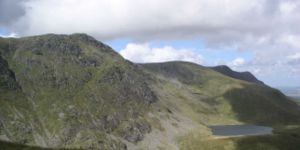
 Aran Fawddwy (on left) and Creiglyn Dyfi | |||
| Range: | Aran Hills | ||
| Summit: | 2,969 feet SH862223 52°47’10"N, 3°41’20"W | ||
Aran Fawddwy is a mountain in Merionethshire which, standing at 2,969 feet, is Merionethshire's county top. Its eastern slope is marked with a high cliff; part of a chain of crags stretching north to south for several miles either side of Aran Fawddwy.
Aran Fawddwy, is only 30 feet short of 3,000 feet. It is the highest peak in the Aran mountain range and indeed the highest mountain in Great Britain south of Snowdon. The other two prominent summits in the Aran range are Glasgwm and Esgeiriau Gwynion.[1]
A predominant south-west to north-east ridge stretches between Dolgellau and Bala, a ridge that continues westwards as Cadair Idris, and of this, Aran Fawddwy is the principal summit.
Nearby peaks and villages
The mountain's sister peak is Aran Benllyn at 2,904 feet.[2]
The name Aran Fawddwy means "Mawddwy Peak", a name shared with the nearest large villages; Dinas Mawddwy to the south and Llanymawddwy to the south-east, both on the course of the River Dovey. The nearest sizeable villages otherwise are Llanuwchllyn on the shores of Bala Lake to the north, and Rhydymain to the west.
Source of the Dovey

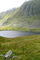
On the eastern slopes of Aran Fawddwy, beneath the crag, is the small lake named Creiglyn Dyfi, which is the source of the River Dovey. The Dovey, from these slopes, runs east as the Llaethnant over waterfalls until it creates a broader river valley at Pennant and heads south as the Dovey.
Ascent
Aran Fawddwy is best ascended from Cywarch in the south.[3] Although a longer ridge climb is possible from the Bala side.
References

- ↑ Nuttall, John & Anne (1999). The Mountains of England & Wales - Volume 1: Wales (2nd edition ed.). Milnthorpe: Cicerone. ISBN 1-85284-304-7.
- ↑ Crocker, Chris; Graham Jackson. "Mountaineering & Rock Climbing in the UK: Aran Benllyn". Database of British Hills. Mountain Days.net. http://www.mountaindays.net/mountains/peak.php?defn=0&area=5&peak=2084. Retrieved 2008-04-08.
- ↑ Walk 1190 - Aran Fawddwy from Cwm Cywarch – ‘’Walking Britain’’
Outside links
| ("Wikimedia Commons" has material about Aran Fawddwy) |
- Computer-generated summit panoramas:
- ’’Geograph.co.uk’’ photos of Aran Fawddwy and surrounding area
