Carn Eige: Difference between revisions
Created page with '{{Infobox hill |name=Càrn Eige |county 1=Ross-shire |county 2=Inverness-shire |picture=Steep Slopes - geograph.org.uk - 883165.jpg |picture caption=Càrn Eige and Mam Sodhail |h…' |
No edit summary |
||
| (3 intermediate revisions by one other user not shown) | |||
| Line 3: | Line 3: | ||
|county 1=Ross-shire | |county 1=Ross-shire | ||
|county 2=Inverness-shire | |county 2=Inverness-shire | ||
|SMC=11 | |||
|picture=Steep Slopes - geograph.org.uk - 883165.jpg | |picture=Steep Slopes - geograph.org.uk - 883165.jpg | ||
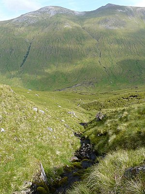
|picture caption=Càrn Eige and Mam Sodhail | |picture caption=Càrn Eige and Mam Sodhail | ||
|height=3,881 feet | |height=3,881 feet | ||
|os grid ref=NH123262 | |os grid ref=NH123262 | ||
|latitude=57.2877 | |||
|longitude=-5.1161 | |||
}} | }} | ||
'''Càrn Eige''', sometimes spelt '''Càrn Eighe''', is the highest mountain north of the [[Great Glen]]. It stands in the midst of the mountains of the northern Highlands, on the | '''Càrn Eige''', sometimes spelt '''Càrn Eighe''', is the highest mountain north of the [[Great Glen]]. It stands in the midst of the mountains of the northern Highlands, on the border between [[Inverness-shire]] and [[Ross-shire]], its summit being the [[county top]], the highest point, of Ross-shire. Its other shire, Inverness-shire, encompasses mighty [[Ben Nevis]], 34 miles due south, which overtops Carn Eige by 528 feet. | ||
Càrn Eige is on the former lands of the Clan Chisholm. Its name is Gaelic, meaning "File hill" or "Notch hill". | Càrn Eige is on the former lands of the Clan Chisholm. Its name is Gaelic, meaning "File hill" or "Notch hill". | ||
The mountain is very remote, more than | The mountain is very remote, more than six miles from the nearest major road, although there is a youth hostel in [[Glen Affric]] that is nearer. | ||
Càrn Eighe is reckoned the 13th mountain in the [[British Isles]] though in terms of relative height, it would be the tallest after [[Ben Nevis]]. | Càrn Eighe is reckoned the 13th mountain in the [[British Isles]] though in terms of relative height, it would be the tallest after [[Ben Nevis]]. | ||
| Line 18: | Line 21: | ||
==Carn Eige and Mam Sodhail== | ==Carn Eige and Mam Sodhail== | ||
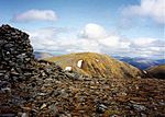
[[File:Carn_Eighe_from_Mam_Sodhail.jpg|left|thumb|150px|Càrn Eige seen from Mam Sodhail]] | [[File:Carn_Eighe_from_Mam_Sodhail.jpg|left|thumb|150px|Càrn Eige seen from Mam Sodhail]] | ||
The neighbouring top is [[Mam Sodhail]], which rises to 3,874 feet a little over half a mile to the south and the two are regarded as twin mountains; they are roughly identical in height and appearance. Carn Eige and Mam Sodhail stand together above Gleann nam Fiadh (Glen of the Deer) and are linked by a high col of around 3,428 feet, making the traverse of the two mountains a natural | The neighbouring top is [[Mam Sodhail]], which rises to 3,874 feet a little over half a mile to the south and the two are regarded as twin mountains; they are roughly identical in height and appearance. Carn Eige and Mam Sodhail stand together above Gleann nam Fiadh (Glen of the Deer) and are linked by a high col of around 3,428 feet, making the traverse of the two mountains a natural day's walk. | ||
{{clear}} | {{clear}} | ||
| Line 25: | Line 28: | ||
==Outside links== | ==Outside links== | ||
{{commons | {{commons}} | ||
*Computer-generated virtual panoramas [http://www.viewfinderpanoramas.org/panoramas/HLD/eige.gif Càrn Eige] [http://www.viewfinderpanoramas.org/panoramas.html Index] | *Computer-generated virtual panoramas [http://www.viewfinderpanoramas.org/panoramas/HLD/eige.gif Càrn Eige] [http://www.viewfinderpanoramas.org/panoramas.html Index] | ||
*Càrn Eighe on [http://www.scottishsport.co.uk/walking/affric.htm Scottish Sport] | *Càrn Eighe on [http://www.scottishsport.co.uk/walking/affric.htm Scottish Sport] | ||
| Line 31: | Line 34: | ||
{{DEFAULTSORT:Carn Eige}} | {{DEFAULTSORT:Carn Eige}} | ||
[[Category:County tops]] | [[Category:County tops]] | ||
{{Munro}} | |||
Latest revision as of 18:57, 10 March 2018
| Càrn Eige | |
| Ross-shire, Inverness-shire | |
|---|---|
 Càrn Eige and Mam Sodhail | |
| Summit: | 3,881 feet NH123262 57°17’16"N, 5°6’58"W |
Càrn Eige, sometimes spelt Càrn Eighe, is the highest mountain north of the Great Glen. It stands in the midst of the mountains of the northern Highlands, on the border between Inverness-shire and Ross-shire, its summit being the county top, the highest point, of Ross-shire. Its other shire, Inverness-shire, encompasses mighty Ben Nevis, 34 miles due south, which overtops Carn Eige by 528 feet.
Càrn Eige is on the former lands of the Clan Chisholm. Its name is Gaelic, meaning "File hill" or "Notch hill".
The mountain is very remote, more than six miles from the nearest major road, although there is a youth hostel in Glen Affric that is nearer.
Càrn Eighe is reckoned the 13th mountain in the British Isles though in terms of relative height, it would be the tallest after Ben Nevis.
Carn Eige and Mam Sodhail

The neighbouring top is Mam Sodhail, which rises to 3,874 feet a little over half a mile to the south and the two are regarded as twin mountains; they are roughly identical in height and appearance. Carn Eige and Mam Sodhail stand together above Gleann nam Fiadh (Glen of the Deer) and are linked by a high col of around 3,428 feet, making the traverse of the two mountains a natural day's walk.

Outside links
| ("Wikimedia Commons" has material about Carn Eige) |
- Computer-generated virtual panoramas Càrn Eige Index
- Càrn Eighe on Scottish Sport
- Càrn Eighe on Munro Magic
| Munros in SMC Area SMC Section 11 - Glen Affric and Kintail |
|---|
|
A' Chràlaig • A' Ghlas-bheinn • An Socach • Aonach Meadhoin • Beinn Fhionnlaidh • Ben Attow • Carn Eige • Carn Ghluasaid • Ciste Dhubh • Mam Sodhail • Mullach Fraoch-choire • Mullach na Dheiragain • Sail Chaorainn • Saileag • Sgùrr a' Bhealaich Dheirg • Sgùrr Fhuaran • Sgùrr na Càrnach • Sgùrr na Ciste Duibhe • Sgùrr nan Ceathramhnan • Sgùrr nan Conbhairean • Toll Creagach • Tom a' Choinich |
