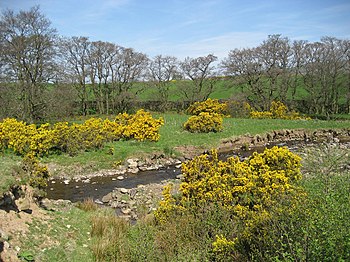
Crowdundle Beck: Difference between revisions
Created page with "right|thumb|350px|The Crowdundle Beck crossed by a footpath, beneath the fells {{county|Cumberland}} The '''Crowdundle..." |
No edit summary |
||
| Line 1: | Line 1: | ||
[[File:Crowdundle Beck - geograph.org.uk - 417492.jpg|right|thumb|350px|The Crowdundle Beck crossed by a footpath, beneath the fells]] | [[File:Crowdundle Beck - geograph.org.uk - 417492.jpg|right|thumb|350px|The Crowdundle Beck crossed by a footpath, beneath the fells]] | ||
{{county|Cumberland}} | {{county|Cumberland}} | ||
The '''Crowdundle Beck''' is a small river, a tributary of the [[River Eden, Cumberland and Westmorland]] which forms the border between [[Cumberland]] to the north and [[Westmorland]] to the south for its whole length, all the way from the ridge of the [[Pennines|Pennine]] watershed down to the River Eden. | The '''Crowdundle Beck''' is a small river, a tributary of the [[River Eden, Cumberland and Westmorland|River Eden]] which forms the border between [[Cumberland]] to the north and [[Westmorland]] to the south for its whole length, all the way from the ridge of the [[Pennines|Pennine]] watershed down to the River Eden. | ||
The beck rises at the watershed, on the ridge between [[Cross Fell]] and [[Little Dun Fell]], and just a few yards from Tees Head; the source of the [[River Tees]]. The ridge is within Cumberland and Westmorland and the [[Pennine Way]] runs along it. Westward, the Tees marks the border for the next few miles eastward before it becomes the border of [[County Durham]] with [[Yorkshire]]. | The beck rises at the watershed, on the ridge between [[Cross Fell]] and [[Little Dun Fell]], and just a few yards from Tees Head; the source of the [[River Tees]]. The ridge is within Cumberland and Westmorland and the [[Pennine Way]] runs along it. Westward, the Tees marks the border for the next few miles eastward before it becomes the border of [[County Durham]] with [[Yorkshire]]. | ||
Latest revision as of 21:46, 27 June 2017

The Crowdundle Beck is a small river, a tributary of the River Eden which forms the border between Cumberland to the north and Westmorland to the south for its whole length, all the way from the ridge of the Pennine watershed down to the River Eden.
The beck rises at the watershed, on the ridge between Cross Fell and Little Dun Fell, and just a few yards from Tees Head; the source of the River Tees. The ridge is within Cumberland and Westmorland and the Pennine Way runs along it. Westward, the Tees marks the border for the next few miles eastward before it becomes the border of County Durham with Yorkshire.
Following downstream, the Crowdundle Beck gathers the waters of other Pennine streams passing no villages nor hamlets until it comes to Acorn Bank a National Trust garden, and its broken down watermill, north of Temple Sowerby. Just a mile downstream, the beck enters the River Eden, and relinquishes to that river for a while its boundary-marking duties.