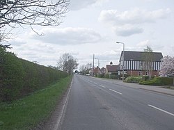
Westwoodside
From Wikishire
Revision as of 07:15, 5 July 2016 by Owain (Talk | contribs) (Created page with "{{Infobox town |county=Lincolnshire |picture=Westwoodside village - geograph.org.uk - 1239256.jpg |picture caption=Westwoodside village |latitude=53.488255 |longitude=-0.86839...")
| Westwoodside | |
| Lincolnshire | |
|---|---|
 Westwoodside village | |
| Location | |
| Grid reference: | SK751996 |
| Location: | 53°29’18"N, 0°52’6"W |
| Data | |
| Post town: | Doncaster |
| Postcode: | DN9 |
| Local Government | |
| Council: | North Lincolnshire |
| Parliamentary constituency: |
Gainsborough |
Westwoodside is a small village within the Isle of Axholme in Lincolnshire, situated seven miles north-west from Gainsborough. Westwoodside is in the civil parish of Haxey (where the population is included), a village a mile to the east.
The village has a primary school.
Along with the rest of the parish, the community is involved in an annual game over seven hundred years old called Haxey Hood.
References
Outside links
| ("Wikimedia Commons" has material about Westwoodside) |
| Isle of Axholme |
|---|
|
Althorpe • Amcotts • Beltoft • Crowle • Ealand • Eastoft • Epworth • Garthorpe • Haxey • Keadby • Luddington • Owston Ferry • Sandtoft • West Butterwick • Westwoodside • Wroot |