Difference between revisions of "Trostan"
(Created page with '{{Infobox hill |name=Trostan |county=County Antrim |picture=From Trostan Hill - geograph.org.uk - 805101.jpg |picture caption =View from Trostan toward the Baing Burn |height=1,…') |
(Picture - wrong Trostan) |
||
| Line 2: | Line 2: | ||
|name=Trostan | |name=Trostan | ||
|county=County Antrim | |county=County Antrim | ||
| − | |picture= | + | |picture=Trig point at summit of Trostan - geograph.org.uk - 642884.jpg |
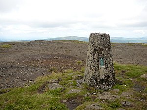
| − | |picture caption = | + | |picture caption=The summit of Trostan |
|height=1,808 feet | |height=1,808 feet | ||
| − | |range =Antrim Hills | + | |range=Antrim Hills |
|os grid ref= D17952360 | |os grid ref= D17952360 | ||
|latitude=55.0457 | |latitude=55.0457 | ||
|longitude=-6.155 | |longitude=-6.155 | ||
}} | }} | ||
| − | '''Trostan''' is a mountain in [[County Antrim]], amongst the Antrim Hills. It rises to 1,808 feet and is the highest point in the county. | + | '''Trostan''' is a mountain in [[County Antrim]], amongst the [[Antrim Hills]]. It rises to 1,808 feet and is the highest point in the county. |
Westward is the Slieveanorra Forest ([[Slieveanorra]] itself is to the north-west) and to the southeast is the Glenariff Forest Park. | Westward is the Slieveanorra Forest ([[Slieveanorra]] itself is to the north-west) and to the southeast is the Glenariff Forest Park. | ||
Revision as of 23:21, 3 November 2017
| Trostan | |||
| County Antrim | |||
|---|---|---|---|
 The summit of Trostan | |||
| Range: | Antrim Hills | ||
| Summit: | 1,808 feet D17952360 55°2’45"N, 6°9’18"W | ||
Trostan is a mountain in County Antrim, amongst the Antrim Hills. It rises to 1,808 feet and is the highest point in the county.
Westward is the Slieveanorra Forest (Slieveanorra itself is to the north-west) and to the southeast is the Glenariff Forest Park.
On the slopes of Trostan rise the burns which run down into several of the Glens of Antrim: flowing north is the burn of the Glenaan River, which waters Glenaan and with others becomes the Dall reaching the sea at Cushendall, in the east the Glendun River rises, before skirting the forest and creating Glendun, to the sea at Cushendun. Several burns run of the eastern slopes of Trostan to create the Ballyemon River and Glenballyemon. The Castlegreen Burn in the south makes for Glenariff.
With Slievanee a mile to the south, Trostan forms the watershed between the east coast of the county, with the rivers of the glens, the north coast (the Bush River) and Lough Neagh.