Barwick, Hertfordshire
| Barwick | |
| Hertfordshire | |
|---|---|
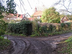
 Houses at Hanging Wood, Barwick | |
| Location | |
| Grid reference: | TL380194 |
| Location: | 51°51’23"N, -0°0’9"E |
| Data | |
| Postcode: | SG11 |
| Local Government | |
Barwick is a hamlet on the River Rib, east of the A10 north of Ware. It lies close to the Greenwich Meridian.

This Hertfordshire article is a stub: help to improve Wikishire by building it up.