Brind
| Brind | |
| Yorkshire East Riding | |
|---|---|
 Brind Chapel | |
| Location | |
| Grid reference: | SE743309 |
| Location: | 53°46’11"N, -0°52’27"W |
| Data | |
| Post town: | Goole |
| Postcode: | DN14 |
| Dialling code: | 01430 |
| Local Government | |
| Council: | East Riding of Yorkshire |
| Parliamentary constituency: |
Haltemprice and Howden |
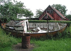
Brind is a tiny hamlet in the East Riding of Yorkshire, two miles of Wressle. It is foud abour two miles north of its nearest market town, Howden, and to the west of the B1228 road. The single-track tarmac road (Brind Lane) runs through the entire hamlet, and joins the Wressle road to the north.
| ("Wikimedia Commons" has material about Brind) |
References
- Gazetteer — A–Z of Towns Villages and Hamlets. East Riding of Yorkshire Council. 2006. p. 4.

This Yorkshire article is a stub: help to improve Wikishire by building it up.
