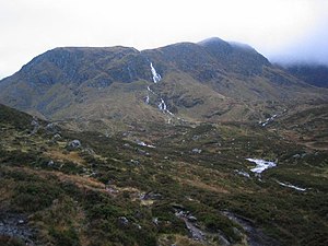
Cairn of Claise
| Cairn of Claise | |||
| Aberdeenshire, Angus | |||
|---|---|---|---|
 Lower Slopes of Cairn of Claise | |||
| Range: | Lochnagar | ||
| Summit: | 3,491 feet NO185788 | ||
Cairn of Claise is a mountainon the border of Aberdeenshire with Angus, which reaches a height of 3,491 feet at its summit, and so it qualifies as a Munro. Its name means "Hill of the Hollow".
The mountain stands on the southwest corner of a large flat summit plateau taking in 4 Munros. The hill overlooks Glen Cluanie to the west. The summit only rises slightly from the main plateau.
The mountain's best feature lies to the west where Garbh Choire bites into the western face. The corrie provides steep stony slopes in abundance. Further corries exist both north and south of the summit at the edge of the plateau. A broad northwest ridge leads round the rim of Coire loch Kander to Carn an Tuirc. Further east on the plateau sit Tom Buidhe and Tolmount, and these four Munros are normally climbed in one outing.
There is parking available just north of the Glenshee Ski Centre on the A83. From here easy paths lead up the western face of Carn an Tuirc and on to the rest of the Munros on the plateau.
| Munros in SMC Area SMC Section 7 - Glenshee to Mount Keen |
|---|
|
Broad Cairn • Cairn Bannoch • Cairn of Claise • Càrn a' Choire Bhoidheach • Càrn an t-Sagairt Mor • Càrn an Tuirc • Creag Leacach • Driesh • Glas Maol • Lochnagar • Mayar • Mount Keen • Tolmount • Tom Buidhe |