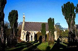
Mickley, Yorkshire
| Mickley | |
| Yorkshire West Riding | |
|---|---|
 St John's, Mickley | |
| Location | |
| Grid reference: | SE265768 |
| Location: | 54°11’17"N, 1°36’47"W |
| Data | |
| Postcode: | HG4 |
| Local Government | |
| Council: | Harrogate |
Mickley is a small village on the south bank of the River Ure in the West Riding of Yorkshire: the river here, unbridged at Mickley, forms the boundary with the North Riding of Yorkshire. The village is in Wensleydale, the Ure's own dale, just as it begins to become gentler below the Pennine moorland.
To the west, a lane runs up to Grewelthorpe, a village barely larger on the slope of the dale, and lanes run eastward to the A6018 and North Stainley. To the northeast is West Tanfield, on the north bank of the river and thus in the North Riding.
The Ripon Rowel Walk, a long path making a ring through this part of the riding, runs through Mickley on it way down Wensleydale to Ripon, where it starts and finishes.
Churches
A Wesleyan chapel was built in the village in 1815, followed in 1841, by the Church of St John the Evangelist, an Anglican church. The Methodist chapel is now a private residence, and is a Grade II listed building.[1] St John's remains the parish church.
The Church of St John is built in the Early English style.[2] and is a Grade II listed building [3]
History
Mickley is not mentioned in the Domesday Book, though neighbouring Azerley is. Its name is recorded as far back as the 12th century as Michelhach, a combination of Michel and Haga, meaning Great Enclosure.[4][5]
The village was historically in the township of Azerley in the ecclesiastical parish of Kirkby Malzeard, in the wapentake of Claro, in the West Riding.
A large mill was in the village with its own mill-race. The mill processed linen and flax, and was operating by 1841, when a court case arose between the mill-owner and a seller of flax in London, who shipped the flax to Ripon by boat, and thence taken to Boroughbridge by cart. Unfortunately the flax-owner went bankrupt, and the flax was seized before it could be delivered.[6][7][8]
About the village
The village is on the Ripon Rowel long-distance path, which forms a circular fifty-mile walk which starts and ends in Ripon. The section through Mickley follows the River Ure through Mickley Barras Wood, which is to the west of the village.[9]
The wood is designated as a site of important nature conservation (a wet wood). [10]
References
- ↑ National Heritage List 1173078: Methodist chapel (Grade II listing)
- ↑ "Mickley: St John the Evangelist". https://www.achurchnearyou.com/church/3261/.
- ↑ National Heritage List 1173065: Church of St John (Grade II listing)
- ↑ Mickley, Yorkshire in the Domesday Book
- ↑ "Mickley :: Survey of English Place-Names". http://epns.nottingham.ac.uk/browse/West+Riding+of+Yorkshire/Kirkby+Malzeard/532881f8b47fc40c81003cd3-Mickley.
- ↑ "Mickley West Riding". https://www.visionofbritain.org.uk/place/24847.
- ↑ "Grewelthorpe History - Mickley Mill. | Grewelthorpe". https://www.grewelthorpe.org.uk/history/mickley-mill.
- ↑ "Court Of Common Pleas, Thursday, Nov. 17". The Times (Column C) (18144). 18 November 1842. SSN 0140-0460.
- ↑ "Long Distance Walkers Association". https://www.ldwa.org.uk/ldp/members/show_path.php?path_name=Ripon+Rowel.
- ↑ "Ure Corridor (Hackfall to Mickley Reach)". February 2004. https://www.harrogate.gov.uk/downloads/file/1568/42-ure-corridor-hackfall-to-mickley-reach.