River Gavenny: Difference between revisions
Created page with "right|thumb|The confluence of the Gavenny and Usk The '''River Gavenny''' is a short river in Monmouthshire. It rises ..." |
No edit summary |
||
| Line 1: | Line 1: | ||
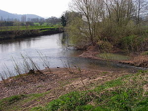
[[File:Abergavenny - geograph.org.uk - 384693.jpg|right|thumb|The confluence of the Gavenny and Usk]] | [[File:Abergavenny - geograph.org.uk - 384693.jpg|right|thumb|The confluence of the Gavenny and Usk]] | ||
The '''River Gavenny''' is a short river in [[Monmouthshire]]. It rises one mile south-west of the village of [[Llanvihangel Crucorney]] from springs in Blaengavenny Wood and flows south for about | The '''River Gavenny''' is a short river in [[Monmouthshire]]. It rises one mile south-west of the village of [[Llanvihangel Crucorney]] from springs in Blaengavenny Wood and flows south for about four miles to its confluence with the [[River Usk]] at [[Abergavenny]].<ref>Ordnance Survey Explorer map OL13 'Brecon Beacons National Park: eastern area'</ref> | ||
Abergavenny derives its name from the confluence, 'aber' meaning 'mouth of' in the Welsh language. | Abergavenny derives its name from the confluence, 'aber' meaning 'mouth of' in the Welsh language. | ||
| Line 9: | Line 9: | ||
{{Reflist}} | {{Reflist}} | ||
== | == Outside links == | ||
*[http://www.geograph.org.uk/search.php?i=7548259 Photos of the River Gavenny and surrounding geography on geograph.org.uk] | *[http://www.geograph.org.uk/search.php?i=7548259 Photos of the River Gavenny and surrounding geography on geograph.org.uk] | ||
Revision as of 17:54, 20 August 2014

The River Gavenny is a short river in Monmouthshire. It rises one mile south-west of the village of Llanvihangel Crucorney from springs in Blaengavenny Wood and flows south for about four miles to its confluence with the River Usk at Abergavenny.[1]
Abergavenny derives its name from the confluence, 'aber' meaning 'mouth of' in the Welsh language.
The diminutive Gavenny is now something of a misfit stream in its broad valley. This is due to the deposition of a spectacular terminal moraine at Llanvihangel Crucorney which has diverted the former headwaters of the river eastwards into the Wye catchment. It is believed that the River Honddu which rises in the Black Mountains and possibly also the upper River Monnow formerly flowed down the valley of the Gavenny to join the Usk.[2]
References
Outside links
Coordinates: 51°50′07″N 3°00′12″W / 51.83528°N 3.00333°W