Tring Salient: Difference between revisions
No edit summary |
mNo edit summary |
||
| (One intermediate revision by the same user not shown) | |||
| Line 3: | Line 3: | ||
|<slippymap lat="51.807" lon="-0.65" z="4" w="400" h="400" layer="colour"/> | |<slippymap lat="51.807" lon="-0.65" z="4" w="400" h="400" layer="colour"/> | ||
|} | |} | ||
The '''Tring Salient''' is that a tongue of [[Hertfordshire]] which projects north-westwards deep into the [[Chilterns]], with [[Buckinghamshire]] either side. It is about 10 miles long and just over a mile wide at its narrowest. The name 'Tring Salient' is an informal name, describing the way this Hertfordshire territory sticks out into what would otherwise be Buckinghamshire. It is named from the town in the midst of the salient, [[Tring]]. Its other town, at the | The '''Tring Salient''' is that a tongue of [[Hertfordshire]] which projects north-westwards deep into the [[Chilterns]], with [[Buckinghamshire]] either side. It is about 10 miles long and just over a mile wide at its narrowest. The name 'Tring Salient' is an informal name, describing the way this Hertfordshire territory sticks out into what would otherwise be Buckinghamshire. It is named from the town in the midst of the salient, [[Tring]]. Its other town, at the root of this tongue of land, is [[Berkhamsted]] | ||
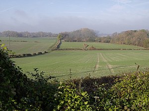
[[File:View from the towpath - geograph.org.uk - 603879.jpg|left|thumb|300px|Famrland near Wilstone]] | [[File:View from the towpath - geograph.org.uk - 603879.jpg|left|thumb|300px|Famrland near Wilstone]] | ||
| Line 12: | Line 12: | ||
The hills here rise up form the dip slope of the Chiltern range, which is cut by valleys and ridges running south-east to north-west, hence the direction that the Tring Salient takes Hertfordshire territory, in a broad pass through the hills. | The hills here rise up form the dip slope of the Chiltern range, which is cut by valleys and ridges running south-east to north-west, hence the direction that the Tring Salient takes Hertfordshire territory, in a broad pass through the hills. | ||
North of Tring are its dependent villages, [[Tringford]], [[Wilstone]], [[Long Marston, Hertfordshire|Long Marston]] and their hamlets. The Tring Salient ends at the Thistle Brook, between [[Long Marston]] (Hertfordshire) and [[Wingrave]] (Buckinghamshire). | North of Tring are its dependent villages, [[Tringford]], [[Wilstone]], [[Long Marston, Hertfordshire|Long Marston]] and their hamlets. The Tring Salient ends at the Thistle Brook, between [[Long Marston, Hertfordshire|Long Marston]] (Hertfordshire) and [[Wingrave]] (Buckinghamshire). | ||
[[Category:Hertfordshire]] | [[Category:Hertfordshire]] | ||
Latest revision as of 22:00, 30 September 2015
| <slippymap lat="51.807" lon="-0.65" z="4" w="400" h="400" layer="colour"/> |
The Tring Salient is that a tongue of Hertfordshire which projects north-westwards deep into the Chilterns, with Buckinghamshire either side. It is about 10 miles long and just over a mile wide at its narrowest. The name 'Tring Salient' is an informal name, describing the way this Hertfordshire territory sticks out into what would otherwise be Buckinghamshire. It is named from the town in the midst of the salient, Tring. Its other town, at the root of this tongue of land, is Berkhamsted

The Tring Salient is wholly within the Dacorum Hundred. It is formed by the Bulbourne Valley, and the route which this valley creates through the Chilterns. This is an ancient route: Tring itself is positioned at a low point in the Chiltern Hills, known as the Tring Gap, and this has been used as a crossing point since ancient times. The Roman road named Akeman Street, the major road linking Londinium to Corinum, runs up the valley to cross the Chilterns here, and in later ages Akeman Street became a main road, and the Grand Junction Canal was taken up through the Chilterns by this route, and the railway followed too.
The Tring Reservoirs, built to supply the canal, are found here, northwest of Tring.
The hills here rise up form the dip slope of the Chiltern range, which is cut by valleys and ridges running south-east to north-west, hence the direction that the Tring Salient takes Hertfordshire territory, in a broad pass through the hills.
North of Tring are its dependent villages, Tringford, Wilstone, Long Marston and their hamlets. The Tring Salient ends at the Thistle Brook, between Long Marston (Hertfordshire) and Wingrave (Buckinghamshire).