County Tipperary: Difference between revisions
| (2 intermediate revisions by 2 users not shown) | |||
| Line 2: | Line 2: | ||
|name=County Tipperary | |name=County Tipperary | ||
|irish=Contae Thiobraid Árann | |irish=Contae Thiobraid Árann | ||
|map image= | |map image=Tipperary Ireland (BI Sect 7).svg | ||
|picture=Castles of Munster, Dromineer, Tipperary - geograph.org.uk - 1543096.jpg | |picture=Castles of Munster, Dromineer, Tipperary - geograph.org.uk - 1543096.jpg | ||
|picture caption=Dromineer Castle | |picture caption=Dromineer Castle | ||
| Line 30: | Line 30: | ||
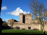
[[File:Cahir Castle 1.jpg|right|thumb|200px|Cahir Castle]] | [[File:Cahir Castle 1.jpg|right|thumb|200px|Cahir Castle]] | ||
*Ahenny - ''{{lang|ga|Áth Eine}}'' | *[[Ahenny]] - ''{{lang|ga|Áth Eine}}'' | ||
*Ballina - ''{{lang|ga|Béal an Átha}}'' | *[[Ballina, County Tipperary|Ballina]] - ''{{lang|ga|Béal an Átha}}'' | ||
*Bansha - ''{{lang|ga|An Bháinseach}}'' | *[[Bansha]] - ''{{lang|ga|An Bháinseach}}'' | ||
*Borrisokane - ''{{lang|ga|Buiríos Uí Chéin}}'' | *[[Borrisokane]] - ''{{lang|ga|Buiríos Uí Chéin}}'' | ||
*Borrisoleigh- ''{{lang|ga|Buiríos Ó Luigheach}}'' | *[[Borrisoleigh]] - ''{{lang|ga|Buiríos Ó Luigheach}}'' | ||
*Cahir - ''{{lang|ga|Cathair Dún Iascaigh or An Chathair}}'' | *[[Cahir]] - ''{{lang|ga|Cathair Dún Iascaigh or An Chathair}}'' | ||
*Carrick-on-Suir - ''{{lang|ga|Carraig na Siúire}}'' | *[[Carrick-on-Suir]] - ''{{lang|ga|Carraig na Siúire}}'' | ||
*Cashel - ''{{lang|ga|Caiseal}}'' | *[[Cashel, County Tipperary|Cashel]] - ''{{lang|ga|Caiseal}}'' | ||
*Castleiney - ''{{lang|ga|Caisleán Aoibhne}}'' | *[[Castleiney]] - ''{{lang|ga|Caisleán Aoibhne}}'' | ||
*Clonmel - ''{{lang|ga|Cluain Meala}}'' | *[[Clonmel]] - ''{{lang|ga|Cluain Meala}}'' | ||
*Clonmore - ''{{lang|ga|An Cluain Mhór}}'' | *[[Clonmore, County Tipperary|Clonmore]] - ''{{lang|ga|An Cluain Mhór}}'' | ||
*Clonoulty - ''{{lang|ga|Cluain Ultaigh}}'' | *[[Clonoulty]] - ''{{lang|ga|Cluain Ultaigh}}'' | ||
*Cloughjordan - ''{{lang|ga|Cloch Shiurdáin}}'' | *[[Cloughjordan]] - ''{{lang|ga|Cloch Shiurdáin}}'' | ||
*Drom - ''{{lang|ga|Drom}}'' | *[[Drom]] - ''{{lang|ga|Drom}}'' | ||
*Dundrum - ''{{lang|ga|Dún Droma}}'' | *[[Dundrum, County Tipperary|Dundrum]] - ''{{lang|ga|Dún Droma}}'' | ||
*Emly - ''{{lang|ga|Imleach Iubhair}}'' | *[[Emly]] - ''{{lang|ga|Imleach Iubhair}}'' | ||
*Fethard - ''{{lang|ga|Fiodh Ard}}'' | *[[Fethard]] - ''{{lang|ga|Fiodh Ard}}'' | ||
*Golden - ''{{lang|ga|An Gabhailín}}'' | *[[Golden]] - ''{{lang|ga|An Gabhailín}}'' | ||
*Hollyford - ''{{lang|ga|Áth an Chuillinn}}'' | *[[Hollyford]] - ''{{lang|ga|Áth an Chuillinn}}'' | ||
*Holycross - ''{{lang|ga|Mainistir na Croiche}}'' | *[[Holycross]] - ''{{lang|ga|Mainistir na Croiche}}'' | ||
*Horse and Jockey - ''{{lang|ga|An Marcach}}'' | *[[Horse and Jockey]] - ''{{lang|ga|An Marcach}}'' | ||
*Killenaule - ''{{lang|ga|Cill Náile}}'' | *[[Killenaule]] - ''{{lang|ga|Cill Náile}}'' | ||
*Kilmoyler - ''{{lang|ga|Cill Mhaoileachair}}'' | *[[Kilmoyler]] - ''{{lang|ga|Cill Mhaoileachair}}'' | ||
*Kilsheelan - ''{{lang|ga|Cill Siolain}}'' | *[[Kilsheelan]] - ''{{lang|ga|Cill Siolain}}'' | ||
*Knockgraffon - ''{{lang|ga|Cnoc Rafann}}'' | *[[Knockgraffon]] - ''{{lang|ga|Cnoc Rafann}}'' | ||
*Lisronagh - ''{{lang|ga|Lios Ruanach}}'' | *[[Lisronagh]] - ''{{lang|ga|Lios Ruanach}}'' | ||
*Littleton - ''{{lang|ga|An Baile Beag}}'' | *[[Littleton]] - ''{{lang|ga|An Baile Beag}}'' | ||
*Lorrha - ''{{lang|ga|Lothra}}'' | *[[Lorrha]] - ''{{lang|ga|Lothra}}'' | ||
*Loughmore - ''{{lang|ga|Luach Magh}}'' | *[[Loughmore]] - ''{{lang|ga|Luach Magh}}'' | ||
*Milestone - ''{{lang|ga|Cloch an Mhíle}}'' | *[[Milestone]] - ''{{lang|ga|Cloch an Mhíle}}'' | ||
*Nenagh - ''{{lang|ga|An tAonach}}'' | *[[Nenagh]] - ''{{lang|ga|An tAonach}}'' | ||
*New Birmingham - ''{{lang|ga|Gleann an Ghuail}}'', "glen of the coal" | *[[New Birmingham]] - ''{{lang|ga|Gleann an Ghuail}}'', "glen of the coal" | ||
*New Inn - ''{{lang|ga|Loch Cheann}}'' | *[[New Inn, County Tipperary|New Inn]] - ''{{lang|ga|Loch Cheann}}'' | ||
*Newport - ''{{lang|ga|An Tulach Sheasta}}'' | *[[Newport, County Tipperary|Newport]] - ''{{lang|ga|An Tulach Sheasta}}'' | ||
*Ninemilehouse - ''{{lang|ga|Tigh na Naoi Míle}}'' | *[[Ninemilehouse]] - ''{{lang|ga|Tigh na Naoi Míle}}'' | ||
*Rearcross - ''{{lang|ga|Crois na Rae}}'' | *[[Rearcross]] - ''{{lang|ga|Crois na Rae}}'' | ||
*Roscrea - ''{{lang|ga|Ros Cré}}'' | *[[Roscrea]] - ''{{lang|ga|Ros Cré}}'' | ||
*Rosegreen - ''{{lang|ga|Faiche Ró}}'' | *[[Rosegreen]] - ''{{lang|ga|Faiche Ró}}'' | ||
*Rathcabbin - ''{{lang|ga|An Rath Cabbàn}}'' | *[[Rathcabbin]] - ''{{lang|ga|An Rath Cabbàn}}'' | ||
*Templemore - ''{{lang|ga|An Teampall Mór}}'' | *[[Templemore]] - ''{{lang|ga|An Teampall Mór}}'' | ||
*Thurles - ''{{lang|ga|Durlas}}'' | *[[Thurles]] - ''{{lang|ga|Durlas}}'' | ||
*Tipperary | *[[Tipperary]] - ''{{lang|ga|Tiobraid Árann}}'' | ||
*Toomevara - ''{{lang|ga|Tuaim Uí Mheára}}'' | *[[Toomevara]] - ''{{lang|ga|Tuaim Uí Mheára}}'' | ||
*Two-Mile Borris - ''{{lang|ga|Buiríos Léith}}'' | *[[Two-Mile Borris]] - ''{{lang|ga|Buiríos Léith}}'' | ||
*Upperchurch - ''{{lang|ga|An Teampall Uachtarach}}' | *[[Upperchurch]] - ''{{lang|ga|An Teampall Uachtarach}}' | ||
==History== | ==History== | ||
Latest revision as of 22:37, 21 March 2017
| County Tipperary Irish: Contae Thiobraid Árann Republic of Ireland | |
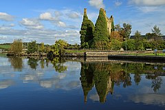 Dromineer Castle | |
|---|---|
| |
| [Interactive map] | |
| Province: | Leinster |
| Area: | 1,661 square miles |
| Population: | 158,754 |
| County seat: | Clonmel |
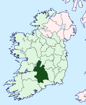
The County Palatine of Tipperary is a shire in the province of Munster in the south of Ireland. The county is named after the town of Tipperary, and was established in the early thirteenth century, shortly after the Norman invasion of Ireland. The population of the county was 158,754 at the 2011 census.[1] In common with County Cork it is split into two "Ridings", analogous to those of Yorkshire.
Geography
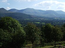
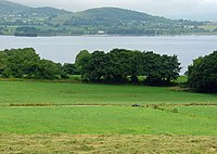
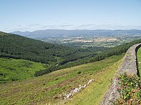
Tipperary is the sixth largest of the 32 counties by area and the 11th largest by population.[2] It is the third largest of Munster’s 6 counties by size and the third largest by population. The region is part of the central plain of Ireland, but the diversified terrain contains several mountain ranges: the Knockmealdown, the Galtee, the Arra Hills and the Silvermine Mountains. The southern portion of the county is drained by the River Suir; the northern by tributaries of the Shannon which widens into Lough Derg. No part of the county touches the coast. The centre is known as 'the Golden Vale', a rich pastoral stretch of land in the Suir basin which extends into the counties of Limerick and Cork.
Baronies
There are six baronies in the North Riding: Eliogarty, Ikerrin, Ormond Upper, Ormond Lower, Owney and Arra and Kilnamanagh Upper, with a further six lying in the South Riding: Clanwilliam, Kilnamanagh Lower, Iffa and Offa East, Iffa and Offa West, Middle Third, and Slievardagh.
Civil parishes and townlands
Parishes were delineated after the Down Survey as an intermediate subdivision, with multiple townlands per parish and multiple parishes per barony. The civil parishes had some use in local taxation and were included on the nineteenth century maps of the Ordnance Survey of Ireland.[3] For poor law purposes, District Electoral Divisions replaced the civil parishes in the mid-nineteenth century. There are 199 civil parishes in the county.[4] Townlands are the smallest officially defined geographical divisions in Ireland; there are 3,159 townlands in the county.[5]
Towns and villages
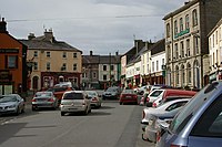
- Ahenny - Irish: Áth Eine'
- Ballina - Irish: Béal an Átha'
- Bansha - Irish: An Bháinseach'
- Borrisokane - Irish: Buiríos Uí Chéin'
- Borrisoleigh - Irish: Buiríos Ó Luigheach'
- Cahir - Irish: Cathair Dún Iascaigh or An Chathair'
- Carrick-on-Suir - Irish: Carraig na Siúire'
- Cashel - Irish: Caiseal'
- Castleiney - Irish: Caisleán Aoibhne'
- Clonmel - Irish: Cluain Meala'
- Clonmore - Irish: An Cluain Mhór'
- Clonoulty - Irish: Cluain Ultaigh'
- Cloughjordan - Irish: Cloch Shiurdáin'
- Drom - Irish: Drom'
- Dundrum - Irish: Dún Droma'
- Emly - Irish: Imleach Iubhair'
- Fethard - Irish: Fiodh Ard'
- Golden - Irish: An Gabhailín'
- Hollyford - Irish: Áth an Chuillinn'
- Holycross - Irish: Mainistir na Croiche'
- Horse and Jockey - Irish: An Marcach'
- Killenaule - Irish: Cill Náile'
- Kilmoyler - Irish: Cill Mhaoileachair'
- Kilsheelan - Irish: Cill Siolain'
- Knockgraffon - Irish: Cnoc Rafann'
- Lisronagh - Irish: Lios Ruanach'
- Littleton - Irish: An Baile Beag'
- Lorrha - Irish: Lothra'
- Loughmore - Irish: Luach Magh'
- Milestone - Irish: Cloch an Mhíle'
- Nenagh - Irish: An tAonach'
- New Birmingham - Irish: Gleann an Ghuail', "glen of the coal"
- New Inn - Irish: Loch Cheann'
- Newport - Irish: An Tulach Sheasta'
- Ninemilehouse - Irish: Tigh na Naoi Míle'
- Rearcross - Irish: Crois na Rae'
- Roscrea - Irish: Ros Cré'
- Rosegreen - Irish: Faiche Ró'
- Rathcabbin - Irish: An Rath Cabbàn'
- Templemore - Irish: An Teampall Mór'
- Thurles - Irish: Durlas'
- Tipperary - Irish: Tiobraid Árann'
- Toomevara - Irish: Tuaim Uí Mheára'
- Two-Mile Borris - Irish: Buiríos Léith'
- Upperchurch - Irish: An Teampall Uachtarach
History
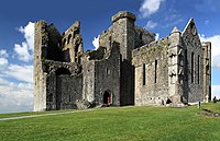
Tipperary was a county by 1210, when the sheriffdom of Munster shired after the Norman invasion of Ireland was split into separate shires of Tipperary and Limerick.[6] In 1328, Tipperary was granted to the Earls of Ormond as a county palatine or liberty.[6] The grant excluded churchlands, including the archiepiscopal seat of Cashel, which formed the separate county of Cross Tipperary.[6] Though the Earls gained jurisdiction over the churchlands in 1662, "Tipperary and Cross Tipperary" were not definitively united until the County Palatine of Tipperary Act 1715, when the 2nd Duke of Ormond was attainted for supporting the Jacobite rising of 1715.[7][8]
The county was divided once again in 1838.[9] The county town of Clonmel, where the grand jury held its twice-yearly assizes, is at the southern limit of the county, and roads leading north were poor, making the journey inconvenient for jurors resident there.[9] A petition to move the county town to a more central location was opposed by the MP for Clonmel, so instead the county was split into two "ridings"; the grand jury of the South Riding continued to meet in Clonmel, while that of the North Riding met in Nenagh.[9]
Economy
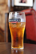
The area around Clonmel is the economic hub of the county: to the west of the town the manufacturers Bulmers (brewers) and Merck & Co. (pharmaceuticals). There is much fertile land, especially in the region known as the Golden Vale, one of the richest agricultural areas in Ireland. Dairy farming and cattle raising are the principal occupations. Other industries are slate quarrying and the manufacture of meal and flour.
Tipperary is famous for its horse breeding industry and is the home of Coolmore Stud, the largest thoroughbred breeding operation in the world.
Tourism plays a significant role in County Tipperary - Lough Derg, Thurles, Rock of Cashel, Ormonde Castle, Ahenny High Crosses, Cahir Castle, Bru Boru Heritage Centre and Tipperary Crystal are some of the primary tourist destinations in the county.
Transport
Road transport dominates in County Tipperary. M7 motorway crosses the north of the county through Roscrea and Nenagh and the M8 motorway bisects the county from north of Two-Mile Borris to the County Limerick border. Both routes are amongst some of the busiest roads on the island. The Limerick to Waterford N24 crosses the southern half of Tipperary, travelling through Tipperary Town, Bansha, north of Cahir and around Clonmel and Carrick-on-Suir. Tipperary also has a number or railway stations situated on the Dublin to Cork, Dublin to Limerick and Limerick to Waterford rail lines.
Sports
County Tipperary has a strong sporting history and is home to the Gaelic Games of Hurling, Gaelic football, Camogie and Handball. It nurtures the ancient game of hurling and since the 19th century its teams have regularly been champions of Ireland. Horse racing takes place at Tipperary Racecourse, Thurles Racecourse and Clonmel Racecourse.
Places of interest
- Athassel Priory
- Cahir Castle
- Coolmore Stud
- Dromineer
- Fethard
- Galtymore - a munro, and the highest mountain in County Tipperary (3,015 ft).
- Glen of Aherlow
- Glengarra Wood
- Holy Cross Abbey
- Kilcash Castle (also Ireland's oldest church in Kilcash)
- Lough Derg
- Mitchelstown Cave
- Nenagh
- Ormonde Castle, Carrick-on-Suir
- Redwood Castle (Castle Egan)
- Rock of Cashel
- Slievenamon - Irish: Sliabh na mBan' - mountain associated with many Irish legends (2,365 ft)
- Thurles.
References
- ↑ CSO Census 2011.
- ↑ Corry, Eoghan (2005). The GAA Book of Lists. Hodder Headline Ireland. pp. 186–191.
- ↑ "Interactive map (civil parish boundaries viewable in Historic layer)". Mapviewer. Ordnance Survey of Ireland. http://ims0.osiemaps.ie/website/publicviewer/main.aspx. Retrieved 9 March 2010.
- ↑ "Placenames Database of Ireland - Tipperary civil parishes". Logainm.ie. 2010-12-13. http://www.logainm.ie/Viewer.aspx?text=Tipperary&streets=yes. Retrieved 2012-09-14.
- ↑ "Placenames Database of Ireland - Tipperary townlands". Logainm.ie. 2010-12-13. http://www.logainm.ie/Viewer.aspx?text=Tipperary&streets=yes. Retrieved 2012-09-14.
- ↑ 6.0 6.1 6.2 Falkiner, Caesar Litton (1904). "The Counties of Ireland". Illustrations of Irish history and topography: mainly of the seventeenth century. Longmans, Green. pp. 108–142. http://books.google.com/books?id=vksNAAAAIAAJ. Retrieved 14 August 2011.
- ↑ Deputy keeper of the public records in Ireland (1873-04-26). "Appendix 3: Extract from Report of the Assistant Deputy Keeper on the Records of the Court of Record of the County Palatine of Tipperary". Fifth Report. Command papers. C.760. HMSO. pp. 32–37. http://books.google.com/books?id=kVYRAQAAMAAJ&pg=RA3-PA33. Retrieved 2011-08-14.
- ↑ Ireland (1794). "2 George I c.8". Statutes Passed in the Parliaments Held in Ireland. III: 1715–1733. Printed by George Grierson, printer to the King's Most Excellent Majesty. pp. 5–11. http://books.google.com/books?id=iJVRAAAAYAAJ&pg=PA5. Retrieved 14 August 2011.
- ↑ 9.0 9.1 9.2 Murphy, Donal A. (1994). The two Tipperarys: the national and local politics, devolution and self-determination, of the unique 1838 division into two ridings, and the aftermath. Relay. ISBN 9780946327133.
This county article is a stub: help to improve Wikishire by building it up.
| Counties of the Republic of Ireland |
|---|
|
Carlow • Cavan • Clare • Cork • Donegal • Dublin • Galway • Kerry • Kildare • Kilkenny • Laois • Leitrim • Limerick • Longford • Louth • Mayo • Meath • Monaghan • Offaly • Roscommon • Sligo • Tipperary • Waterford • Westmeath • Wexford • Wicklow |